The Outer Hebrides or Western Isles, sometimes known as the Long Isle or Long Island, is an island chain off the west coast of mainland Scotland. The islands form part of the archipelago of the Hebrides, separated from the Scottish mainland and from the Inner Hebrides by the waters of the Minch, the Little Minch, and the Sea of the Hebrides. The Outer Hebrides are considered to be the traditional heartland of the Gaelic language. The islands form one of the 32 council areas of Scotland, which since 1998 has used only the Gaelic form of its name, including in English language contexts. The council area is called Na h-Eileanan an Iar and its council is Comhairle nan Eilean Siar.

Harris is the southern and more mountainous part of Lewis and Harris, the largest island in the Outer Hebrides, Scotland. Although not an island itself, Harris is often referred to in opposition to the Isle of Lewis as the Isle of Harris, which is the former postal county and the current post town for Royal Mail postcodes starting HS3 or HS5.

Barra is an island in the Outer Hebrides, Scotland, and the second southernmost inhabited island there, after the adjacent island of Vatersay to which it is connected by the Vatersay Causeway.

Eriskay, from the Old Norse for "Eric's Isle", is an island and community council area of the Outer Hebrides in northern Scotland with a population of 143, as of the 2011 census. It lies between South Uist and Barra and is connected to South Uist by a causeway which was opened in 2001. In the same year Ceann a' Ghàraidh in Eriskay became the ferry terminal for travelling between South Uist and Barra. The Caledonian MacBrayne vehicular ferry travels between Eriskay and Ardmore in Barra. The crossing takes around 40 minutes.
The Barra Isles, also known as the Bishop's Isles, are a small archipelago in the Outer Hebrides of Scotland. They lie south of the island of Barra, for which they are named. The group consists of nine islands and numerous rocky islets, skerries, and sea stacks.

A tidal island is a raised area of land within a waterbody, which is connected to the larger mainland by a natural isthmus or man-made causeway that is exposed at low tide and submerged at high tide, causing the land to switch between being a promontory/peninsula and an island depending on tidal conditions.
Comhairle nan Eilean Siar is the local authority for Na h-Eileanan an Iar, one of the 32 council areas of Scotland. It is based in Stornoway on the Isle of Lewis.
Ceann a' Ghàraidh is the location of the ferry terminal on the south-western side of the island of Eriskay in the Outer Hebrides of Scotland. It provides a service across the Sound of Barra to Ardmore on the island of Barra The placename literally means "The head of the garden". This location is so called due to the presence of the old crofting boundary walls, which can no longer be seen.
Biruaslum or Bioruaslam is a stack in the Barra Isles of Scotland, to the west of Vatersay. Approximately 2.5 kilometres from the nearest road, it reaches 72 m (236 ft) in height and there is a ruined prehistoric fort on the southern side. Francis G. Thompson characterizes it as "high and virtually inaccessible"; James Fisher mentions a "fulmar flying up and down its tiny cliff."

Elections to Comhairle nan Eilean Siar were held on 3 May 2012, the same day as the other Scottish local government elections. The election was the second one using the 9 wards created as a result of the Local Governance (Scotland) Act 2004. Each ward elected three or four Councillors using the single transferable vote system: a form of proportional representation. A total of 31 Councillors were elected.

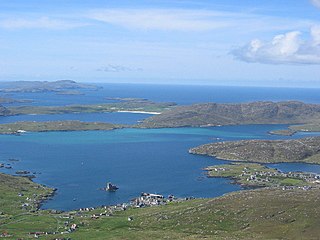
The Sound of Barra is a large ocean inlet or sound situated to the north of the isle of Barra and to the south of South Uist in the Outer Hebrides in Scotland. Since 2014 it has been designated as a Special Area of Conservation (SAC). The Sound of Barra is composed of 98.91% marine and inlet areas, 1.07% mudflats and other semi-submerged areas and 0.02% sea cliffs and islets. There are ten islands in the sound, with only Eriskay still being inhabited:

Barraigh, Bhatarsaigh, Eirisgeigh agus Uibhist a Deas was one of the nine wards of Comhairle nan Eilean Siar. Created in 2007, the ward elected four councillors using the single transferable vote electoral system. As a result of the Islands (Scotland) Act 2018, the ward was abolished in 2022.
MV Eilean Na H-Oige is a small passenger ferry built for the Outer Hebrides and now operating in Southern Ireland.

Elections toComhairle nan Eilean Siar took place on 5 May 2022 on the same day as the 31 other Scottish local government elections. As with other Scottish council elections, it was held using the single transferable vote (STV) system – a form of proportional representation – in which multiple candidates are elected in each ward, and voters rank candidates in order of preference.

The Vatersay Causeway is a 250-metre-long causeway that links the Scottish Hebridean Islands of Vatersay and Barra across the Sound of Vatersay.
Barraigh agus Bhatarsaigh is one of the 11 wards of Comhairle nan Eilean Siar. Created in 2022, the ward elects two councillors using the single transferable vote electoral system and covers an area with a population of 1,308 people.
Uibhist a Deas, Èirisgeigh agus Beinn na Faoghla is one of the 11 wards of Comhairle nan Eilean Siar. Created in 2022, the ward elects three councillors using the single transferable vote electoral system and covers an area with a population of 3,067 people.


