A ghost town, deserted city, extinct town, or abandoned city is an abandoned settlement, usually one that contains substantial visible remaining buildings and infrastructure such as roads. A town often becomes a ghost town because the economic activity that supported it has failed or ended for any reason. The town may have also declined because of natural or human-caused disasters such as floods, prolonged droughts, extreme heat or extreme cold, government actions, uncontrolled lawlessness, war, pollution, or nuclear and radiation-related accidents and incidents. The term can sometimes refer to cities, towns, and neighborhoods that, though still populated, are significantly less so than in past years; for example, those affected by high levels of unemployment and dereliction.

A town is a type of a human settlement. Towns are generally larger than villages and smaller than cities, though the criteria to distinguish between them vary considerably in different parts of the world.
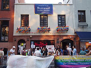
A gay village, also known as a gayborhood or gaybourhood, is a geographical area with generally recognized boundaries that is inhabited or frequented by many lesbian, gay, bisexual, transgender, and queer (LGBTQ) people. Gay villages often contain a number of gay-oriented establishments, such as gay bars and pubs, nightclubs, bathhouses, restaurants, boutiques, and bookstores.

Westlake Village is a city in Los Angeles County, California on its western border with Ventura County. Upon its incorporation in 1981, Westlake Village became the 82nd municipality of Los Angeles County. The population of the city was 8,029 at the 2020 census, down from 8,270 at the 2010 census.

Menomonee Falls is a village in Waukesha County, Wisconsin, United States. The population was 38,527 at the 2020 census, making it the most populous village in Wisconsin. It is part of the Milwaukee metropolitan area.
A census-designated place (CDP) is a concentration of population defined by the United States Census Bureau for statistical purposes only.

A hamlet is a human settlement that is smaller than a town or village. This is often simply an informal description of a smaller settlement or possibly a subdivision or satellite entity to a larger settlement. Sometimes a hamlet is defined for official or administrative purposes.
In the United States, the meaning of village varies by geographic area and legal jurisdiction. In formal usage, a "village" is a type of administrative division at the local government level. Since the Tenth Amendment to the United States Constitution prohibits the federal government from legislating on local government, the states are free to have political subdivisions called "villages" or not to and to define the word in many ways. Typically, a village is a type of municipality, although it can also be a special district or an unincorporated area. It may or may not be recognized for governmental purposes.

A village development committee in Nepal was the lower administrative part of its Ministry of Federal Affairs and Local Development. Each district had several VDCs, similar to municipalities but with greater public-government interaction and administration. There were 3,157 village development committees in Nepal. Each village development committee was further divided into several wards depending on the population of the district, the average being nine wards.
Karajgi is a village in northern Karnataka, in central India. Administratively, it is in Afzalpur Taluka of Kalaburagi district in Karnataka.
Madlur is a village in the Belgaum district of Karnataka State, India. The village is famous for its history and its also called Siddhabhoomi. The place was once ruled by the Chalukyas. The ancient village is rich with the architecture of the Chalukyas. The Historical name of the place is Shreerangapur. Shree Shiddeshwar temple and Koranar Bhavi are the major attractions. Other major attractions are Marakumb Kola and lake Maagani.