Tiguent

Last updated
Tiguent
Commune and town
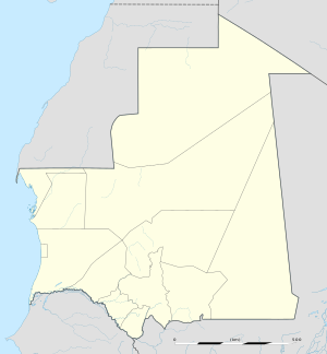
Mauritania location map.svg
Red pog.svg
Tiguent
Location in Mauritania
Coordinates: 17°15′N16°0′W / 17.250°N 16.000°W / 17.250; -16.000
CountryFlag of Mauritania.svg  Mauritania
Region Trarza
Population
 (2000)
  Total12,170
Time zone UTC+0 (GMT)

Tiguent is a small town and commune in south-western Mauritania, not far from the coast. In 2000 it had a population of 12,170. [1]

Mauritania Islamic republic in Northwest Africa

Mauritania, officially the Islamic Republic of Mauritania, is a country in Northwest Africa. It is the eleventh largest sovereign state in Africa and is bordered by the Atlantic Ocean to the west, Western Sahara to the north and northwest, Algeria to the northeast, Mali to the east and southeast, and Senegal to the southwest.

Contents

Transport

It is proposed to be served by a new station on railway to serve the phosphate mines at Kaedi.

See also

Citizens of Mauritania have various transportation methods. Railways and highways connect major cities in the country. Mauritania is a coastal country so there are many ports along its coast and there are a few big rivers that run through the country. Lastly, there are 26 airports spread out throughout the country.

Related Research Articles

Mauritania Railway railway line

The Mauritania Railway is the national railway of Mauritania. Opened in 1963, it consists of a single, 704-kilometre (437 mi) railway line linking the iron mining centre of Zouerate with the port of Nouadhibou, via Fderik and Choum. The state agency Société Nationale Industrielle et Minière controls the railway line.

Néma Commune and town in Hodh Ech Chargui Region, Mauritania

Néma is a town in southeastern Mauritania, close to the border with Mali. It is located at around 16°37′0″N7°15′0″W at the eastern end of the Aoukar. It is the capital of Hodh Ech Chargui Region and of the Néma Department.

Choum Commune and town in Adrar Region, Mauritania

Choum is a town in northern Mauritania, lying in the Adrar Region close to the border with the Western Sahara. Choum has a population of around 5,000.

Downing Provincial Park is a provincial park in British Columbia, Canada, created when Mr. and Mrs. Clair Downing donated their half mile of lake frontage property on Kelly Lake. The park's size, including the 97 acres (390,000 m2) donated by the Downings, is 105 ha. It is located adjacent to the British Columbia Railway line and the Pavilion Mountain Road about 30 km west of Clinton, at the junction with the road to Jesmond and Kostering.

Proaza Municipality in Asturias, Spain

Proaza is a municipality in the Autonomous Community of the Principality of Asturias, Spain. It is bordered on the north by Santo Adriano and Grado, on the south by Teverga and Quirós, on the west by Yernes y Tameza and Teverga, and on the east by Quirós.

The Utah Test and Training Range (UTTR) is a military testing and training area located in Utah's West Desert, approximately 80 miles (130 km) west of Salt Lake City, Utah. UTTR is currently the largest contiguous block of over-land supersonic-authorized restricted airspace in the contiguous United States. The range, which has a footprint of 2,675 square miles (6,930 km2) of ground space and over 19,000 square miles (49,000 km2) of air space, is divided into North and South ranges. Interstate 80 divides the two sections of the range. The site is administered and maintained by the US Air Force's HQ UTTR, formerly known as the 388th Range Squadron (388RANS) stationed at Hill Air Force Base, Utah.

Saskatchewan Highway 316 highway in Saskatchewan

Highway 316 is a highway in the Canadian province of Saskatchewan. It runs from Highway 16 near Clavet to Highway 5. Highway 316 is about 17 km (11 mi.) long. This area is an industrial commercial area along Highway #316 which extends from Clavet north to the PCS Patience Lake Mine which is just 10 miles from the city of Saskatoon. Highway 316 is a primary weight highway, and also runs near the Canadian National Railway line which goes from Saskatoon through Clavet. In 1941, the Canadian Pacific Railway ran from Saskatoon through Cheviot and on south eastward.

The Okanagan Indian Band is a First Nations government in the Canadian province of British Columbia, located in the city of Vernon in the northern Okanagan Valley. The band is a member government of the Okanagan Nation Alliance.

Canoe Creek Band/Dog Creek Indian Band

The Canoe Creek Band/Dog Creek Indian Band, also known as the Canoe Creek First Nation and/or Dog Creek First Nation is a First Nations government of the Secwepemc (Shuswap) Nation, located in the Fraser Canyon-Cariboo region of the Central Interior of the Canadian province of British Columbia. It was created when the government of the then-Colony of British Columbia established an Indian Reserve system in the 1860s. It is a member government of the Northern Shuswap Tribal Council.

The Tl'etinqox-t'in Government Office is a First Nations government located in the Chilcotin District in the western Central Interior region of the Canadian province of British Columbia. Governing a reserve communities near Alexis Creek known as Anaham Reserve First Nations or Anaham, it is a member of the Tsilhqot'in Tribal Council aka known as the Tsilhqot'in National Government. The main reserve is officially known as Anahim's Flat No. 1, and is more commonly as Anaham. Other reserves are Anahim's Meadow No. 2 and 2A, and Anahim Indian Reserves Nos. 3 through 18. Anaham, or Anahim and Alexis were chiefs of the Tsilhqot'in during the Chilcotin War of 1864, although they and their people did not take part in the hostilities.

Robson Valley valley in British Columbia, Canada

The Robson Valley is a geographic region of the Canadian province of British Columbia, comprising the section of the Rocky Mountain Trench that lies southeast of the city of Prince George following the Fraser River to the Yellowhead Pass. The name is derived from Mount Robson, which stands near the entrance to the Yellowhead Pass. Communities in the Robson Valley include the settlements of Dome Creek, Crescent Spur, Dunster, and Tête Jaune Cache, with larger population concentrations in the villages of McBride and Valemount. On a map, the Robson Valley is located immediately south of the elbow in the boundary between Alberta and British Columbia. Transportation corridors through the Robson Valley include the Canadian National Railway lines, and Highways 16 and 5.

Mederdra Commune and town in Trarza, Mauritania

Mederdra is a small town and commune in south-west Mauritania. In 2000 it had a population of 6,858.

Campania Sound is a sound on the North Coast of British Columbia, Canada, located between Campania Island and Princess Royal Island. It was named in association with Campania Island.

Alison Sound is a sound in the Central Coast region of British Columbia, Canada. It extends north and northwest from Belize Inlet, which itself is one of the many sidewaters of Seymour Inlet. There is no connection in name or geography to Allison Harbour, which is to the southwest.

Fimbulheimen

Fimbulheimen is a mountain range in Queen Maud Land, Antarctica. It stretches from Jutulstraumen by 1° west of Carsten Borchgrevink Ice at 18° east, about 200 km from the ice edge. Fimbulheimen is thus between Maudheim Plateau and Sør-Rondane.

The Scowlitz First Nation or Scowlitz Indian Band is the band government of Skaulits subgroup of the Sto:lo people located on Harrison Bay in the Upper Fraser Valley region between Chehalis (E) and Lake Errock, British Columbia, Canada (W). They are a member government of the Stó:lō Tribal Council.

Horneline Creek Provincial Park is a provincial park in far northern British Columbia, Canada. It is located west of the Kechika River about 130 km south of Lower Post and 30 km north of Denetiah Provincial Park and southwest of the community of Liard River.
The Burdwood Bank, called Namuncurá in Argentina and other countries, is an undersea bank with a prominence of approximately 200 m, part of the Scotia Arc projecting some 600 km (370 mi) from Cape Horn in the South Atlantic Ocean and located some 200 kilometres (120 mi) south of the Falkland Islands. Argentina claims economic rights over the whole of the bank, while the United Kingdom has designated about half of the bank as part of the Falklands Outer Economic Zone.

Tewkesbury Borough Non-metropolitan district in England

Tewkesbury Borough is a local government district and borough in Gloucestershire, England. It is named after its main town, Tewkesbury. Other places in the borough include Ashchurch, Bishop's Cleeve, Churchdown and Winchcombe. It is administratively distinct from the parish of Tewkesbury, which is served by Tewkesbury Town Council.

References

  1. "Statistiques Demographiques: Résultats du RGPH 2000 des Wilayas". République Islamique de Mauritanie. Archived from the original on February 3, 2010. Retrieved February 1, 2009.

Coordinates: 17°15′00″N16°00′00″W / 17.25000°N 16.00000°W / 17.25000; -16.00000

Geographic coordinate system Coordinate system

A geographic coordinate system is a coordinate system that enables every location on Earth to be specified by a set of numbers, letters or symbols. The coordinates are often chosen such that one of the numbers represents a vertical position and two or three of the numbers represent a horizontal position; alternatively, a geographic position may be expressed in a combined three-dimensional Cartesian vector. A common choice of coordinates is latitude, longitude and elevation. To specify a location on a plane requires a map projection.