
Nouakchott is the capital and largest city of Mauritania. Located in the southwestern part of the country, it is one of the largest cities in the Sahara. The city also serves as the administrative and economic center of Mauritania.
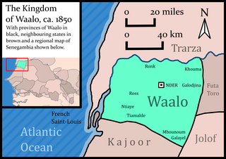
Waalo was a kingdom on the lower Senegal River in West Africa, in what is now Senegal and Mauritania. It included parts of the valley proper and areas north and south, extending to the Atlantic Ocean. To the north were Moorish emirates; to the south was the kingdom of Cayor; to the east was Jolof.
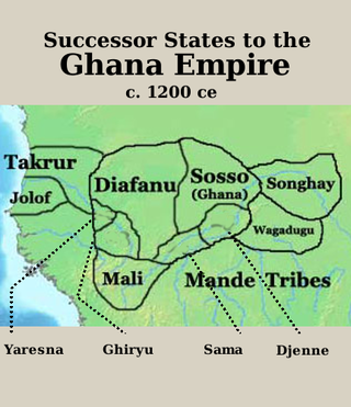
Takrur, Tekrur or Tekrour was a state based in the Senegal River valley in modern day Mauritania and Northern Senegal, Northwestern Africa, which was at its height in the 10th and 11th centuries, roughly parallel to the Ghana Empire. It lasted in some form into the 18th century.
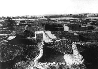
Tagant is a region in south-central Mauritania named for the Tagant Plateau. Its capital is Tidjikdja. Other major cities/towns include Tichit and Rachid, Nbeika. The region borders the Mauritanian regions of Adrar to the north, Hodh Ech Chargui to the east, Hodh El Gharbi and Assaba to the south and Brakna to the west. The Aoukar basin, which formerly gave name to the greater region, is located in the southern part of Tagant.

Tidjikja is the capital of the Tagant region of central Mauritania, lying on the Tagant plateau. Founded in 1680, it has a population of around 11,000 people.

The Adrar is a highland natural and historical region of the Sahara Desert in northern Mauritania. The Adrar Region, an administrative division of Mauritania, is named after the traditional region. It is sometimes called Adrar Tamar to distinguish it from other areas called Adrar in the Sahara.

The Tagant Plateau is located in eastern Mauritania, forming a stony part of the Sahara Desert. The Tagant Region, a national administrative division, is named after the plateau.

Aoukar or Erg Aoukar is a geological depression area of south eastern Mauritania. It is located between Kiffa and Néma, south of the Tagant Plateau. The region is also referred to as Hodh or El Hodh.

Abu Bakr ibn Umar ibn Ibrahim ibn Turgut, sometimes suffixed al-Sanhaji or al-Lamtuni was a chieftain of the Lamtuna Berber Tribe and Amir of the Almoravids from 1056 until his death. He is credited to have founded the Moroccan city of Marrakesh, and under his rule the heretic Barghawatas were destroyed. In 1076, he conquered Koumbi Saleh capital of the Ghana Empire, and is credited to have brought Islam in this Western Sub-Saharan Africa region. In November of 1087, Abu Bakr died of a poisoned arrow in what is now Mauritania.
Bakel is a town and urban commune, with a population of 18,939, located in the eastern part of Senegal, West Africa. The town is located on the left bank of the Sénégal River, 65 kilometers (40 mi) from the Malian border and linked by canoe ferry to the village of Gouraye in Mauritania.
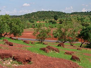
Kayes Region is one of ten first level national subdivisions in Mali called Regions. It is the first administrative area of Mali and covers an area of 120,760 square kilometres or 46,630 square miles. Its capital is the town of Kayes. The province was historically part of the Ghana Empire and the Mali Empire.
The Lamtuna are a nomadic Berber tribe belonging to the Iẓnagen / Sanhaja (Zenaga) confederation, who traditionally inhabited areas from Sous to Adrar Plateau. During the Almoravid period, many Lamtunas emigrated northwards. Currently, the Lemtuna Tribe is based in the South of Mauritania. The chief of this Tribe is Mr. Limam Ould Teguedi Among notable families are the family of Ehl Aly Ibn Ibrahim, the family of Ehel Sidelemine, Ehl Abdawa, Ehl Mohamed El-Emine and Ehl Mohammed Ghali. Sahrawi Tajakant as well as Messouma tribes are of the most recognisable offshoots of the Lamtunas. They inhabit areas in Algeria, Morocco, Mauritania and Western Sahara. The Banu Ghaniya, the successors of this dynasty in Tripoli and the Nafusa Mountains and the governors of the Spanish Balearic Islands until about the middle of the 13th century, originated from this tribe as well.
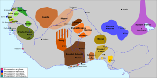
Futa Toro, often simply the Futa, is a semidesert region around the middle run of the Senegal River. This region, along the border of Senegal and Mauritania, is historically significant as the center of several Fulani states, and a source of jihad armies and migrants to the Fouta Djallon.
Rachid is a town in central Mauritania at the foot of the Tagant Plateau. It is located in the Tidjikja Department in the Tagant region. It is located 39 kilometres (21 nmi) from the department capital of Tidjikja.
Moudjeria is a town and commune in the Tagant Region of southern-central Mauritania, founded in 1934 as an administrative post by the French.
The 2010–11 Mauritanian Premier League was the 31st season of the Mauritanian Premier League, the top-level football championship of Mauritania. It began on 24 December 2010 and concluded on 18 June 2011. CF Cansado are the defending champions.

Djigueni is a department of Hodh Ech Chargui Region in Mauritania.

The Tichitt Culture, or Tichitt Tradition, was created by proto-Mande peoples, namely the ancestors of the Soninke people. In 4000 BCE, the start of sophisticated social structure developed among herders amid the Pastoral Period of the Sahara. Saharan pastoral culture was intricate. By 1800 BCE, Saharan pastoral culture expanded throughout the Saharan and Sahelian regions. The initial stages of sophisticated social structure among Saharan herders served as the segue for the development of sophisticated hierarchies found in African settlements, such as Dhar Tichitt. After migrating from the Central Sahara, proto-Mande peoples established their civilization in the Tichitt region of the Western Sahara. The Tichitt Tradition of eastern Mauritania dates from 2200 BCE to 200 BCE.
Lake Gabou is a lake and wetlands area in Tagant Region of Mauritania. It captures runoff from the Tagant plateau and supports a range of indigenous flora and fauna, including Phoenix dactylifera and Hyphaene thebaica, two economically important palm species, and Adansonia digitata and Adenium obesum. It is also a refuge for the West African crocodile and migrating birds. It was designated a Ramsar convention site in 2009.


