Koumbi Saleh

Last updated
Koumbi Saleh
Site of medieval town and Commune
Mauritania location map.svg
Red pog.svg
Koumbi Saleh
Location within Mauritania
Coordinates: 15°45′56″N7°58′07″W / 15.76556°N 7.96861°W / 15.76556; -7.96861
CountryFlag of Mauritania.svg  Mauritania
Area
  Total1,484 km2 (573 sq mi)
Population
 (census 2013)
  Total11,064
  Density7.5/km2 (19/sq mi)

Koumbi Saleh, or Kumbi Saleh, is the site of a ruined ancient and medieval city in south east Mauritania that may have been the capital of the Ghana Empire. It is also a commune with a population of 11,064 (census 2013). [1]

Contents

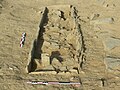
From the ninth century, Arab authors mention the Ghana Empire in connection with the trans-Saharan gold trade. Al-Bakri who wrote in eleventh century described the capital of Ghana as consisting of two towns 10 kilometres (6 mi) apart, one inhabited by Muslim merchants, and the other by the king of Ghana. The discovery in 1913 of a 17th-century African chronicle that gave the name of the capital as Koumbi led French archaeologists to the ruins at Koumbi Saleh. Excavations at the site have revealed the ruins of a large Muslim town with houses built of stone and a congregational mosque but no inscription to unambiguously identify the site as that of capital of Ghana. Ruins of the king's town described by al-Bakri have not been found. Radiocarbon dating suggests that the site was occupied between the late 5th and 14th centuries.

Arabic sources and the capital of the Ghana Empire

Archaeological site of Koumbi Saleh Archaeological site of Koumbi Saleh.jpg
Archaeological site of Koumbi Saleh

The earliest author to mention Ghana is the Persian astronomer Ibrahim al-Fazari who, writing at the end of the eighth century, refers to "the territory of Ghana, the land of gold". [2] The Ghana Empire lay in the Sahel region to the north of the West African gold fields and was able to profit from controlling the trans-Saharan gold trade. The early history of Ghana is unknown but there is evidence that North Africa had begun importing gold from West Africa before the Arab conquest in the middle of the seventh century. [3]

In the medieval Arabic sources the word "Ghana" can refer to a royal title, the name of a capital city or a kingdom. [4] The earliest reference to Ghana as a town is by al-Khuwarizmi who died in around 846 AD. [5] [6] Two centuries later a detailed description of the town is provided by al-Bakri in his Book of Routes and Realms which he completed in around 1068. Al-Bakri never visited the region but obtained his information from earlier writers and from informants that he met in his native Spain:

The city of Ghāna consists of two towns situated on a plain. One of these towns, which is inhabited by Muslims, is large and possesses twelve mosques, in one of which they assemble for Friday prayer. ... In the environs are wells with sweet water, from which they drink and with which they grow vegetables. The king's town is six miles [10 km] distant from this one and bears the name of Al-Ghāba. Between these two towns are continuous habitations. The houses of the inhabitants are of stone and acacia wood. The king has a palace and a number of domed dwellings all surrounded with an enclosure like a city wall. In the king's town, and not far from his courts of justice, is a mosque where Muslims who arrive in his court pray. Around the king's town are domed buildings and groves and thickets where the sorcerers of these people, men in charge of the religious cult, live. [7]

The descriptions provided by the early Arab authors lack sufficient detail to pinpoint the exact location of the town. The much later 17th-century African chronicle, the Tarikh al-fattash , states that the Malian Empire was preceded by the Kayamagna dynasty which had a capital at a town called Koumbi. [8] The chronicle does not use the word Ghana. The other important 17th-century chronicle, the Tarikh al-Sudan mentions that the Malian Empire came after the dynasty of Qayamagha which had its capital at the city of Ghana. [9] It is assumed that the "Kayamagna" or "Qayamagha" dynasty ruled the empire of Ghana mentioned in the early Arabic sources. [10]

Contested Identification

In recent years, the identification of Koumbi Saleh with the 'city of Ghana' described in the sources has been increasingly disputed by scholars. [11] [12] [13] No inscription has been found to unambiguously link the ruins with the Muslim capital of Ghana described by al-Bakri. Moreover, the ruins of the king's town of Al-Ghaba have not been found. [14]

al-Idrisi, a twelfth-century writer, described Ghana's royal city as lying on a riverbank, a river he called the "Nile." This followed the geographic custom of his day, which confused the Niger and Senegal Rivers and believed that they formed a single river often called the "Nile of the Blacks". Whether al-Idrisi was referring to a new and later capital located elsewhere, or whether there was confusion or corruption in his text is unclear. However, he does state that the royal palace he knew was built in 510 AH (1116–1117 AD), suggesting that it was a newer town, rebuilt closer to the river than Koumbi Saleh. [5] [15] [16] This has led to the suggestion that at some point the capital may have been moved south to the Niger River. [17]

In the French translation of the Tarikh al-fattash published in 1913, Octave Houdas and Maurice Delafosse include a footnote in which they comment that local tradition also suggested that the first capital of Kayamagna was at Koumbi and that the town was in the Ouagadou region in Mali, northeast of Goumbou on the road leading from Goumbou to Néma and Oualata. [18]

Ann Kritzinger, relying on a re-reading of ibn Battuta and other Arabic writers, has argued that the archaeological site of Koumbi Saleh in fact represents the Berber town of Awdaghost, and that the capital of the Ghana Empire was Djenne. [19]

Archaeological site

Trade routes of the Western Sahara desert c. 1000-1500. Goldfields are indicated by light brown shading: Bambuk, Bure, Lobi, and Akan. Trans-Saharan routes early.svg
Trade routes of the Western Sahara desert c. 1000–1500. Goldfields are indicated by light brown shading: Bambuk, Bure, Lobi, and Akan.

Dig History

The extensive ruins at Koumbi Saleh were first reported by Albert Bonnel de Mézières in 1914. [20] The site lies in the Sahel region of southern Mauritania, 30 km north of the Malian border, 57 km south-southeast of Timbédra and 98 km northwest of the town of Nara in Mali. The vegetation is low grass with thorny scrub and the occasional acacia tree. In the wet season (July–September) the limited rain fills a number of depressions, but for the rest of the year there is no rain and no surface water.

Beginning with Bonnel de Mézières in 1914, the site has been excavated by successive teams of French archaeologists. Paul Thomassey and Raymond Mauny excavated between 1949 and 1951, [21] [22] Serge Robert during 1975-76 and Sophie Berthier during 1980–81. [23]

Epigraphic shale plate from Koumbi Saleh bearing religious formulae and geometric decorations exposed at the National Museum Nouakchott NouakchottNationalMuseum2.jpg
Epigraphic shale plate from Koumbi Saleh bearing religious formulae and geometric decorations exposed at the National Museum Nouakchott

Site Description

The urban planning of Koumbi Saleh was complex and well-organized. Connah (2008) notes that the city was divided into two main areas: the royal palace and the commercial district. The palace was located on a raised platform and was surrounded by a moat. The commercial district consisted of a large central market and numerous smaller markets that specialized in specific goods. Insoll (1997) suggests that the layout of the city was influenced by Islamic urban planning principles, such as the use of mosques and the orientation of streets towards Mecca.

The main section of the town lay on a small hill that nowadays rises to about 15 m above the surrounding plain. The hill would have originally been lower as part of the present height is a result of the accumulated ruins. [24] The houses were constructed from local stone (schist) using banco rather than mortar. [25] From the quantity of debris it is likely that some of the buildings had more than one storey. [26] The rooms were quite narrow, probably due to the absence of large trees to provide long rafters to support the ceilings. [27] The houses were densely packed together and separated by narrow streets. In contrast a wide avenue, up to 12 m in width, ran in an east–west direction across the town. At the western end lay an open site that was probably used as a marketplace. [28] The main mosque was centrally placed on the avenue. It measured approximately 46 m east to west and 23 m north to south. The western end was probably open to the sky. The mihrab faced due east. [29] The upper section of the town covered an area of 700 m by 700 m. To the southwest lay a lower area (500 m by 700 m) that would have been occupied by less permanent structures and the occasional stone building. [30] There were two large cemeteries outside the town suggesting that the site was occupied over an extended period. Radiocarbon dating of charcoal fragments from a house near the mosque have given dates that range between the late 5th and the 14th centuries. [31]

Interpretation

The archaeology of Koumbi Saleh provides insight into the urbanization process of one of the earliest West African states. According to Es'andah (1976), the city was either founded or greatly expanded upon in the 8th century AD with recent estimates in the last 2 decades of a possible foundation period as far back as the 2nd century to 1st century BCE and as of the 8th century AD served as the primary epicenter of a vast trade network that spanned the Sahara Desert. Archaeological evidence suggests that the city was a hub for the exchange of gold, iron, salt, ivory, and other commodities. One of the most significant archaeological discoveries at Koumbi Saleh was the uncovering of large numbers of Islamic coins, ceramics, and glassware. This suggests that the city had extensive trading links with other Islamic regions such as North Africa, the Mediterranean, and the Middle East. The coins were minted in locations as far away as Baghdad, providing evidence of the far-reaching trade networks that once existed in West Africa.

The French archaeologist Raymond Mauny estimated that the town would have accommodated between 15,000 and 20,000 inhabitants, acknowledging that this is an enormous population for a town in the Sahara with a very limited supply of water ("Chiffre énorme pour une ville saharienne"). [28] [32]

The archaeological excavations at Koumbi Saleh have provided valuable insights into the political, economic, and social structures of the Ghana Empire. The city's ruins and ancient artifacts have been recognized by UNESCO as a World Heritage Site, and ongoing research continues to shed light on the rich history of West Africa's ancient kingdoms.

The Mosque

Background

The mosques of Western Sahara, known as "Mauritanian", are distinct from those of the Niger valleys, occupying an area between Mauritania and north-western Mali. These mosques, dating from the ninth and eleventh centuries, are the last vestiges of a stone architecture that influenced the mosques of the Niger valleys. Spread southwards by Ibadi traders and later by the Almoravids, this architectural style flourished as the Almoravids expanded their empire, establishing commercial centres and centres of Islamic culture.

Constructed mainly of stone ashlars joined with a clay mortar, Mauritanian mosques reflect the influence of the Berbers of the Sahara. The fusion of Berber techniques with African traditions led to a significant architectural evolution between the eleventh and thirteenth centuries. Despite differences in building materials - stone rather than mud brick - these mosques share striking similarities in their rectangular plans and semicircular mihrab.

Architecture

Believed to have been built between the ninth and fourteenth centuries, the Kumbi Saleh mosque is one of the earliest recognised structures among its counterparts, such as the Awdaghust, found in the Adrar and Hodh regions. Despite the limited historical documentation, these mosques are of great importance in understanding the architectural heritage of the region. In particular, in the eleventh century, Al-Bakri identified Kumbi Saleh as the capital of the Kingdom of Wagadu, also known as the Kingdom of Ghana.

Situated in what was probably a Sahelian steppe environment, the Mosque of Kumbi Saleh has undergone numerous transformations and extensions throughout its history. Original measurements suggest that the building spanned approximately 46 metres on the east-west axis and 23 metres on the north-south axis, making it one of the larger structures of its time.

First observations by Raymond Mauny and Paul Thomassey in 1950 [33] [34] led to extensive excavations between 1979 and 1982 by Serge Robert, [35] which provided important insights into its architectural development. The mosque, built primarily of dry stone and decorated with a plaster of red mud, featured decorative slabs of slate with intricate painted designs, including epigraphic, geometric and floral motifs.

Throughout its existence, the Kumbi Saleh mosque has undergone several phases of expansion and renovation. Later extensions raised the height of the prayer hall to about 3 metres, supported by columns with stone drums on top. Architectural excavations revealed a series of mihrabs, demonstrating the mosque's continuous adaptation to the changing needs of its community.

The urban vitality of Kumbi Saleh is exemplified by the successive additions and alterations to the mosque, demonstrating the historical importance of the area as a cultural and religious centre. Similarly, the mosque of Awdaghust shares many architectural characteristics with the mosque of Kumbi Saleh, with stone construction and decorative elements, albeit with unique variations reflecting its own historical context and development.

World Heritage Status

The archaeological site was added to the UNESCO World Heritage Tentative List on June 14, 2001 in the Cultural category. [36]

Related Research Articles

<span class="mw-page-title-main">Mali Empire</span> Empire in West Africa from c. 1226 to 1670

The Mali Empire was an empire in West Africa from c. 1226 to 1670. The empire was founded by Sundiata Keita and became renowned for the wealth of its rulers, especially Mansa Musa. At its peak, Mali was the largest empire in West Africa, widely influencing the culture of the region through the spread of its language, laws, and customs.

<span class="mw-page-title-main">Sudano-Sahelian architecture</span> Range of similar indigenous architectural styles in West Africa

Sudano-Sahelian architecture refers to a range of similar indigenous architectural styles common to the African peoples of the Sahel and Sudanian grassland (geographical) regions of West Africa, south of the Sahara, but north of the fertile forest regions of the coast.

Taghaza is an abandoned salt-mining centre located in a salt pan in the desert region of northern Mali. It was an important source of rock salt for West Africa up to the end of the 16th century when it was abandoned and replaced by the salt-pan at Taoudenni which lies 150 km (93 mi) to the southeast. Salt from the Taghaza mines formed an important part of the long distance trans-Saharan trade. The salt pan is located 857 km (533 mi) south of Sijilmasa, 787 km (489 mi) north-northwest of Timbuktu and 731 km (454 mi) north-northeast of Oualata.

<span class="mw-page-title-main">Gao</span> Urban commune and town in Mali

Gao, or Gawgaw/Kawkaw, is a city in Mali and the capital of the Gao Region. The city is located on the River Niger, 320 km (200 mi) east-southeast of Timbuktu on the left bank at the junction with the Tilemsi valley.

<span class="mw-page-title-main">Oualata</span> Commune and town in Hodh Ech Chargui, Mauritania

Oualata or Walata is a small oasis town in southeast Mauritania, located at the eastern end of the Aoukar basin. Oualata was important as a caravan city in the thirteenth and fourteenth centuries as the southern terminus of a trans-Saharan trade route and now it is a World Heritage Site.

<span class="mw-page-title-main">Ouadane</span> Commune and town in Adrar Region, Mauritania

Ouadane or Wādān is a small town in the desert region of central Mauritania, situated on the southern edge of the Adrar Plateau, 93 km northeast of Chinguetti. The town was a staging post in the trans-Saharan trade and for caravans transporting slabs of salt from the mines at Idjil.

<span class="mw-page-title-main">Azougui</span> Site of medieval town in Adrar Region, Mauritania

Azougui was a town in north-western Mauritania, lying on the Adrar Plateau, north-west of Atar. In the eleventh century it was the first capital of the Almoravid dynasty, who conquered a territory stretching from the Ghana Empire to Morocco and the Iberian Peninsula.

<span class="mw-page-title-main">Aoudaghost</span> Site of medieval town in Mauritania

Aoudaghost, also transliterated as Awadaghust, Awdughast, Awdaghusht, Awdaghost, and Awdhaghurst is a former Berber town in Hodh El Gharbi, Mauritania. It was an important oasis town at the southern end of a trans-Saharan caravan route that is mentioned in a number of early Arabic manuscripts. The archaeological ruins at Tegdaoust in southern Mauritania are thought to be the remains of the medieval town.

Abū ʿUbayd ʿAbd Allāh ibn ʿAbd al-ʿAzīz ibn Muḥammad ibn Ayyūb ibn ʿAmr al-Bakrī, or simply al-Bakrī was an Arab Andalusian historian and a geographer of the Muslim West.

<span class="mw-page-title-main">Abu Bakr ibn Umar</span> Amir Al-Muslimin

Abu Bakr ibn Umar ibn Ibrahim ibn Turgut, sometimes suffixed al-Sanhaji or al-Lamtuni was a chieftain of the Lamtuna Berber Tribe and Amir of the Almoravids from 1056 until his death. He is credited to have founded the Moroccan city of Marrakesh, and under his rule the heretic Barghawatas were destroyed. In 1076, he conquered Koumbi Saleh capital of the Ghana Empire, and is credited to have brought Islam in this Western Sub-Saharan Africa region. In November of 1087, Abu Bakr died of a poisoned arrow in what is now Mauritania.

<span class="mw-page-title-main">Sijilmasa</span> Historical Medieval city in Morocco

Sijilmasa was a medieval Moroccan city and trade entrepôt at the northern edge of the Sahara in Morocco. The ruins of the town extend for five miles along the River Ziz in the Tafilalt oasis near the town of Rissani. The town's history was marked by several successive invasions by Berber dynasties. Up until the 14th century, as the northern terminus for the western trans-Sahara trade route, it was one of the most important trade centres in the Maghreb during the Middle Ages.

<span class="mw-page-title-main">Sosso Empire</span> 12th century kingdom in West Africa

The Sosso Empire, also written as Soso or Susu, or alternatively Kaniaga, was kingdom of West Africa that originated as a vassal of the Ghana Empire before breaking away and conquering their former overlords. Inhabited by the Soninke ancestors of the modern-day Sosso people, it was centered in the region south of Wagadou and north of Beledougou. The empire peaked under the reign of Soumaoro Kante, who was defeated by the rising Mali Empire of Sundiata Keita.

<span class="mw-page-title-main">Essouk</span> Commune and village in Mali

Essouk is a commune and small village in the Kidal Region of Mali. The village lies 45 km northwest of Kidal in the Adrar des Ifoghas massif. The ruins of the medieval town of Tadmakka lie 2 km northeast of the present village. Between the 9th and the 15th centuries Tadmekka served as an important entrepôt for the trans-Saharan trade.

Tunka Manin (1010–1078) was a ruler of the Ghana Empire who reigned from 1062 to at least 1076 C.E. Preceded by Ghana Bassi, Manin was the last ruler of the Ghana Empire before the Almoravid conquest. Accounts of Tunka Manin come from Al-Bakri who described him as a "lover of justice and favorable to Muslims".

<span class="mw-page-title-main">Pre-imperial Mali</span>

Pre-imperial Mali refers to the period of history before the establishment of the Mali Empire, an African empire located mostly in present-day Mali, in c. 1235.

<span class="mw-page-title-main">Precolonial Mauritania</span>

Precolonial Mauritania, lying next to the Atlantic coast at the western edge of the Sahara Desert, received and assimilated into its complex society many waves of Saharan migrants and conquerors.

<span class="mw-page-title-main">Ghana Empire</span> Empire in West Africa from c. 200s to c. 1200s

The Ghana Empire, also known as simply Ghana, Ghanata, or Wagadou, was a West African classical to post-classical era western-Sahelian empire based in the modern-day southeast of Mauritania and western Mali.

<i>Tarikh al-fattash</i> 16th century West African chronicle

The Tarikh al-fattash is a West African chronicle written in Arabic in the second half of the 17th century. It provides an account of the Songhay Empire from the reign of Sonni Ali up to 1599 with a few references to events in the following century. The chronicle also mentions the earlier Mali Empire. It and the Tarikh al-Sudan, another 17th century chronicle giving a history of Songhay, are together known as the Timbuktu Chronicles.

The Gao Empire was a powerful kingdom that ruled the Niger bend from approximately the 7th century CE until their fall to the Mali Empire in the late 14th century. Ruled by the Za dynasty from the capital of Gao, the empire was an important predecessor of the Songhai Empire.

Diarra, also referred to as Kingui or Kaniaga was a Soninke state in what is now northwestern Mali, centered around the town of Diarra.

References

  1. "Koumbi Saleh (Agricultural Urban Commune, Mauritania) - Population Statistics, Charts, Map and Location". www.citypopulation.de. Retrieved 2024-02-16.
  2. Mauny 1954, p. 201.
  3. Garrard 1982, p. 450.
  4. Masonen 2000, p. 516.
  5. 1 2 Mauny 1954, p. 205.
  6. Levtzion & Hopkins 2000, p. 7.
  7. Levtzion & Hopkins 2000 , pp. 79–80. A translation into French is available online: El-Bekri 1913 , p.  328.
  8. Houdas & Delafosse 1913, pp.  75-76.
  9. Hunwick 2003, p. 13.
  10. Hunwick 2003, p. 13 note 1.
  11. Gomez 2018, p. 33.
  12. Masonen 2000, p. 523.
  13. Insoll 1999, p. 84.
  14. Mauny 1954, p. 207.
  15. Levtzion & Hopkins 2000, pp. 109, 390 note 8.
  16. Masonen 2000, p. 355.
  17. Levtzion 1973, pp. 46–47.
  18. Houdas & Delafosse 1913, p.  76 note 2.
  19. Kritzinger, Ann (November 2010). Close Fit of Seven Towns in Ptolemy’s Geographica with Seven Aoukar Heritage Sites: Impacts on Early Arab Itineraries across Mauritania, Senegal, and Mali. Proceedings of 13th Pan African Archaeological Congress. Dakar, Senegal.
  20. Bonnel de Mézière 1914.
  21. Thomassey & Mauny 1951.
  22. Thomassey & Mauny 1956.
  23. Berthier 1997.
  24. Thomassey & Mauny 1951, p. 439.
  25. Thomassey & Mauny 1951, pp. 440 note 4, 449.
  26. Thomassey & Mauny 1951, p. 447.
  27. Thomassey & Mauny 1951, p. 449 note 1.
  28. 1 2 Mauny 1961, p. 482.
  29. Mauny 1961, pp. 472–473.
  30. Mauny 1961, p. 481.
  31. Berthier 1997, p. 21.
  32. Levtzion 1973, pp. 23–24.
  33. Berthier, Recherches archéologiques sur la capitale de l'empire de Ghana (1997): 2.
  34. Thomassey & Mauny " Campagne de fouilles à Koumbi Saleh " (1951): 436-462; Thomassey & Mauny " Cam¬pagne de fouilles à Koumbi Saleh " (1956): 117-140.
  35. Devisse & Diallo, " Le seuil du Wagadu " (1993): 108-113.
  36. Site archéologique de Kumbi Saleh (in French), UNESCO – World Heritage Convention, 14 June 2001, retrieved 8 October 2011.

Bibliography

Further reading