
Cauca Department is a Department of Colombia. Located in the southwestern part of the country, facing the Pacific Ocean to the west, the Valle del Cauca Department to the north, Tolima Department to the northeast, Huila Department to the east, and Nariño Department to the south. Putumayo and Caqueta Departments border the southeast portion of Cauca Department as well. It covers a total area of 29,308 km2 (11,316 sq mi), the 13th largest in Colombia. Its capital is the city of Popayán. The offshore island of Malpelo belongs to the department. It is located in the southwest of the country on the Andean and Pacific regions. The area includes 2.56% of the country.
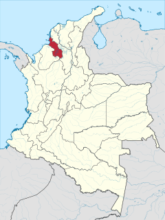
Sucre is a department in the Caribbean Region of Colombia. The department ranks 27th by area, 10,670 km2 (4,120 sq mi) and it has a population of 904,863, ranking 20th of all the 32 departments of Colombia. Sucre is bordered by the Caribbean on the northwest; by Bolívar Department on the east and by Córdoba Department on the west.
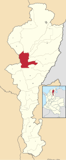
El Paso is a municipality in the Cesar Department of Colombia. El Paso is mostly known for having the second largest coal mine in Colombia, located in the corregimiento of La Loma.
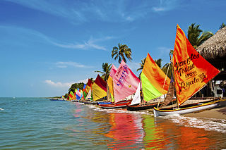
Tolú is a small municipality and town in Sucre Department, northern Colombia by the Caribbean sea. The municipality has an area of 500 km². The name of Tolú comes from a tree called the Balsam of Tolú.

Sincé is a town and municipality located in the Department of Sucre, northern Colombia.

El Carmen de Bolivar is a municipality in the department of Bolivar, Colombia, 114 km southeast of Cartagena, in the mountain system of the Serrania de San Jacinto, near the Colombian Caribbean coast.

Caimito is a town and municipality located in the Sucre Department, northern Colombia.

Chalán is a town and municipality located in the Sucre Department, northern Colombia.

Colosó is a town and municipality located in the Sucre Department, northern Colombia.

Corozal is a town and municipality in the Sucre Department, northern Colombia.
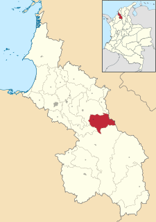
Galeras is a town and municipality located in the Sucre Department, northern Colombia. The main economic activities are agriculture and cattle raising. Galeras is 50 km away from the department's capital, Sincelejo.

Los Palmitos is a town and municipality located in the Sucre Department, northern Colombia.
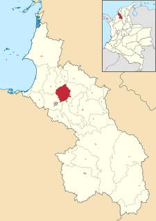
Morroa is a town and municipality located in the Sucre Department, northern Colombia.
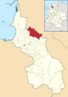
Ovejas is a town and municipality located in the Sucre Department, northern Colombia where the traditional Cumbia festival "Francisco Llirene" takes place in October.

Palmito is a town and municipality located in the Sucre Department, northern Colombia.

Sampués is a town and municipality located in the Sucre Department, northern Colombia.

San Juan Betulia is a town and municipality located in the Sucre Department, northern Colombia.

San Onofre is a town and municipality located in the Sucre Department, northern Colombia.

Toluviejo is a town and municipality located in the Sucre Department, northern Colombia.
The Gulf of Morrosquillo is a gulf of the Caribbean Sea bounded by the Colombian Departments of Sucre and Córdoba. From West to East it runs approximately 80 kilometres (50 mi) from Boca de Tinajones, mouth of Sinú River, in Córdoba, to Punta San Bernardo in Sucre.


