You can help expand this article with text translated from the corresponding article in Spanish. Click [show] for important translation instructions.
|
Buenavista | |
|---|---|
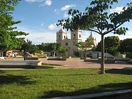 View of Buenavista | |
 Flag  Seal | |
 Buenavista | |
| Coordinates: 9°19′13.6″N74°58′24.2″W / 9.320444°N 74.973389°W | |
| Country | |
| Department | |
| Government | |
| • Mayor | José Nicolás Arrieta Guzmán |
| Area | |
• Total | 146.5 km2 (56.6 sq mi) |
| Population (June 30, 2020) | |
• Total | 10,829 |
| • Density | 73.92/km2 (191.5/sq mi) |
| Time zone | UTC−05:00 |
| Area code(s) | 70110 |
| Website | Official website |
Buenavista is a municipality located in the Sucre Department, northern Colombia.