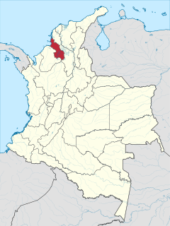
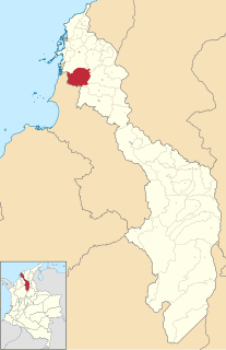
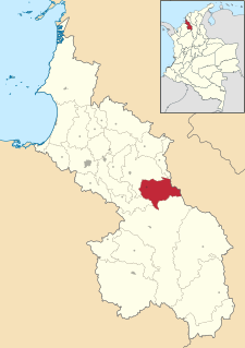
Sucre is a department in the Caribbean Region of Colombia. The department ranks 27th by area, 10,670 km2 (4,120 sq mi) and it has a population of 904,863, ranking 20th of all the 32 departments of Colombia. Sucre is bordered by the Caribbean on the northwest; by Bolívar Department on the east and by Córdoba Department on the west.
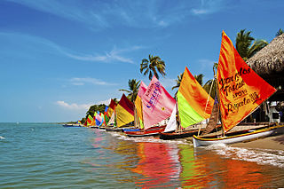
Tolú is a small municipality and town in Sucre Department, northern Colombia by the Caribbean sea. The municipality has an area of 500 km². It is named for Tolú, one the pre-Columbian indigenous people of the North Colombia lowlands.

The Montes de María is an isolated group of small mountains near the northern coast of Colombia in the Caribbean Region. The Montes de María are the last part of the Serranía de San Jerónimo which extends from the West Andes. A part of the mountains are protected as the Los Colorados fauna and flora sanctuary.
San Onofre or Santo Onofre may refer to:

Sincé is a town and municipality located in the Department of Sucre, northern Colombia.

El Carmen de Bolívar is a municipality in the department of Bolívar, Colombia, 114 km southeast of Cartagena de Indias. It is located in the orographic system of the Montes de María, being the largest population, as well as the one that concentrates the economic and commercial movement of the subregion. It is the third most populated municipality in the department and an important agricultural center, considered "the agricultural and food pantry of the department of Bolívar" for being a great supplier to the entire department of products, especially avocado, tobacco, cocoa, banana, yam and sesame. This is how it is known as the Sweet City of Colombia since a part of its economy is based on food processing such as Chepacorinas Cookies, Coco Casadilla, Panochas, among others.
María La Baja is a town and municipality located in the Bolívar Department, northern Colombia.

Colosó is a town and municipality located in the Sucre Department, northern Colombia.

Corozal is a town and municipality in the Sucre Department, northern Colombia.
Galeras is a town and municipality located in the Sucre Department, northern Colombia. The main economic activities are agriculture and cattle raising. Galeras is 50 km away from the department's capital, Sincelejo.

El Roble is a town and municipality located in the Sucre Department, northern Colombia.

Guaranda is a town and municipality located in the Sucre Department, northern Colombia.

Los Palmitos is a town and municipality located in the Sucre Department, northern Colombia.
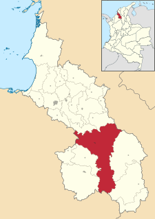
San Benito Abad is a town and municipality located in the Sucre Department, northern Colombia.
San Juan Betulia is a town and municipality located in the Sucre Department, northern Colombia.
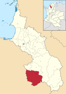
San Marcos is a town and municipality located in the Sucre Department, northern Colombia. It is also called "La Perla del San Jorge".

Toluviejo is a town and municipality located in the Sucre Department, northern Colombia.
The Gulf of Morrosquillo is a gulf of the Caribbean Sea bounded by the Colombian Departments of Sucre and Córdoba. From West to East it runs approximately 80 kilometres (50 mi) from Boca de Tinajones, mouth of Sinú River, in Córdoba, to Punta San Bernardo in Sucre.

The Archipelago of San Bernardo is a set of nine coastal coral islands and one artificial island belonging to and governed by Colombia, located in the Gulf of Morrosquillo in the Caribbean Sea, with an approximate area of 213 km2. Administratively, the archipelago belongs to the Bolívar Department, with the exception of Boquerón Island, which belongs to the Sucre Department. It consists of Boquerón Island, Cabruna Island, Ceycén Island, Mangle Island, Múcura Island, Palma Island, Panda Island, Santa Cruz del Islote, Tintipán Island and Maravilla Island. All the 10 islands are close to the towns Tolu and Coveñas.
Boquerón Island is a coral island located in the Archipelago of San Bernardo, Gulf of Morrosquillo, Caribbean Sea. It is governed by Colombia, and, unlike the other nine islands of the archipelago, is a part of the Colombian Sucre Department,.

