Sucre is a department in the Caribbean Region of Colombia. The department ranks 27th by area, 10,670 km2 (4,120 sq mi) and it has a population of 904,863, ranking 20th of all the 32 departments of Colombia. Sucre is bordered by the Caribbean on the northwest; by Bolívar Department on the east and by Córdoba Department on the west.

Ebéjico is a town and municipality in the West of Antioquia Department, Colombia.

The Municipalities of Colombia are decentralized subdivisions of the Republic of Colombia. Municipalities make up most of the departments of Colombia with 1,122 municipalities (municipios). Each one of them is led by a mayor (alcalde) elected by popular vote and represents the maximum executive government official at a municipality level under the mandate of the governor of their department which is a representative of all municipalities in the department; municipalities are grouped to form departments.
Tolú is a small municipality and town in Sucre Department, northern Colombia by the Caribbean sea. The municipality has an area of 500 km². It is named for Tolú, one the pre-Columbian indigenous people of the North Colombia lowlands.

Sincé is a town and municipality located in the Department of Sucre, northern Colombia.

El Carmen de Bolívar is a municipality in the department of Bolívar, Colombia, 114 km southeast of Cartagena de Indias. It is located in the orographic system of the Montes de María, being the largest population, as well as the one that concentrates the economic and commercial movement of the subregion. It is the third most populated municipality in the department and an important agricultural center, considered "the agricultural and food pantry of the department of Bolívar" for being a great supplier to the entire department of products, especially avocado, tobacco, cocoa, banana, yam and sesame. This is how it is known as the Sweet City of Colombia since a part of its economy is based on food processing such as Chepacorinas Cookies, Coco Casadilla, Panochas, among others.
María La Baja is a town and municipality located in the Bolívar Department, northern Colombia.

Caimito is a town and municipality located in the Sucre Department, northern Colombia.
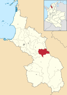
Galeras is a town and municipality located in the Sucre Department, northern Colombia. The main economic activities are agriculture and cattle raising. Galeras is 50 km away from the department's capital, Sincelejo.

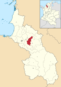
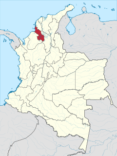
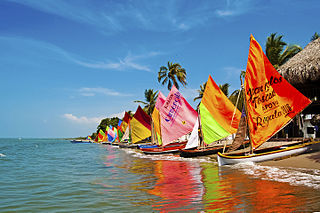
Coveñas is a town and municipality located in the Sucre Department, northern Colombia. It was established in the 16th century as a port for slave traders, then it became an oil port in the twentieth century. It became a municipality in 2002. The town is now a popular vacation place for the people of the Colombian Andean region.

El Roble is a town and municipality located in the Sucre Department, northern Colombia.

La Unión is a town and municipality located in the Sucre Department, northern Colombia.

Los Palmitos is a town and municipality located in the Sucre Department, northern Colombia.
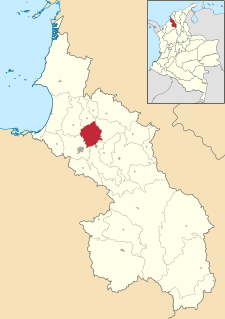
Morroa is a town and municipality located in the Sucre Department, northern Colombia.

Sampués is a town and municipality located in the Sucre Department, northern Colombia.
San Benito Abad is a town and municipality located in the Sucre Department, northern Colombia.
San Marcos is a town and municipality located in the Sucre Department, northern Colombia. It is also called "La Perla del San Jorge".

San Onofre is a town and municipality located in the Sucre Department, northern Colombia.

San Pedro is a town and municipality located in the Sucre Department, northern Colombia.

Toluviejo is a town and municipality located in the Sucre Department, northern Colombia.