Guaranda, Sucre

Last updated
Guaranda, Sucre
Municipality and town
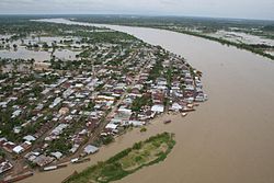
Sobre vuelo en guaranda 006.jpg
View of Guaranda
Flag of Guaranda (Sucre).svg
Escudo Guaranda.JPG
Colombia - Sucre - Guaranda.svg
Location of the municipality and town of Guaranda, Sucre in the Sucre Department of Colombia.
CountryFlag of Colombia.svg  Colombia
Department Sucre Department
Area
  Total
354 km2 (137 sq mi)
Population
 (Census 2018 [1] )
  Total
15,618
  Density44/km2 (110/sq mi)
Time zone UTC-5 (Colombia Standard Time)

Guaranda is a town and municipality located in the Sucre Department, northern Colombia.

Climate

Guaranda has a tropical monsoon climate (Am) with heavy rainfall in all months except January.

Climate data for Guaranda
MonthJanFebMarAprMayJunJulAugSepOctNovDecYear
Mean daily maximum °C (°F)32.5
(90.5)
33.2
(91.8)
33.3
(91.9)
33.1
(91.6)
32.1
(89.8)
32.0
(89.6)
32.2
(90.0)
32.0
(89.6)
31.7
(89.1)
31.4
(88.5)
31.6
(88.9)
32.0
(89.6)
32.3
(90.1)
Daily mean °C (°F)27.7
(81.9)
28.1
(82.6)
28.5
(83.3)
28.5
(83.3)
27.8
(82.0)
27.9
(82.2)
27.7
(81.9)
27.7
(81.9)
27.3
(81.1)
27.2
(81.0)
27.6
(81.7)
27.6
(81.7)
27.8
(82.1)
Mean daily minimum °C (°F)23.0
(73.4)
23.1
(73.6)
23.7
(74.7)
23.9
(75.0)
23.6
(74.5)
23.8
(74.8)
23.2
(73.8)
23.4
(74.1)
23.0
(73.4)
23.1
(73.6)
23.6
(74.5)
23.3
(73.9)
23.4
(74.1)
Average rainfall mm (inches)0.8
(0.03)
70.8
(2.79)
100.5
(3.96)
230.2
(9.06)
444.6
(17.50)
446.7
(17.59)
482.8
(19.01)
439.3
(17.30)
374.7
(14.75)
440.9
(17.36)
295.6
(11.64)
159.7
(6.29)
3,486.6
(137.28)
Average rainy days2338121213141213116109
Source: [2]

References

  1. "Censo Nacional de Población y Vivienda 2018" (in Spanish). DANE. Archived from the original on 13 August 2020. Retrieved 25 April 2020.
  2. http://www.ideam.gov.co/documents/21021/553571/Promedios+Climatol%C3%B3gicos++1981+-+2010.xlsx/f28d0b07-1208-4a46-8ccf-bddd70fb4128 [ bare URL ]

8°28′N75°32′W / 8.467°N 75.533°W / 8.467; -75.533