El Rosario, Tenerife

Last updated
El Rosario
Bandera de El Rosario (con escudo).svg
Escudo de El Rosario.svg
Tenerife municipio El Rosario.svg
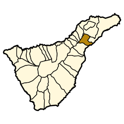
Municipal location in Tenerife
Location map Spain Tenerife.png
Red pog.svg
El Rosario
Location in Tenerife
Canarias-loc.svg
Red pog.svg
El Rosario
El Rosario (Canary Islands)
Espana-Canarias-loc.svg
Red pog.svg
El Rosario
El Rosario (Spain, Canary Islands)
Coordinates: 28°27′N16°22′W / 28.450°N 16.367°W / 28.450; -16.367
CountryFlag of Spain.svg  Spain
Autonomous Region Canary Islands
Province Santa Cruz de Tenerife
Island Tenerife
Area
[1]
  Total39.43 km2 (15.22 sq mi)
Population
 (2018) [2]
  Total17,352
  Density440/km2 (1,100/sq mi)
Time zone UTC+0 (GMT)
Climate Csb
Website www.ayuntamientoelrosario.org

El Rosario is a municipality in the northeastern part of the island of Tenerife in the Santa Cruz de Tenerife province, on the Canary Islands, Spain. The seat of the municipality is the town La Esperanza, in the mountainous interior of the island. The municipality includes the coastal town Radazul.

Contents

The population is 15,542 (2013 [3] ), its area is 39.43 km2. [1]

La Esperanza

The seat of the municipality, La Esperanza, sits at an elevation of 900 meters above sea level, La Esperanza’s historic architecture—whitewashed houses with wooden balconies—speaks of a simpler time when life revolved around agriculture and community. [4]

From Llanos to Coast

Radazul: A Coastal Town

Cultural Resilience

Education and International Connections

Historical population

YearPopulation
19918,103
199610,880
200113,462
200213,718
200314,862
200415,542
200516,024
201317,465

Education

The Deutsche Schule Santa Cruz de Tenerife, a German international school, is located in the Tabaita Alta section of El Rosario. [7]

See also

Related Research Articles

<span class="mw-page-title-main">Barlovento, Santa Cruz de Tenerife</span> Municipality in Canary Islands, Spain

Barlovento is a municipality in the northern part of the island of La Palma, one of the Canary Islands, and a part of the province of Santa Cruz de Tenerife. Barlovento is on the main highway which encircles the island. The land rises steeply from a small coastal plain, to the rim of the Caldera de Taburiente at Pico de la Cruz (2,350m)

<span class="mw-page-title-main">Puerto del Rosario</span> Municipality in Canary Islands, Spain

Puerto del Rosario is a town and a municipality in the eastern part of the island of Fuerteventura in the Las Palmas province in the Canary Islands. It has been the capital of Fuerteventura since 1860. The town's population is 29,160 (2013), the administrative district's population is 36,744 and its area is 289.95 km².

<span class="mw-page-title-main">Vilaflor, Santa Cruz de Tenerife</span> Municipality in Canary Islands, Spain

Vilaflor is a municipality and village in the south-central part of the island of Tenerife, one of the Canary Islands, and part of Santa Cruz de Tenerife (province), Spain. Vilaflor, with an altitude of 1,400 m, is the highest village on Tenerife, situated south of the Teide volcano. It is located 7 km north of San Miguel de Abona and 51 km southwest of the island's capital Santa Cruz de Tenerife. The population is 1,645 (2018) and the area is 56.26 km².

<span class="mw-page-title-main">Los Silos</span> Municipality and town in Canary Islands, Spain

Los Silos is a municipality and town in the northwestern part of the island Tenerife, Canary Islands, Spain. It is located on the north coast, 57 km West of the capital Santa Cruz de Tenerife.

<span class="mw-page-title-main">El Tanque</span> Municipality in Canary Islands, Spain

El Tanque is a town and a municipality in the northwestern part of the island of Tenerife, one of the Canary Islands, and part of the province of Santa Cruz de Tenerife, Spain. It is located 6 km west of Icod de los Vinos and 53 km west of the island's capital Santa Cruz de Tenerife.

<span class="mw-page-title-main">San Juan de la Rambla, Santa Cruz de Tenerife</span> Municipality in Canary Islands, Spain

San Juan de la Rambla is a town and a municipality in the northern part of the island of Tenerife, one of the Canary Islands, and part of the province of Santa Cruz de Tenerife, Spain. It is located on the north coast, 12 km west of La Orotava and 40 km west of the island's capital Santa Cruz de Tenerife. The population is 5,110 (2013) and the area is 20.67 km².

<span class="mw-page-title-main">La Orotava</span> Municipality in Canary Islands, Spain

La Orotava is a town and a municipality in the northern part of Tenerife, one of the Canary Islands of Spain. The area of the municipality stretches from the north coast to the mountainous interior, and includes the summit of the Teide volcano, Canary Islands' and Spain's highest point at 3,718 m. At 207.31 km2, it is the largest municipality of the island of Tenerife. The population is 41,255 (2013).

<span class="mw-page-title-main">La Matanza de Acentejo</span> Municipality in Canary Islands, Spain

La Matanza de Acentejo is a town near the north coast of Tenerife, Canary Islands, Spain. It is located 10 km east of Puerto de la Cruz, and about 20 km west of the island's capital, Santa Cruz de Tenerife. Its name means "the Slaughter of Acentejo" in Spanish, and refers to the 1494 First Battle of Acentejo, lost by the Spanish.

<span class="mw-page-title-main">El Sauzal</span> Municipality in Canary Islands, Spain

El Sauzal is a town and a municipality in the northeastern part of the island of Tenerife, Canary Islands, Spain. It is located on the north coast, 12 km west of San Cristóbal de La Laguna, 13 km northeast of La Orotava and 18 km west of the island's capital, Santa Cruz de Tenerife. The TF-5 motorway passes through the municipality. The population is 9,076 (2013) and the area is 18.31 km2.

<span class="mw-page-title-main">Alajeró</span> Municipality in Canary Islands, Spain

Alajeró is a municipality on the island of La Gomera in the province of Santa Cruz de Tenerife in the Canary Islands. It is located on the south coast, SW of the capital San Sebastián de la Gomera. As well as being a municipality, Alajeró is also the name of the administrative town that governs that municipality.

<span class="mw-page-title-main">Vallehermoso, Santa Cruz de Tenerife</span> Municipality in Canary Islands, Spain

Vallehermoso is a village and municipality in the western part of the island La Gomera in the province of Santa Cruz de Tenerife of the Canary Islands, Spain. The town of Vallehermoso, the seat of the municipality, is situated in the northern part of the municipality, 3 km from the coast and 18 km northwest of the island capital, San Sebastián de la Gomera.

<span class="mw-page-title-main">Villa de Mazo</span> Municipality in Canary Islands, Spain

Villa de Mazo is a town and a municipality on the island of La Palma, Province of Santa Cruz de Tenerife, Canary Islands, Spain. It is situated in the southeastern part of the island. The population of the municipality is 4,858 (2013) and the area is 71.17 km². Villa de Mazo is 9 km south of the island capital Santa Cruz de La Palma. La Palma Airport is located on the coast of Villa de Mazo.

<span class="mw-page-title-main">Breña Baja</span> Municipality in Canary Islands, Spain

Breña Baja is a municipality on the eastern side of the island of La Palma, in the province of Santa Cruz de Tenerife, in the Canary Islands. The ayuntamiento is in the town of San José with an elevation of 300 m. Until the 17th century the area was known as Breña, but was then divided into Breña Alta and Breña Baja.

<span class="mw-page-title-main">Breña Alta</span> Municipality in Canary Islands, Spain

Breña Alta is a municipality on the eastern side of the island of La Palma, in the province of Santa Cruz de Tenerife, in the Canary Islands. The ayuntamiento is in the town of San Pedro, at 350 m above sea-level, and only 9 km south of the island's capital Santa Cruz de la Palma. Breña Alta lies on the main highway encircling the island, just north of La Palma Airport. Until the 17th century the area was known as Breña, but was then divided into Breña Alta and Breña Baja.

<span class="mw-page-title-main">Santa Cruz de La Palma</span> Municipality in Canary Islands, Spain

Santa Cruz de la Palma is a city and a municipality on the east coast of the island of La Palma in the province of Santa Cruz de Tenerife of the Canary Islands. Santa Cruz de la Palma is the second-largest city and is the capital of the island. It is along an old lava flow coming from the Caldereta, a volcano just south of the city. Santa Cruz de La Palma has the privilege of having the first democratically elected town hall in Spain.

<span class="mw-page-title-main">Puntallana</span> Municipality in Canary Islands, Spain

Puntallana is a town and a municipality on the island of La Palma, Province of Santa Cruz de Tenerife, Canary Islands, Spain. It is situated in the northeastern part of the island. The population of the municipality is 2,346 (2013) and the area is 35.10 km². The elevation is 420 m. Puntallana is 7 km northeast of the island capital Santa Cruz de La Palma.

<span class="mw-page-title-main">Tijarafe</span> Municipality in Canary Islands, Spain

Tijarafe is a town and a municipality on the island of La Palma, Province of Santa Cruz de Tenerife, Canary Islands, Spain. It is situated in the northwestern part of the island. The population of the municipality is 2,776 (2013) and the area is 53.76 km². Tijarafe is 7 km northwest of Los Llanos de Aridane and 19 km west of the island capital Santa Cruz de La Palma.

<span class="mw-page-title-main">San Andrés, Santa Cruz de Tenerife</span> Village in Canary Islands, Spain

San Andrés is a village located on the island of Tenerife in the Canary Islands (Spain). It is located on the coast, at the foot of the Anaga mountains, 7 km (4.3 mi) northeast of the capital city Santa Cruz de Tenerife. It is administratively part of the municipality of Santa Cruz de Tenerife. San Andrés is one of the oldest villages of Canary Islands, and was founded around 1498.

<span class="mw-page-title-main">Santa Úrsula</span> Municipality in Canary Islands, Spain

Santa Úrsula is a town and a municipality on the north coast of Tenerife. It is located 6 km east of Puerto de la Cruz and 24 km west of the island's capital, Santa Cruz de Tenerife. The population is 14,545 (2013) and the area is 22.59 km2. The elevation is 290 m. The TF-5 motorway passes through the municipality.

Deutsche Schule Santa Cruz de Tenerife is a German international school in the Tabaita Alta section of El Rosario, on the island of Tenerife in Spain, near Santa Cruz de Tenerife. It serves years 1–12, serving kindergarten through Oberstufe II.

References

  1. 1 2 Instituto Canario de Estadística, area
  2. Municipal Register of Spain 2018. National Statistics Institute.
  3. Instituto Canario de Estadística Archived 2014-04-18 at the Wayback Machine , population
  4. Surprise, Tenerife (2019-08-19). "El Rosario municipality in the north of Tenerife". Tenerife Surprise. Retrieved 2024-07-11.
  5. "Web Ayuntamiento El Rosario". Web Ayuntamiento El Rosario (in Spanish). Retrieved 2024-07-11.
  6. "El Rosario | Tenerife". www.webtenerife.co.uk. Retrieved 2024-07-11.
  7. "Deutsche Schule Santa Cruz de Tenerife [ permanent dead link ]." ZfA. Retrieved on 13 February 2016. "Deutsche Schule - Colegio Alemán Calle Drago , 1 38190 Tabaiba Alta (El Rosario) Spanien"