San Miguel de Abona

Last updated
San Miguel de Abona
Flag of San Miguel de Abona.svg
Escudo de San Miguel de Abona (Santa Cruz de Tenerife).svg
Tenerife municipio San Miguel de Abona.svg
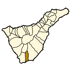
Municipal location in Tenerife
Santa Cruz de Tenerife-loc.svg
Red pog.svg
San Miguel de Abona
Location in Province of Santa Cruz de Tenerife
Canarias-loc.svg
Red pog.svg
San Miguel de Abona
San Miguel de Abona (Canary Islands)
Espana-Canarias-loc.svg
Red pog.svg
San Miguel de Abona
San Miguel de Abona (Spain, Canary Islands)
Coordinates: 28°6′N16°37′W / 28.100°N 16.617°W / 28.100; -16.617 Coordinates: 28°6′N16°37′W / 28.100°N 16.617°W / 28.100; -16.617
Sovereign state Flag of Spain.svg  Spain
Autonomous community Flag of the Canary Islands.svg  Canary Islands
Province Provincia de Santa Cruz de Tenerife - Escudo.svg  Santa Cruz de Tenerife
IslandFlag of Tenerife.svg  Tenerife
Area
[1]
  Total42.04 km2 (16.23 sq mi)
Population
 (2018) [2]
  Total19,672
  Density470/km2 (1,200/sq mi)
Time zone UTC+0 (GMT)
Climate Csb
Website www.sanmigueldeabona.org

San Miguel de Abona is a town and a municipality in the southern part of the island of Tenerife, one of the Canary Islands, and part of the province of Santa Cruz de Tenerife, Spain. The TF-1 motorway passes through the southern part of the municipality.

Contents

The population is 16,099 (2013 [3] ), its area is 42.04 km2. [1]

In the south of the municipality, on the coastline, lies the golf course and holiday/residential village of Golf del Sur. Also on the coast is Amarilla Golf & Country Club. Golf del Sur has hosted several professional golf tournaments including the Tenerife Open, the Tenerife Ladies Open.

Historical population

YearPopulation
1991
19965,776
20018,398
20029,174
20039,988
200410,802
201316,099

Related Research Articles

<span class="mw-page-title-main">Province of Santa Cruz de Tenerife</span> Province of Spain

Province of Santa Cruz de Tenerife, also Province of Santa Cruz, is a province of Spain, consisting of the western part of the autonomous community of the Canary Islands. It consists of about half of the Atlantic archipelago: the islands of Tenerife, La Gomera, El Hierro, and La Palma. It occupies an area of 3,381 km2 (1,305 sq mi). It also includes a series of adjacent roques.

<span class="mw-page-title-main">Tenerife</span> Largest, most populous Canary Island

Tenerife is the largest and most populous island of the Canary Islands. It is home to 43% of the total population of the archipelago. With a land area of 2,034 square kilometres (785 sq mi) and a population of 978,100 inhabitants as of January 2022, it is also the most populous island of Spain and of Macaronesia.

<span class="mw-page-title-main">El Rosario, Tenerife</span> Municipality in Canary Islands, Spain

El Rosario is a municipality in the northeastern part of the island of Tenerife in the Santa Cruz de Tenerife province, on the Canary Islands, Spain. The seat of the municipality is the town La Esperanza, in the mountainous interior of the island. The municipality includes the coastal town Radazul. The TF-1 motorway passes through the southern part of the municipality.

<span class="mw-page-title-main">Vilaflor, Santa Cruz de Tenerife</span> Municipality in Canary Islands, Spain

Vilaflor is a municipality and village in the south-central part of the island of Tenerife, one of the Canary Islands, and part of Santa Cruz de Tenerife (province), Spain. Vilaflor, with an altitude of 1,400 m, is the highest village on Tenerife, situated south of the Teide volcano. It is located 7 km north of San Miguel de Abona and 51 km southwest of the island's capital Santa Cruz de Tenerife. The population is 1,645 (2018) and the area is 56.26 km².

<span class="mw-page-title-main">Santiago del Teide</span> Municipality in Canary Islands, Spain

Santiago del Teide is a town and a municipality in the western part of the island Tenerife, Canary Islands, and part of the province of Santa Cruz de Tenerife. The area of the municipality is 52.21 km², the population is 12,634 (2013). Beach resort towns in the municipality are Los Gigantes, Puerto de Santiago and Playa de la Arena. The steep cliffs Acantilados de Los Gigantes are situated on the coast of the municipality.

<span class="mw-page-title-main">El Tanque</span> Municipality in Canary Islands, Spain

El Tanque is a town and a municipality in the northwestern part of the island of Tenerife, one of the Canary Islands, and part of the province of Santa Cruz de Tenerife, Spain. It is located 6 km west of Icod de los Vinos and 53 km west of the island's capital Santa Cruz de Tenerife.

<span class="mw-page-title-main">La Guancha, Tenerife</span> Municipality in Canary Islands

La Guancha is a municipality in the northern part of the island of Tenerife, one of the Canary Islands, and part of the province of Santa Cruz de Tenerife. It is located about 40 km west of the island's capital Santa Cruz de Tenerife, and 6 km east of Icod de los Vinos. The population is 5,448 (2013) and the area is 23.77 km². The elevation is 501 m.

<span class="mw-page-title-main">San Juan de la Rambla, Santa Cruz de Tenerife</span> Municipality in Canary Islands, Spain

San Juan de la Rambla is a town and a municipality in the northern part of the island of Tenerife, one of the Canary Islands, and part of the province of Santa Cruz de Tenerife, Spain. It is located on the north coast, 12 km west of La Orotava and 40 km west of the island's capital Santa Cruz de Tenerife. The population is 5,110 (2013) and the area is 20.67 km².

<span class="mw-page-title-main">La Victoria de Acentejo</span> Municipality in Canary Islands, Spain

La Victoria de Acentejo is a town and a municipality in the northern part of the island Tenerife, Canary Islands, Spain. It is located near the north coast, 2 km southwest of La Matanza de Acentejo, 7 km northeast of La Orotava and 22 km west of the island capital Santa Cruz de Tenerife. The TF-5 motorway passes through the municipality. The population is 9,069 (2013) and the area is 18.36 km².

<span class="mw-page-title-main">La Matanza de Acentejo</span> Municipality in Canary Islands, Spain

La Matanza de Acentejo is a town near the north coast of Tenerife, Canary Islands, Spain. It is located 10 km east of Puerto de la Cruz, and about 20 km west of the island's capital, Santa Cruz de Tenerife. Its name means "the Slaughter of Acentejo" in Spanish, and refers to the 1494 First Battle of Acentejo, lost by the Spanish.

<span class="mw-page-title-main">El Sauzal</span> Municipality in Canary Islands, Spain

El Sauzal is a town and a municipality in the northeastern part of the island of Tenerife, Canary Islands, Spain. It is located on the north coast, 12 km west of San Cristóbal de La Laguna, 13 km northeast of La Orotava and 18 km west of the island's capital, Santa Cruz de Tenerife. The TF-5 motorway passes through the municipality. The population is 9,076 (2013) and the area is 18.31 km².

<span class="mw-page-title-main">Agulo</span> Municipality in Canary Islands, Spain

Agulo is located on the north coast of the island of La Gomera in the province of Santa Cruz de Tenerife of the Canary Islands. It is located 13 km northwest of the capital San Sebastián de la Gomera. The population was 1,100 in 2013.

<span class="mw-page-title-main">San Sebastián de La Gomera</span> Municipality in Canary Islands, Spain

San Sebastián de La Gomera is the capital and a municipality of La Gomera in the Canary Islands, Spain. It also hosts the main harbour. The population was 8,699 in 2013, and the area is 113.59 square kilometres (43.86 sq mi).

<span class="mw-page-title-main">Vallehermoso, Santa Cruz de Tenerife</span> Municipality in Canary Islands, Spain

Vallehermoso is a village and municipality in the western part of the island La Gomera in the province of Santa Cruz de Tenerife of the Canary Islands, Spain. The town of Vallehermoso, the seat of the municipality, is situated in the northern part of the municipality, 3 km from the coast and 18 km northwest of the island capital, San Sebastián de la Gomera.

<span class="mw-page-title-main">Fuencaliente de La Palma</span> Municipality in Canary Islands, Spain

Fuencaliente de La Palma, also Fuencaliente, is a municipality in the southern part of the island La Palma in the province of Santa Cruz de Tenerife of the Canary Islands, Spain. The seat of the municipality is the village Los Canarios. It has been the seat since 1837. The population of the municipality is 1,798 (2013) and the area is 56.42 km².

<span class="mw-page-title-main">Breña Baja</span> Municipality in Canary Islands, Spain

Breña Baja is a municipality on the eastern side of the island of La Palma, in the province of Santa Cruz de Tenerife, in the Canary Islands. The ayuntamiento is in the town of San José with an elevation of 300 m. Until the 17th century the area was known as Breña, but was then divided into Breña Alta and Breña Baja.

<span class="mw-page-title-main">Puntallana</span> Municipality in Canary Islands, Spain

Puntallana is a town and a municipality on the island of La Palma, Province of Santa Cruz de Tenerife, Canary Islands, Spain. It is situated in the northeastern part of the island. The population of the municipality is 2,346 (2013) and the area is 35.10 km². The elevation is 420 m. Puntallana is 7 km northeast of the island capital Santa Cruz de La Palma.

<span class="mw-page-title-main">San Andrés y Sauces</span> Municipality in Canary Islands, Spain

San Andrés y Sauces is a municipality on the island of La Palma, Province of Santa Cruz de Tenerife, Canary Islands, Spain. It is situated in the northeastern part of the island. The population of the municipality is 4,473 (2013) and the area is 42.75 km². The elevation of the largest village Los Sauces is 250 m. Los Sauces is 14 km north of the island capital Santa Cruz de La Palma. The municipality takes its name from the villages Los Sauces and San Andrés, 1.5 km southeast of Los Sauces, at the coast.

<span class="mw-page-title-main">Santa Úrsula</span> Municipality in Canary Islands, Spain

Santa Úrsula is a town and a municipality on the north coast of Tenerife. It is located 6 km east of Puerto de la Cruz and 24 km west of the island's capital, Santa Cruz de Tenerife. The population is 14,545 (2013) and the area is 22.59 km². The elevation is 290 m. The TF-5 motorway passes through the municipality.

<span class="mw-page-title-main">Autopista TF-1</span>

The TF-1 is a motorway encircling the eastern and the southern parts of the island of Tenerife. The TF-1 motorway runs from the capital Santa Cruz in the north to Adeje with its major tourist resorts Los Cristianos and Playa de las Américas in the south of the island, and continues to Santiago del Teide in the west. It is a 103 km motorway and interchange numbers go facing south. The motorway is one in the Canary Islands that passes through most of the municipalities and is the longest in the archipelago as well.

References

  1. 1 2 Instituto Canario de Estadística, area
  2. Municipal Register of Spain 2018. National Statistics Institute.
  3. Instituto Canario de Estadística Archived 2014-04-19 at the Wayback Machine , population

WEBCAM LIVE COSTA SAN MIGUEL,AMARILLA GOLF