Related Research Articles

Warrego is an electoral district of the Legislative Assembly in the Australian state of Queensland.
Toowoomba West was an electoral district of the Legislative Assembly in the Australian state of Queensland. It was created with the 1960 redistribution and removed by the 1972 redistribution.
The Electoral district of Toowoomba East was an electoral district of the Legislative Assembly in the Australian state of Queensland. It was created with the 1960 redistribution and removed by the 1972 redistribution.
Toowoomba was an electoral district of the Legislative Assembly in the Australian state of Queensland. The seat was in Toowoomba.
Electoral District of East Toowoomba was an electoral district of the Legislative Assembly in the Australian state of Queensland. It was created in 1912 when the old seat of Drayton & Toowoomba split into East Toowoomba, Toowoomba and Drayton. East Toowoomba ceased to exist in 1950.
Electoral District of Drayton and Toowoomba was the original seat for the urban settlement on the eastern Darling Downs, Queensland, Australia.
Darling Downs was an electoral district of the Legislative Assembly in the Australian state of Queensland. It was named for the Darling Downs region.
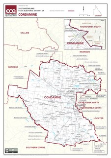
Condamine is an electoral district of the Legislative Assembly in the Australian state of Queensland.
The electoral district of Aubigny was a Legislative Assembly electorate in the state of Queensland. It was first created in a redistribution ahead of the 1873 colonial election, and existed until the 1972 state election.
Town of South Brisbane was an electoral district of the Legislative Assembly in the Australian state of Queensland from 1860 to 1873.
Croydon was an electoral district of the Legislative Assembly in the Australian state of Queensland from 1893 to 1912.
The electoral district of Flinders was an electoral district of the Legislative Assembly in the Australian state of Queensland.
Fassifern was an electoral district of the Legislative Assembly in the Australian state of Queensland from 1873 to 1992.
Roma was an electoral district of the Legislative Assembly in the Australian state of Queensland from 1950 to 1992.
Northern Downs was a Legislative Assembly electorate in the state of Queensland, one of the original 16 created in 1859. It covered the Dalby and Condamine areas. In the electoral redistribution of 1887, Northern Downs was split into two new electoral districts, the Electoral district of Dalby and the Electoral district of Murilla.
Maranoa was a Legislative Assembly electorate in the state of Queensland.
Fortitude Valley, originally known as Hamlet of Fortitude Valley, was a Legislative Assembly electorate in the state of Queensland.
Eastern Downs was a Legislative Assembly electorate in the colony of Queensland.
Clermont was a Legislative Assembly electorate in the state of Queensland. The electorate was based on the town of Clermont and surrounding areas.
The electoral district of Murilla was a Legislative Assembly electorate in the state of Queensland, Australia.
References
- ↑ "Representatives of Queensland State Electorates 1860-2017" (PDF). Queensland Parliamentary Record 2012-2017: The 55th Parliament. Queensland Parliament. Archived from the original on 27 April 2020. Retrieved 27 April 2020.CS1 maint: unfit URL (link)