Electoral district of Ipswich

Last updated

Ipswich
QueenslandLegislative Assembly
ECQ-2017-Final-Ipswich.pdf
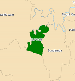
Ipswich electoral map 2017
State Queensland
Dates current1860–1960, 1972–present
MP Jennifer Howard
Party Labor
Namesake Ipswich
Electors 33,668 (2020)
Area86 km2 (33.2 sq mi)
DemographicProvincial
Coordinates 27°38′S152°46′E / 27.633°S 152.767°E / -27.633; 152.767
Electorates around Ipswich:
Ipswich West Ipswich West Bundamba
Scenic Rim Ipswich Bundamba
Scenic Rim Jordan Bundamba
2008 Electoral Map QLD - Ipswich 2008.png
2008 Electoral Map

Ipswich is a Legislative Assembly of Queensland electoral district on the Brisbane River, west of Brisbane in the Australian state of Queensland. The electorate includes Ipswich and its suburbs, south and east of the Bremer River, west of Bundamba Creek and north of the Cunningham Highway. [1]

Contents

History

The electoral district of Town of Ipswich was one of the original 16 established in 1859, when Queensland became a separate colony. It returned 3 members.

In the redistribution of 1872, its name was shortened to just "Ipswich" and it became a single member constituency, due to the creation of the electoral district of Bundamba. In the redistribution of 1878, it absorbed the electoral district of Bremer and became a dual-member constituency.

In 1912, it again reverted to a single member constituency, due to the re-introduction of the single-member electoral district of Bremer. [2]

Members for Ipswich

Town of Ipswich: First incarnation (1860–1960),   3 members until 1873
Member 1PartyTermMember 2PartyTermMember 3PartyTerm
  Frederick Forbes Unaligned1860–1863  Patrick O'Sullivan Unaligned1860–1863  Arthur Macalister Unaligned1860–1868
  Ratcliffe Pring Unaligned1863–1866  Henry Challinor Unaligned1863–1868
  George Reed Unaligned1866–1867  John Thompson Unaligned1868–1873  Henry Williams Unaligned1868–1870
  John Murphy Unaligned1867–1870
  Benjamin Cribb Unaligned1870–1873  John Johnston Unaligned1870–1872
  Arthur Macalister Unaligned1872–1873
Ipswich: 1873–1878,   1 member
MemberPartyTerm
  Arthur Macalister Unaligned1873–1876
  George Thorn, Jr. Unaligned1876–1878
1878–1912,   2 members
Member 1PartyTermMember 2PartyTerm
  John Thompson Unaligned1878–1881  John MacFarlane Ministerialist1878–1894
  Josiah Francis Unaligned1881–1883
  William Salkeld Unaligned1883–1888
  Andrew Henry Barlow Ministerialist1888–1896
  James Wilkinson Labour 1894–1896  Alfred Stephenson Ministerialist1896–1902
  Thomas Bridson Cribb Ministerialist1896–1904 Sir James Blair Independent/
Ministerialist/
Opposition
1902–1912
  William Maughan Labour 1904–1912
1912–1960,   1 member
MemberPartyTerm
 Sir James Blair Ministerialist/Independent1912–1915
  David Gledson Labor 1915–1929
  James Walker Country and Progressive National 1929–1932
  David Gledson Labor 1932–1949
  Ivor Marsden Labor 1949–1960
Second incarnation (1972–present),   1 member
MemberPartyTerm
  Llew Edwards Liberal 1972–1983
  David Hamill Labor 1983–2001
  Rachel Nolan Labor 2001–2012
  Ian Berry Liberal National 2012–2015
  Jennifer Howard Labor 2015–present

Election results

2020 Queensland state election: Ipswich [3]
PartyCandidateVotes%±%
Labor Jennifer Howard 14,69951.80+3.82
Liberal National Scott O'Connell5,76920.33+6.43
One Nation Suzie Holmes3,94713.91−12.70
Greens Pat Walsh2,3968.44−0.24
Legalise Cannabis Shelly Morton1,5655.52+5.52
Total formal votes28,37696.92+2.14
Informal votes9033.08−2.14
Turnout 29,27986.96−1.73
Two-party-preferred result
Labor Jennifer Howard 18,87666.52+5.64
Liberal National Scott O'Connell9,50033.48+33.48
Labor hold 

Related Research Articles

<span class="mw-page-title-main">Electoral district of Algester</span> State electoral district of Queensland, Australia

The electoral district of Algester is an electoral district of the Legislative Assembly of Queensland in south-west Brisbane. It includes the suburbs of Algester, Parkinson, Hillcrest, Boronia Heights, Forestdale, Larapinta, Heathwood, Forest Lake, Doolandella and Pallara, as well as the Greenbank Military Range. It borders the electoral districts of Sunnybank, Stretton, Logan, Lockyer, Bundamba and Inala.

<span class="mw-page-title-main">Electoral district of Brisbane Central</span>

Brisbane Central was an electoral division in the state of Queensland, Australia.

This is a list of current and former electoral divisions for the Legislative Assembly of Queensland, the state legislature for Queensland, Australia.

<span class="mw-page-title-main">Electoral district of Lockyer</span> State electoral district of Queensland, Australia

Lockyer is an electoral district of the Legislative Assembly in the Australian state of Queensland.

<span class="mw-page-title-main">Electoral district of Townsville</span> State electoral district of Queensland, Australia

Townsville is an electoral district of the Legislative Assembly in the Australian state of Queensland. The seat is one of four within the Townsville urban area in North Queensland, and covers the Eastern and Northern suburbs of the City of Townsville as well as Magnetic Island and Palm Island.

<span class="mw-page-title-main">Electoral district of Moggill</span> State electoral district of Queensland, Australia

Moggill is an electoral district in the Legislative Assembly of Queensland in the state of Queensland, Australia. The electorate is held by Dr Christian Rowan, for the Liberal National Party of Queensland.

<span class="mw-page-title-main">Electoral district of Bundamba</span> State electoral district of Queensland, Australia

Bundamba is a Legislative Assembly of Queensland electoral division in the state of Queensland, Australia.

<span class="mw-page-title-main">Electoral district of Inala</span> State electoral district of Queensland, Australia

The electoral district of Inala is an electoral district of the Legislative Assembly of Queensland in south-west Brisbane. It includes the suburbs of Inala, Ellen Grove, Forest Lake, Doolandella, Durack, Wacol, Richlands and parts of Oxley. It borders the electoral districts of Mount Ommaney, Miller, Algester, Jordan, Bundamba and Moggill.

West Moreton was the name of two incarnations of an electoral district of the Legislative Assembly in the Australian state of Queensland.

<span class="mw-page-title-main">Electoral district of Morayfield</span> State electoral district of Queensland, Australia

Morayfield is an electoral district of the Legislative Assembly in the Australian state of Queensland. It is located in the northern outskirts of Brisbane, south of the Sunshine Coast.

Brisbane City was an electoral district of the Legislative Assembly in the Australian state of Queensland from 1873 to 1878.

Town of South Brisbane was an electoral district of the Legislative Assembly in the Australian state of Queensland from 1860 to 1873.

Wolston was an electoral district of the Legislative Assembly in the Australian state of Queensland from 1972 to 1992.

Fassifern was an electoral district of the Legislative Assembly in the Australian state of Queensland from 1873 to 1992.

Enoggera was an electoral district of the Legislative Assembly in the Australian state of Queensland. It existed from 1873 to 1950 and centred on the suburb of Enoggera in Brisbane.

Wide Bay was a Legislative Assembly electorate in the state of Queensland.

Fortitude Valley, originally known as Hamlet of Fortitude Valley, was a Legislative Assembly electorate in the state of Queensland.

Bremer was a Legislative Assembly electorate in the state of Queensland.

<span class="mw-page-title-main">James Clarke Cribb</span> Australian politician

James Clarke Cribb was a businessman and politician in Queensland, Australia. He was a Member of the Queensland Legislative Assembly.

The electoral district of Ipswich East was a Legislative Assembly electorate in the state of Queensland. It was first created in a redistribution ahead of the 1960 state election, and existed until the 1972 state election.

References

  1. "Maps and Districts : Brisbane - South : Ipswich". Electoral Commission of Queensland. Archived from the original on 30 August 2007. Retrieved 23 May 2007.
  2. "Representatives of Queensland State Electorates 1860-2017" (PDF). Queensland Parliamentary Record 2012-2017: The 55th Parliament. Queensland Parliament. Archived from the original (PDF) on 27 April 2020. Retrieved 27 April 2020.
  3. 2020 State General Election – Ipswich – District Summary, ECQ.