Elgin, Manitoba

Last updated
Elgin
Unincorporated Urban Community
Elgin Manitoba museum storefront.jpg
Elgin and District Museum
Canada Manitoba location map 2.svg
Red pog.svg
Elgin
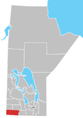
Location of Hartney in Manitoba
Coordinates: 49°26′31″N100°16′09″W / 49.44194°N 100.26917°W / 49.44194; -100.26917 Coordinates: 49°26′31″N100°16′09″W / 49.44194°N 100.26917°W / 49.44194; -100.26917
Established1898
IncorporatedUnknown
Lost IncorporationJanuary 1, 2015

Elgin is an unincorporated community recognized as a local urban district [1] in the Municipality of Grassland in the Canadian province of Manitoba, Canada. It currently has a population of just over 100.

Contents

Major attractions

The Elgin and District Historical Museum, open during July and August, details the history of Elgin and of the Rural Municipality of Whitewater. The Whitewater Centennial Park, located one mile east of Elgin, is a popular recreation area for birdwatching, camping, picnicking, golfing, hiking and other recreational activities. Elgin also has a museum that is open all summer on weekends.

Notable people

Related Research Articles

Deloraine, Manitoba Place in Manitoba, Canada

Deloraine is an unincorporated urban community in the Municipality of Deloraine – Winchester within the Canadian province of Manitoba that held town status prior to January 1, 2015. It is situated near the Turtle Mountains in the southwestern corner of the province. Located in the Westman Region, the community is 100 km (62 mi) south of Brandon. Deloraine originally incorporated as a village in 1904 and then as a town in 1907. Its town status was relinquished in 2015 when it amalgamated with the Rural Municipality of Winchester.

Austin is an unincorporated community recognized as a local urban district in western Manitoba on the Trans-Canada Highway about 110 km (68 mi) west of Winnipeg. It is part of the Municipality of North Norfolk. It sits at the western edge of the table-flat Portage Plains, but to the south and west is surrounded by miles of low wooded hills known as the Carberry sandhills. The biggest attraction is the annual rodeo and Threshermen's Reunion held at the Manitoba Agricultural Museum the last four business days of July.

Ashern is an unincorporated community recognized as a local urban district located in the Municipality of West Interlake in Manitoba's Interlake Region. The RM of Siglunes was incorporated in 1917. Ashern was named after A. S. Hern, a timekeeper of the firm that constructed the railway that served the Western Interlake.

The Rural Municipality of Cameron is a former rural municipality (RM) in the Canadian province of Manitoba. It was originally incorporated as a rural municipality on November 16, 1896. It ceased on January 1, 2015 as a result of its provincially mandated amalgamation with the RM of Whitewater and the Town of Hartney to form the Municipality of Grassland.

St. Claude is an unincorporated community recognized as a local urban district in the Rural Municipality of Grey within the Canadian province of Manitoba that held village status prior to January 1, 2015. It is located to the west of Winnipeg and is home to the world's largest smoking pipe. It is named the dairy capital of Manitoba as it is home to one of Manitoba's largest dairy processing plants and also displays a dairy museum filled with many artifacts. One of the other museums holds a two-headed calf, which was born over 120 years ago. It had a population of 590 in 2014.

Alonsa is an unincorporated community recognized as a local urban district located in north central Manitoba in the Rural Municipality of Alonsa.

Binscarth is an unincorporated urban community in the Municipality of Russell – Binscarth, Manitoba. It is located approximately 167 km (104 mi) northwest of Brandon, 16 km (9.9 mi) south from Russell, and 16 km (10 mi) east of the Saskatchewan border.

Crystal City, Manitoba Place in Manitoba, Canada

Crystal City is an unincorporated community recognized as a local urban district in the Municipality of Louise within the Canadian province of Manitoba. It held village status prior to January 1, 2015. It is located on Highway 3, 16 kilometres north of the Canada–United States border and 200 kilometres southwest of Winnipeg.

Elkhorn, Manitoba Place in Manitoba, Canada

Elkhorn is an unincorporated community recognized as a local urban district in the Rural Municipality of Wallace – Woodworth within the Canadian province of Manitoba that held village status prior to January 1, 2015. It was originally incorporated as a village on January 2, 1906. Elkhorn is located approximately 105 kilometres (65 mi) west of Brandon.

St. Jean Baptiste is an unincorporated community recognized as a local urban district in Manitoba. It is located in the Rural Municipality of Montcalm along Highway 75, 40 km north of Emerson at the United States border, and 60 km south of Winnipeg.

Richer is a local urban district in southeast Manitoba, almost 60 kilometres (37 mi) east south-east of Winnipeg. It is located in the Rural Municipality of Ste. Anne, at the junction of the Trans-Canada Highway and Provincial Road 302.

The Rural Municipality of Whitewater is a former rural municipality (RM) in the Canadian province of Manitoba. It was originally incorporated as a rural municipality on December 22, 1883. It ceased on January 1, 2015 as a result of its provincially mandated amalgamation with the RM of Cameron and the Town of Hartney to form the Municipality of Grassland.

Ninette, Manitoba Local urban district in Manitoba, Canada

Ninette is an unincorporated community recognized as a local urban district located in Manitoba, Canada at the north end of Pelican Lake. It is located in the Rural Municipality of Prairie Lakes. Ninette has many small businesses, and is known locally for its wide range of sports facilities. In the summer, activities such as boating, fishing, and hunting are offered, while snowmobiling and ice fishing are offered during the wintertime.

Miniota, Manitoba is an unincorporated community recognized as a local urban district in Prairie View Municipality, Manitoba, Canada. It is located northwest of Virden near the intersection of PTH 83 and PTH 24. The post office opened in 1885 on 36-13-27W. It was originally named Parkisimo and changed to its present name in 1900. It had two railways in its history: the Canadian Pacific Railway and the Grand Trunk Railway. Both had rail points about one mile apart and there was a Miniota Station on the latter.

The Municipality of Grassland is a rural municipality (RM) in the Canadian province of Manitoba.

References

  1. "Local Urban Districts Regulation". Government of Manitoba. April 23, 2016. Retrieved April 24, 2016.

Ahrens, C. (2007). Essentials of Meteorology . Pacific Grove: Brooks Cole. ISBN   978-0-495-11477-2.