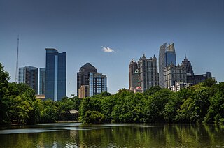
Midtown Atlanta, or Midtown, is a high-density commercial and residential neighborhood of Atlanta, Georgia. The exact geographical extent of the area is ill-defined due to differing definitions used by the city, residents, and local business groups. However, the commercial core of the area is anchored by a series of high-rise office buildings, condominiums, hotels, and high-end retail along Peachtree Street between North Avenue and 17th Street. Midtown, situated between Downtown to the south and Buckhead to the north, is the second-largest business district in Metro Atlanta. In 2011, Midtown had a resident population of 41,681 and a business population of 81,418.
The city of Minneapolis, Minnesota is officially defined by the Minneapolis City Council as divided into eleven communities, each containing multiple official neighborhoods. Informally, there are city areas with colloquial labels. Residents may also group themselves by their city street suffixes, North, Northeast, South, Southeast, and Southwest.

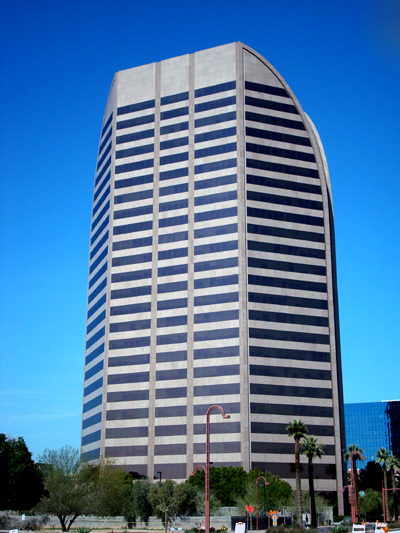
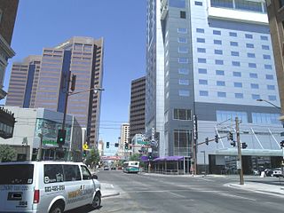
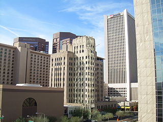
Downtown Phoenix is the central business district (CBD) of the City of Phoenix, Arizona, United States. It is located in the heart of the Phoenix metropolitan area or Valley of the Sun. Phoenix, being the county seat of Maricopa County and the capital of Arizona, serves as the center of politics, justice and government on the local, state and federal levels. The area is a major center of employment for the region, with many financial, legal, and other national and international corporations housed in a variety of skyscrapers. Major arts and cultural institutions also call the area home. Downtown Phoenix is a center of major league sports activities, live concert events, and is an equally prominent center of banking and finance in Arizona. Regional headquarters for several major banks, including JP Morgan Chase, Wells Fargo, US Bank, Bank of America, Compass Bank and Midfirst Bank are all located within or close proximity to the area.
Midtown Memphis, Tennessee is a collection of neighborhoods to the east of Downtown.

The Central West End is a neighborhood in St. Louis, Missouri, stretching from Midtown's western edge to Union Boulevard and bordering on Forest Park with its outstanding array of free cultural institutions. It includes the Cathedral Basilica of Saint Louis on Lindell Boulevard at Newstead Avenue, which houses the largest collection of mosaics in the world. The Central West End is represented by three aldermen as it sits partially in the 17th, 18th, and 28th Wards.
The West Village District is a walkable urban village in the Uptown area of Dallas, Texas. West Village is located at the northern edge of Uptown along McKinney Avenue and is bordered by Lemmon Avenue, Cole Avenue, Haskell Drive and Central Expressway. West Village proper has 88 retail, restaurant and entertainment tenants within 244,000 square feet (22,700 m2) and contains approximately 700 residential units. This has been the catalyst for the West Village District, which contains approximately 3,600 residential units, an emerging office market, and an estimated 500,000 square feet of gross leasable space- all within walking distance.
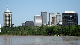
Tulsa is the second-largest city in the state of Oklahoma. It has many diverse neighborhoods due to its size.
Park Central Mall was the first shopping mall in Phoenix, Arizona. It is located in Encanto Village, on Central Avenue and Osborn Road.
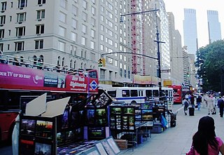
59th Street is a crosstown street in the New York City borough of Manhattan, running from York Avenue/Sutton Place to the West Side Highway, with a discontinuity between Ninth Avenue/Columbus Avenue and Eighth Avenue/Central Park West where the Time Warner Center is located. At Second Avenue, 59th Street branches off onto the Ed Koch Queensboro Bridge, which is often referred to as the 59th Street Bridge, even though 59th Street continues east to York Avenue/Sutton Place.
Midtown Toronto is one of four central business districts outside Downtown Toronto in Toronto, Ontario, Canada. Located in the north of Old Toronto, its borders are roughly defined by St. Clair Avenue to the south and Lawrence Avenue to the north, Bayview Avenue to the east and Ossington Avenue, Oakwood Avenue, and Marlee Avenue to the west. The central neighbourhood of the area is Yonge–Eglinton.

Encanto/Central Avenue is a light rail station on Valley Metro Rail in uptown Phoenix, Arizona, United States. It is the ninth stop southbound and the twenty-first stop northbound on the initial 20 mile starter line. The station is located on Central Avenue north of Encanto Boulevard directly in front of the Tapestry on Central condominium complex. The Heard Museum is located across the street from this station.
The Central Avenue Corridor is a significant stretch of north-south Central Avenue, in Phoenix, Arizona. Roughly bounded by Camelback Road to its north, and McDowell Road to its south, this is one of Phoenix's most vital and heavily trafficked stretches of roadway. It is also one of the region's largest centers of employment, with nearly 60,000 people being employed within a three-mile (5 km) radius of this swath of Central Avenue. Major employers here include major banks and financial institutions, hi-tech companies, and several significant law firms and government agencies.
Central City Village is the urban village of Phoenix, Arizona, that includes the downtown area of the city. As of 2010, it had a population of 58,161 residents.
Many arterial roads in the Phoenix metropolitan area have the same name in multiple cities or towns. Some roads change names or route numbers across town borders, resulting in occasional confusion. For example, the road known as Apache Boulevard in Tempe continues east as Main Street in neighboring Mesa and then as Apache Trail in Apache Junction. Although Broadway Road maintains the same name through Goodyear, Avondale, Phoenix, Tempe, Mesa, and Apache Junction, each town uses a different reference point for address numbers.

Deer Valley or Deer Valley Village is one of the 15 urban villages that make up Phoenix, Arizona, United States. As of 2010, the population was 165,656, 25% of whom were under 18 years of age. The origin of the name is unclear; it first appeared on a 1921 General Land Office map of the area describing the valley created by Skunk Creek.

The Phoenix Historic Property Register is the official listing of the historic and prehistoric properties in the city of Phoenix, the capital and largest city, of the U.S. state of Arizona.