Ergersheim, Middle Franconia

Last updated
Ergersheim
Wappen Ergersheim.svg
Location of Ergersheim within Neustadt a.d.Aisch-Bad Windsheim district
Ergersheim in NEA.svgErgersheimLangenfeldOsing (unincorporated area)Wilhelmsdorf
Germany adm location map.svg
Red pog.svg
Ergersheim
Bavaria location map.svg
Red pog.svg
Ergersheim
Coordinates: 49°30′41″N10°19′43″E / 49.51139°N 10.32861°E / 49.51139; 10.32861
Country Germany
State Bavaria
Admin. region Mittelfranken
District Neustadt a.d.Aisch-Bad Windsheim
Municipal assoc. Uffenheim
Subdivisions6 Ortsteile
Government
   Mayor (202026) Dieter Springmann [1]
Area
  Total30.04 km2 (11.60 sq mi)
Elevation
334 m (1,096 ft)
Population
 (2022-12-31) [2]
  Total1,081
  Density36/km2 (93/sq mi)
Time zone UTC+01:00 (CET)
  Summer (DST) UTC+02:00 (CEST)
Postal codes
91465
Dialling codes 09847
Vehicle registration NEA

Ergersheim is a municipality in Bavaria, Germany.

Location

Ergersheim is located in the Middle Franconian district of Neustadt (Aisch)-Bad Windsheim. Administrative offices are located in Uffenheim.

Contents

History

The first mention of Ergersheim was on December 25, 822 in a charter from the Emperor Louis the Pious.

It is home to the oldest chapel of the area, which was built during that era, and is still used for special church functions.

Politics

The town council is made up of 12 members.

Election in 2020 (comparison to 2014):

Villages

Twin town

Related Research Articles

<span class="mw-page-title-main">Vilshofen an der Donau</span> Town in Bavaria, Germany

Vilshofen an der Donau is a town in the German district of Passau.

<span class="mw-page-title-main">Wattendorf</span> Municipality in Bavaria, Germany

Wattendorf is the smallest community in the Upper Franconian district of Bamberg and a member of the administrative community (Verwaltungsgemeinschaft) of Steinfeld.

<span class="mw-page-title-main">Meitingen</span> Municipality in Bavaria, Germany

Meitingen is a market town in the district of Augsburg, in Bavaria, Germany. It is situated on the left bank of the Lech, 20 km (12 mi) south of Donauwörth, and 21 km (13 mi) north of Augsburg.

<span class="mw-page-title-main">Baiersdorf</span> Town in Bavaria, Germany

Baiersdorf is a town in the district of Erlangen-Höchstadt, in northern Bavaria, Germany.

<span class="mw-page-title-main">Schlüsselfeld</span> Town in Bavaria, Germany

Schlüsselfeld is a town on the southwestern edge of the Upper Franconian district (Landkreis) of Bamberg

<span class="mw-page-title-main">Geroda, Lower Franconia</span> Municipality in Bavaria, Germany

Geroda is a municipality in the district of Bad Kissingen in Bavaria in Germany.

<span class="mw-page-title-main">Breitengüßbach</span> Municipality in Bavaria, Germany

Breitengüßbach is a community in the Upper Franconian district of Bamberg. It was first mentioned as Gusibach and as belonging to the royal court at Hallstadt in an Imperial document issued between 812 and 830.

<span class="mw-page-title-main">Gundelsheim, Bavaria</span> Municipality in Bavaria, Germany

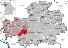
Gundelsheim is a community in the Upper Franconian district of Bamberg.

<span class="mw-page-title-main">Pettstadt</span> Municipality in Bavaria, Germany

Pettstadt is a community in the Upper Franconian district of Bamberg with about 1,900 inhabitants.

<span class="mw-page-title-main">Priesendorf</span> Municipality in Bavaria, Germany

Priesendorf is a community in the Upper Franconian district of Bamberg and a member of the administrative community (Verwaltungsgemeinschaft) of Lisberg.

<span class="mw-page-title-main">Schönbrunn im Steigerwald</span> Municipality in Bavaria, Germany

Schönbrunn im Steigerwald is a community in the Upper Franconian district of Bamberg and a member of the administrative community (Verwaltungsgemeinschaft) of Burgebrach.

<span class="mw-page-title-main">Eckersdorf</span> Municipality in Bavaria, Germany

Eckersdorf is a municipality in the district of Bayreuth in Bavaria in Germany.

<span class="mw-page-title-main">Tuchenbach</span> Municipality in Bavaria, Germany

Tuchenbach is a municipality in the district of Fürth in Bavaria in Germany.

<span class="mw-page-title-main">Ziemetshausen</span> Municipality in Bavaria, Germany

Ziemetshausen is a municipality in the district of Günzburg in Bavaria in Germany.

<span class="mw-page-title-main">Maierhöfen</span> Municipality in Bavaria, Germany

Maierhöfen is a municipality in the district of Lindau in Bavaria in Germany.

<span class="mw-page-title-main">Eichenbühl</span> Municipality in Bavaria, Germany

Eichenbühl is a community in the Miltenberg district in the Regierungsbezirk of Lower Franconia (Unterfranken) in Bavaria, Germany.

<span class="mw-page-title-main">Eschau</span> Municipality in Bavaria, Germany

Eschau is a market community in the Miltenberg district in the Regierungsbezirk of Lower Franconia (Unterfranken) in Bavaria, Germany. It has a population of around 3,800.

<span class="mw-page-title-main">Röllbach</span> Municipality in Bavaria, Germany

Röllbach is a municipality in the Miltenberg district in the Regierungsbezirk of Lower Franconia (Unterfranken) in Bavaria, Germany and a member of the Verwaltungsgemeinschaft of Mönchberg.

<span class="mw-page-title-main">Uehlfeld</span> Municipality in Bavaria, Germany

Uehlfeld is a municipality in the district of Neustadt (Aisch)-Bad Windsheim in the administrative region of Middle Franconia in northern Bavaria in Germany.

<span class="mw-page-title-main">Ustersbach</span> Municipality in Bavaria, Germany

Ustersbach is a municipality in the district of Augsburg in Bavaria in Germany. It is situated approx. 20 kilometres (12 mi) west of Augsburg

References