Dachsbach

Last updated
Dachsbach
2014-04-02-Turm1.JPG
Tower of the former Dachsbach Castle
DEU Dachsbach COA.svg
Location of Dachsbach within Neustadt a.d.Aisch-Bad Windsheim district
Dachsbach in NEA.svgErgersheimLangenfeldOsing (unincorporated area)Wilhelmsdorf
Germany adm location map.svg
Red pog.svg
Dachsbach
Bavaria location map.svg
Red pog.svg
Dachsbach
Coordinates: 49°38′N10°42′E / 49.633°N 10.700°E / 49.633; 10.700
Country Germany
State Bavaria
Admin. region Mittelfranken
District Neustadt a.d.Aisch-Bad Windsheim
Municipal assoc. Uehlfeld
Subdivisions5 Ortsteile
Government
   Mayor (202026) Peter Kaltenhäuser [1]
Area
  Total
20.58 km2 (7.95 sq mi)
Elevation
280 m (920 ft)
Population
 (2023-12-31) [2]
  Total
1,797
  Density87/km2 (230/sq mi)
Time zone UTC+01:00 (CET)
  Summer (DST) UTC+02:00 (CEST)
Postal codes
91462
Dialling codes 09163
Vehicle registration NEA
Website www.dachsbach.de

Dachsbach is a market town and municipality in the district of Neustadt (Aisch)-Bad Windsheim, in the administrative region of Middle Franconia in northern Bavaria in Germany.

Contents

Geography

Dachsbach is located in the valley of the Aisch. The borough Rauschenberg is on the southern hills of the Steigerwald. The neighbouring municipalities are (from the north in clockwise direction): Uehlfeld, Weisendorf, Gerhardshofen and Gutenstetten. The municipality has five boroughs: Arnshöchstädt, Traishöchstädt, Göttelbrunn, Oberhöchstädt and Rauschenberg with Ziegelhütte.

History

The first documented notice of Dachsbach is from 1129 - a Knight Heinrich von Dachsbach sold one of his properties to the monastery St. Michael in Bamberg. In 1132 there was a witness with name Knight Albrecht von Dachsbach for the foundation of the monastery Heilsbronn. From 1298 until 1347 there was a Knight Konrad von Dachsbach reeve of the monastery of Münchsteinach. On April 14, 1280 the castle was pledged to the burgraves of Nuremberg, who made an official residence of it and built up Dachsbach as a bastion against the Cathedral Foundation Bamberg. Until 1797 the official residence remained in Dachsbach. At this time Neustadt an der Aisch became the central residence in the valley of the Aisch. Until this time the blood court for up to 41 surrounding areas was localized in the bailiff's office. The gallows at Galgenberg (i.e. Gallows Hill) were broken down in 1814.

Several wars have left their marks in Dachsbach. In the First Margrave War (1449–1450) and the Second Margrave War (1552–1555) troops from Nuremberg, in the Peasants' War the rebellious peasants occupied and raided Dachsbach. On November 12, 1553 Albrecht Alcibiades burned down his own castle to "learn the Nuremberg moneybags the bourning". In the Thirty Years' War (August 10, 1634) troops from Forchheim destroyed Dachsbach nearly complete. They only left the church, the tithe barn and six houses. At the beginning of the Thirty Years' War the mint of the margrave in Dachsbach manufactured "Bad Thaler" (worth 120 Kreutzer), which had the size of full-fledged Thaler, but were made of low-grade silver with a high copper fraction.

The end of the bailiff-time in Dachsbach was 1797. At this time the bailiff Herrgott (i.e. God) resided in Dachsbach. To him the proverb "living like God in Dachsbach" and the naming "God's heads" for the citizens of Dachsbach are traced back. In August 1798 he interrogated a custodian and initiated the smashing of the "Big Franconian Thieves and Robber Gang". But his end was not very "God-like": He got into custody in Bamberg in 1806 for breach of duty. Since then Dachsbach passed a contemplative existence and can document its partly outstanding regional importance only with its cultural monuments.

Mayor

The current mayor is Peter Kaltenhäuser, elected in March 2020. [1] He replaced Hans-Jürgen Regus, mayor since 2011 and re-elected in 2014. Regus was the successor of Walter Neudecker. [3] [4]

Cultural monuments

Ecclesiastic

Theatre

Culinary specialties

Carps of the valley of the Aisch in the local gastronomy.

Pretzels from the Erbel bakery. [5]

Economy and infrastructure

Federal highway B 470 is directed from north-east to south-west through the community area.

From 12 July 1904, until 30 May 1976, there was a railway from Neustadt (Aisch) to Demantsfürth-Uehlfeld called Aischtalbahn which led to the railway Nuremberg Würzburg. It was broken down and since then only busses connect Dachsbach with the surrounding areas. The lines belong to the pay scale area of VGN.

Personalities

Literature

Related Research Articles

Erlangen-Höchstadt is a Landkreis (district) in Bavaria, Germany. It is bounded by the districts of Fürth, Neustadt (Aisch)-Bad Windsheim, Bamberg, Forchheim and Nürnberger Land, and by the cities of Nuremberg and Erlangen. The city of Erlangen is not part of the district, but nonetheless its administrative seat.

<span class="mw-page-title-main">Neustadt an der Aisch</span> Town in Bavaria, Germany

Neustadt an der Aisch is a small town of around 13,000 inhabitants in the northern part of Bavaria (Germany), within the Franconian administrative region Middle Franconia. It is the district town of the district Neustadt (Aisch)-Bad Windsheim.

<span class="mw-page-title-main">Kulmbach</span> Town in Bavaria, Germany

Kulmbach is the capital of the district of Kulmbach in Bavaria in Germany. The town, once a stronghold of the Principality of Bayreuth, is renowned for its University of Life Sciences, a branch of the University of Bayreuth, the massive Plassenburg Castle, which houses the largest tin soldier museum in the world, for its brewery, its vivid food industry, which hosts some of the world's biggest food businesses, and for its sausages, or Bratwürste.

<span class="mw-page-title-main">Principality of Bayreuth</span> Immediate territory of the Holy Roman Empire

The Principality of Bayreuth or Margraviate of Brandenburg-Bayreuth was an immediate territory of the Holy Roman Empire, ruled by a Franconian branch of the Hohenzollern dynasty. Since Burgrave Frederick VI of Nuremberg was enfeoffed with the Margraviate of Brandenburg in 1415/17, the Hohenzollern princes transferred the margravial title to their Franconian possessions, though the principality never had been a march. Until 1604 they used Plassenburg Castle in Kulmbach as their residence, hence their territory was officially called the Principality of Kulmbach or Margraviate of Brandenburg-Kulmbach until the Empire's dissolution in 1806.

<span class="mw-page-title-main">Casimir, Margrave of Brandenburg-Kulmbach</span> Margrave of Brandenburg-Kulmbach (1515-1527)

Casimirof Brandenburg-Bayreuth was Margrave of Bayreuth or Margrave of Brandenburg-Kulmbach from 1515 to 1527.

<span class="mw-page-title-main">Bad Berneck im Fichtelgebirge</span> Place in Bavaria, Germany

Bad Berneck im Fichtelgebirge is a spa town in the district of Bayreuth, in Bavaria, Germany. It is situated on the White Main river, in the Fichtel Mountains, 13 km northeast of Bayreuth. It lies in the northern part of the Bavarian province of Upper Franconia. Since 1857 it has been a spa, initially based on its climate and whey products. In 1930 it became a Kneipp spa and, in 1950, a Kneipp health spa.

<span class="mw-page-title-main">Ebermannstadt</span> Town in Bavaria, Germany

Ebermannstadt is a town in the district of Forchheim, in Bavaria, Germany. It is situated 10 km northeast of Forchheim and 25 km southeast of Bamberg.

<span class="mw-page-title-main">Breitengüßbach</span> Municipality in Bavaria, Germany

Breitengüßbach is a community in the Upper Franconian district of Bamberg in Bavaria. It was first mentioned as Gusibach and as belonging to the royal court at Hallstadt in an Imperial document issued between 812 and 830.

<span class="mw-page-title-main">Burgebrach</span> Municipality in Bavaria, Germany

Burgebrach is a market town in the Upper Franconian district of Bamberg and the seat of the administrative community (Verwaltungsgemeinschaft) of Burgebrach.

<span class="mw-page-title-main">Buttenheim</span> Town in Bavaria, Germany

Buttenheim is a market town in the Upper Franconian district of Bamberg and lies in the Regnitz Valley between Bamberg and Nuremberg, Germany.

<span class="mw-page-title-main">Heroldsberg</span> Municipality in Bavaria, Germany

Heroldsberg is a municipality in the district of Erlangen-Höchstadt, in Bavaria, Germany. It is located eleven kilometers north-east from the city of Nuremberg and 23 kilometers east from Erlangen and is the headquarters of Schwan-Stabilo.

<span class="mw-page-title-main">Röttenbach</span> Town in Erlangen-Höchstadt district, Bavaria, Germany

Röttenbach is a town in the district of Erlangen-Höchstadt, in Bavaria, Germany.

<span class="mw-page-title-main">Castell, Bavaria</span> Municipality in Bavaria, Germany

Castell is a municipality in the district of Kitzingen in Bavaria in Germany. It was the seat of the Counts of Castell. Today it is part of the municipal association Wiesentheid. It has around 800 inhabitants.

<span class="mw-page-title-main">Gerhardshofen</span> Municipality in Bavaria, Germany

Gerhardshofen is a municipality in the district of Neustadt (Aisch)-Bad Windsheim in the administrative region of Middle Franconia in northern Bavaria in Germany.

<span class="mw-page-title-main">Illesheim</span> Municipality in Bavaria, Germany

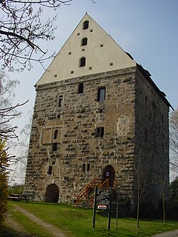
Illesheim, founded 1283 AD, is a municipality in the district of Neustadt (Aisch)-Bad Windsheim in Bavaria in Germany. The earliest leader affiliated with Illesheim's foundation was Götz von Berlichingen, known as "the Knight with the Iron Hand." Also known locally as "Illesa". It lies 6 kilometers west of Bad Windsheim and 11 kilometers east of the A7 motorway.

<span class="mw-page-title-main">Uehlfeld</span> Municipality in Bavaria, Germany

Uehlfeld is a municipality in the district of Neustadt (Aisch)-Bad Windsheim in the administrative region of Middle Franconia in northern Bavaria in Germany.

<span class="mw-page-title-main">Weigand of Redwitz</span>

Weigand of Redwitz was Prince-Bishop of Bamberg from 1522 until his death.

<span class="mw-page-title-main">Egloffstein Castle</span> Castle in Germany

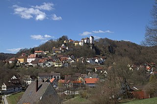
Egloffstein Castle is a former high mediaeval, aristocratic castle, that stands immediately west of the eponymous village of Egloffstein in the Upper Franconian county of Forchheim in the German state of Bavaria.

<span class="mw-page-title-main">Schloss Kunreuth</span> Castle in Germany

Schloss Kunreuth is situated on the northwestern edge of the eponymous village of Kunreuth which is part of the collective municipality of Gosberg in the county of Forchheim, in the province of Upper Franconia in the south German state of Bavaria.

Horst Weigelt (1934–2024) was a German Protestant theologian. From 1975 to 2002 he was Professor of Historical and Systematic Theology at the Otto Friedrich University of Bamberg. His research focuses on the Reformation, Pietism and Enlightenment in the early modern period. He also wrote specifically on Schwenkfelders.

References

  1. 1 2 Liste der ersten Bürgermeister/Oberbürgermeister in kreisangehörigen Gemeinden, Bayerisches Landesamt für Statistik, 15 July 2021.
  2. Genesis Online-Datenbank des Bayerischen Landesamtes für Statistik Tabelle 12411-003r Fortschreibung des Bevölkerungsstandes: Gemeinden, Stichtag (Einwohnerzahlen auf Grundlage des Zensus 2011).
  3. "Wahlen". www.statistik.bayern.de. Retrieved 25 April 2019.
  4. "Dachsbach hat einen neuen Bürgermeister".
  5. Crair, Ben (2018). "This German Baker Makes What May Be The World's Best Pretzel". SAVEUR. Retrieved 25 April 2019.