Petting is a municipality in the district Traunstein, Bavaria, Germany. It is located on the shore of the Waginger See, a diluvial lake.

Münnerstadt is a town in the district of Bad Kissingen in Bavaria, Germany. It has a population of around 7,600.

Roth is a town in Bavaria, Germany, the capital of the Roth District. It is located about 25 km south of Nuremberg.

Neumarkt in der Oberpfalz is the capital of the Neumarkt district in the administrative region of the Upper Palatinate, in Bavaria, Germany. With a population of about 40,000, Neumarkt is the seat of various projects, and acts as the economic and cultural center of the western Upper Palatinate, along with Nürnberg, Ingolstadt, and Regensburg.

Immenstadt im Allgäu is a town in Oberallgäu, the southernmost district of Bavaria, Germany, in the German Alps. First mentioned in a 1275 administrative tract, it was granted town privileges in 1360, which makes it one of the oldest towns in the area. It was the seat of the counts of Königsegg-Rothenfels until 1804.

Fladungen is a town in the Rhön-Grabfeld district, in Bavaria, Germany. It is situated in the Rhön Mountains, 11 km northwest of Ostheim, 20 km west of Meiningen, and 33 km east of Fulda. It is the northernmost town in Bavaria, bordering Hesse to the northwest and Thuringia to the northeast.

Gstadt am Chiemsee is a municipality and a village in the district of Rosenheim, Bavaria, Germany. It is located on Lake Chiemsee.

Rothenbuch is a community in the Aschaffenburg district in the Regierungsbezirk of Lower Franconia (Unterfranken) in Bavaria, Germany. It has a population of around 1,700.
Fischach is a municipality in the district of Augsburg in Bavaria in Germany.

Münsing is a municipality in the district of Bad Tölz-Wolfratshausen in Bavaria in Germany.

Gerach is a community in the Upper Franconian district of Bamberg and a member of the administrative community (Verwaltungsgemeinschaft) of Baunach. It lies in the Naturpark Haßberge roughly 20 km north of Bamberg and roughly 10 km south of Ebern.

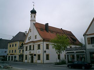
Schönbrunn im Steigerwald is a community in the Upper Franconian district of Bamberg and a member of the administrative community (Verwaltungsgemeinschaft) of Burgebrach.

Altomünster is a municipality in the district of Dachau in Bavaria in Germany.
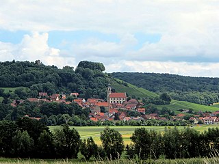
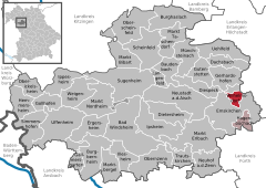
Castell is a municipality in the district of Kitzingen in Bavaria in Germany. It was the seat of the Counts of Castell. Today it is part of the municipal association Wiesentheid. It has around 800 inhabitants.

Uehlfeld is a municipality in the district of Neustadt (Aisch)-Bad Windsheim in the administrative region of Middle Franconia in northern Bavaria in Germany.

Bad Feilnbach is a municipality in the Upper Bavarian district of Rosenheim at the foot of Wendelstein Mountain in Germany. As a famous 'Moorheilbad' the municipality was awarded in 1973 the title "Bad". Since the 19th century the peat deposits were the basis for a continued expansion of the spa and health facilities. The recognized healing success of "black gold" on a variety of diseases were the basis for the development of a well-known spa and tourist community. Due to its wooded surroundings and the mild climate Feilnbach is called the "Bavarian Meran". The entire municipality is recognized as a healing spa resort except for parts of the former municipality Dettendorf.

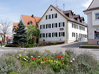
Babenhausen is a municipality in the district of Unterallgäu in Bavaria, Germany. It is seat of a municipal association with Egg an der Günz, Kettershausen, Kirchhaslach, Oberschönegg and Winterrieden. The view of Babenhausen is dominated by the Fugger Castle, a local attraction with a museum, and the Sankt Andreas Church. It is the seat of the Fuggers, a merchant family from Augsburg which played an important role during the Middle Ages and the Renaissance.
Türkheim is a municipality in the district of Unterallgäu in Bavaria, Germany. The neighboring places of Türkheim are Ettringen, Berg, Rammingen, Irsingen, Wiedergeltingen and Amberg. The administrative collectivity of Türkheim administrate Türkheim and Irsingen. The town is seat of a municipal association with Amberg, Rammingen and Wiedergeltingen.
Ustersbach is a municipality in the district of Augsburg in Bavaria in Germany. It is situated approx. 20 kilometres (12 mi) west of Augsburg

Erlenbach bei Marktheidenfeld is a community in the Main-Spessart district in the Regierungsbezirk of Lower Franconia in Bavaria, Germany and a member of the Verwaltungsgemeinschaft of Marktheidenfeld. It has given itself the title Weinort mit Herz – Wine Town with Heart.