The Westlink M7 is a 40-kilometre (25 mi) tolled urban motorway in Sydney, New South Wales that is part of the Sydney Orbital Network. Owned by the NorthWestern Roads (NWR) Group, it connects three motorways: the M5 South-West Motorway at Prestons, the M4 Western Motorway at Eastern Creek, and the M2 Hills Motorway at Baulkham Hills.

Marayong is a suburb of Sydney, in the state of New South Wales, Australia. Marayong is located approximately 32 kilometres north west of the Sydney central business district, in the local government area of the City of Blacktown and is part of the Greater Western Sydney region.

Bella Vista is located 33 kilometres north-west of the Sydney central business district and is part of The Hills Shire. It is a suburb in the Hills District of Greater Western Sydney and is in the state of New South Wales, Australia. Bella Vista's Norwest Business Park is home to several Fortune 500 companies, a number of shopping centres, high-rise buildings, and industrial and recreational spaces.

Bidwill is a suburb of Sydney, in the state of New South Wales, Australia. Bidwill is located 48 kilometres west of the Sydney central business district, in the local government area of the City of Blacktown and is part of the Greater Western Sydney region.

Blackett is a suburb of Sydney, in the state of New South Wales, Australia. Blackett is located 48 kilometres west of the Sydney central business district, in the local government area of the City of Blacktown and is part of the Greater Western Sydney region.

Emerton is a suburb of Sydney, in the state of New South Wales, Australia. Emerton is located 46 kilometres west of the Sydney central business district, in the local government area of the City of Blacktown and is part of the Greater Western Sydney region.
Glenwood is a suburb of Sydney, in the state of New South Wales, Australia. Glenwood is located 33 kilometres north-west of the Sydney central business district in the local government area of the City of Blacktown and part of the Greater Western Sydney region.

Kings Langley is a suburb of Sydney, in the state of New South Wales, Australia. Kings Langley is located 28.3 kilometres north-west in a straight line from the Sydney central business district in the local government area of Blacktown City council.

Kings Park is a suburb of Sydney, in the state of New South Wales, Australia. Kings Park is located 40 km west of the Sydney central business district, in the local government area of the City of Blacktown and part of the Greater Western Sydney region.

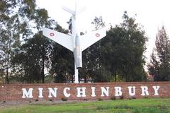
Minchinbury is a small suburb in western Sydney, in the state of New South Wales, Australia. Minchinbury is located 38 kilometres (24 mi) west of the Sydney central business district, in Blacktown local government area and is part of the Greater Western Sydney region.

Plumpton is located 45 kilometres west of the Sydney central business district, in the local government area of the City of Blacktown and is part of the Greater Western Sydney region.
Wetherill Park is a suburb in Greater Western Sydney, in the state of New South Wales, Australia. Wetherill Park is located 34 kilometres west of the Sydney central business district, in the local government area of the City of Fairfield.

St Marys is a suburb in western Sydney, in the state of New South Wales, Australia. It is 45 kilometres (28 mi)west of the Sydney central business district, in the local government area of the City of Penrith.

St Clair is a suburb of Sydney, in the state of New South Wales, Australia. It is 44 kilometres west of the Sydney central business district, in the local government area of the City of Penrith and is part of the Greater Western Sydney region. St Clair is within view of the Blue Mountains.

South Penrith is a suburb of Sydney, in the state of New South Wales, Australia. South Penrith is located 55 kilometres west of the Sydney central business district, in the local government area of the City of Penrith and is part of the Greater Western Sydney region.

Northbridge is a suburb on the Lower North Shore of Sydney, New South Wales, Australia. It is located 6 kilometres north of the Sydney Central Business District, and 3 kilometres north of the North Sydney CBD in the local government area of the City of Willoughby. The major transport and shopping hub of Chatswood is 3 kilometers north west of Northbridge.

Kellyville is a suburb of Sydney, in the state of New South Wales, Australia 36 kilometres north-west of the Sydney central business district in the local government area of The Hills Shire. It is part of the Hills District region.

Lurnea is a suburb of Sydney, in the state of New South Wales, Australia. It is 35 kilometres south-west of the Sydney central business district, in the local government area of the City of Liverpool.

Glenmore Park is a suburb of Sydney, in the state of New South Wales, Australia. Glenmore Park is located 54 kilometres (34 mi) west of the Sydney central business district, in the local government area of the City of Penrith and is part of the Greater Western Sydney region.
Caddens is a suburb of Sydney, in the state of New South Wales in Australia. It is a new masterplanned residential neighborhood located 49 kilometres (30 mi) west of the Sydney central business district, in the local government area of the City of Penrith featuring views of the scenic Blue Mountains. The suburb's postcode is 2747.


