Esquel

Last updated
Esquel
Town

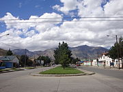
Avenida Alvear - Esquel - Argentina.jpg

City Centre
EscudodeEsquel.jpg
Coat of arms
Argentina location map.svg
Red pog.svg
Esquel
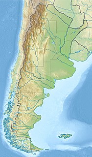
Location of Esquel in Argentina
Coordinates: 42°54′S71°19′W / 42.900°S 71.317°W / -42.900; -71.317 Coordinates: 42°54′S71°19′W / 42.900°S 71.317°W / -42.900; -71.317
Country Flag of Argentina.svg  Argentina
Province Flag of chubut province in argentina - bandera de chubut.svg  Chubut
Department Futaleufú
Founded February 25, 1906
Government
   Mayor Sergio Ongarato (Cambiemos)
Elevation 563 m (1,847 ft)
Population (2010 census)
  Total 32,343
Time zone ART (UTC-3)
CPA base U9200
Dialing code +54 2945
Climate Csb
Website esquel.gov.ar

Esquel is a town in the northwest of Chubut Province in Argentine Patagonia. It is located in Futaleufú Department, of which it is the government seat. The town's name derives from one of two Tehuelche words. One meaning "marsh" and the other meaning "land of burrs", which refers to the many thorny plants including the pimpinella and other herbaceous plants whose fruits, when ripe turn into prickly burrs that stick to the animals' skins and wool or people's clothes as a way of propagation.

Chubut Province Province of Argentina

Chubut is a province in southern Argentina, situated between the 42nd parallel south, the 46th parallel south, the Andes range to the west, and the Atlantic ocean to the east. The province's name derives from the Tehuelche word chupat, meaning "transparent," their description of the Chubut River.

Argentina federal republic in South America

Argentina, officially the Argentine Republic, is a country located mostly in the southern half of South America. Sharing the bulk of the Southern Cone with Chile to the west, the country is also bordered by Bolivia and Paraguay to the north, Brazil to the northeast, Uruguay and the South Atlantic Ocean to the east, and the Drake Passage to the south. With a mainland area of 2,780,400 km2 (1,073,500 sq mi), Argentina is the eighth-largest country in the world, the fourth largest in the Americas, and the largest Spanish-speaking nation. The sovereign state is subdivided into twenty-three provinces and one autonomous city, Buenos Aires, which is the federal capital of the nation as decided by Congress. The provinces and the capital have their own constitutions, but exist under a federal system. Argentina claims sovereignty over part of Antarctica, the Falkland Islands, and South Georgia and the South Sandwich Islands.

Patagonia Region of South America

Patagonia is a sparsely populated region at the southern end of South America, shared by Argentina and Chile. The region comprises the southern section of the Andes mountains and the deserts, pampas and grasslands to the east. Patagonia is one of the few regions with coasts on three oceans, with the Pacific Ocean to the west, the Atlantic Ocean to the east, and the Southern Ocean to the south.

Contents

History

The founding of the town dates back to the arrival of Welsh immigrants in Chubut in 1865. The settlement was created on 25 February 1906, as an extension of the Colonia 16 de Octubre, that also contains the town of Trevelin.

Wales Country in northwest Europe, part of the United Kingdom

Wales is a country that is part of the United Kingdom and the island of Great Britain. It is bordered by England to the east, the Irish Sea to the north and west, and the Bristol Channel to the south. It had a population in 2011 of 3,063,456 and has a total area of 20,779 km2 (8,023 sq mi). Wales has over 1,680 miles (2,700 km) of coastline and is largely mountainous, with its higher peaks in the north and central areas, including Snowdon, its highest summit. The country lies within the north temperate zone and has a changeable, maritime climate.

Immigration Movement of people into another country or region to which they are not native

Immigration is the international movement of people into a destination country of which they are not natives or where they do not possess citizenship in order to settle or reside there, especially as permanent residents or naturalized citizens, or to take up employment as a migrant worker or temporarily as a foreign worker.

Trevelin Town in Chubut, Argentina

Trevelin is a town in the Patagonian Argentine province of Chubut. The town lies on the eastern banks of the Rio Percy/Río Percey. It is located in the department of Futaleufú, 22 kilometres south of Esquel, and had 6,395 inhabitants at the time of the 2001 census [INDEC] and 7,908 inhabitants in the 2010 census [INDEC].

The city, the main town of the area, is located by the Esquel Stream and surrounded by the mountains La Zeta, La Cruz, Cerro 21 and La Hoya. La Hoya is known as a ski resort with good quality snow right through the spring. The Los Alerces National Park is 50 km (31 mi) northwest of the city.

A ski is a narrow strip of semi-rigid material worn underfoot to glide over snow. Substantially longer than wide and characteristically employed in pairs, skis are attached to ski boots with ski bindings, with either a free, lockable, or partially secured heel. For climbing slopes, ski skins can be attached at the base of the ski.

Los Alerces National Park national park of Argentina

Los Alerces National Park is located in the Andes in Chubut Province in the Patagonian region of Argentina. Its western boundary coincides with the Chilean border. Successive glaciations have molded the landscape in the region creating spectacular features such as moraines, glacial cirques and clear-water lakes. The vegetation is dominated by dense temperate forests, which give way to alpine meadows higher up under the rocky Andean peaks. A highly distinctive and emblematic feature is its alerce forest; the globally threatened alerce tree is the second longest living tree species in the world. The alerce forests in the park are in an excellent state of conservation. The property is vital for the protection of some of the last portions of continuous Patagonian Forest in an almost pristine state and is the habitat for a number of endemic and threatened species of flora and fauna.

Another important tourist attraction is the narrow-gauge train (with 75 cm between the rails), known as La Trochita locally and in English as The Old Patagonian Express after The Old Patagonian Express by Paul Theroux. It is said to be the only narrow-gauge long-distance train in operation and the southernmost railway in the world. The first fifty locomotives were made by Henschel & Son of Germany in 1922 and were originally modified to use fuel oil and steam. Later twenty-five locomotives were bought from the Baldwin Locomotive Works of Philadelphia.

Train A series of coupled vehicles for transporting cargo/passengers

A train is a form of transport consisting of a series of connected vehicles that generally runs along a rail track to transport cargo or passengers. The word "train" comes from the Old French trahiner, derived from the Latin trahere meaning "to pull" or "to draw".

La Trochita 750mm gauge line in Patagonia, Argentina

La Trochita, in English known as the Old Patagonian Express, is a 750 mm narrow gauge railway in Patagonia, Argentina using steam locomotives. The nickname La Trochita means literally "little gauge" though it is sometimes translated as "The Little Narrow Gauge" in Spanish while "trocha estrecha", "trocha angosta" in Argentina, is often used for a generic description of "narrow gauge."

<i>The Old Patagonian Express</i> book by Paul Theroux

The Old Patagonian Express (1979) is a written account of a journey taken by novelist Paul Theroux. Starting out from his home town in Massachusetts, via Boston and Chicago, Theroux travels by train across the North American plains to Laredo, Texas. He then crosses the border and takes a train south through Mexico to Veracruz where he meets a woman looking for her long-lost lover. He then takes the train south into Guatemala and then El Salvador where he goes to a soccer match and is amazed by the violence. He then flies to Costa Rica where he takes the train to Limón and Puntarenas. He ended his transit of Central America in Panama where he takes the short train ride across the isthmus. Theroux then proceeds to Colombia and then over the Andes and finally reaches the small town of Esquel in Patagonia. He endures harsh climates, including the extreme altitude of Peru and the Bolivian Plateau, meets the author Jorge Luis Borges in Buenos Aires and is reunited with long lost family in Ecuador.

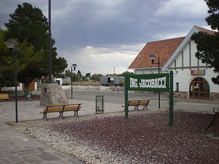
The train remains authentic and in operation thanks to the effort of the team of workers at Talleres Ferroviarios El Maiten, that make a lot of pieces and parts by hand. The trains now run as a tourist excursion between Esquel and the small settlement of Nahuel Pan, located at the foot of the volcano of the same name, with other services all the way to El Maitén. Until 1993, the train ran all the way to the city of Ingeniero Jacobacci in Río Negro Province, from where trains ran to Viedma, Río Negro and from there to Buenos Aires, forming the General Roca railway.

Volcano A rupture in the crust of a planetary-mass object that allows hot lava, volcanic ash, and gases to escape from a magma chamber below the surface

A volcano is a rupture in the crust of a planetary-mass object, such as Earth, that allows hot lava, volcanic ash, and gases to escape from a magma chamber below the surface.

Ingeniero Jacobacci human settlement in Argentina

Ingeniero Jacobacci is a city in Río Negro Province, Argentina. It has a population of 5,719 inhabitants and was named in honor of Guido Jacobacci, the director of the railway opened in 1916 between San Antonio Oeste, on the Atlantic Ocean coast, and San Carlos de Bariloche, in the Andes. A remote outpost in windswept Patagonia, Jacobacci benefited from its proximity to scenic Lake Carilaufquen and in 1990, an airstrip was opened to facilitate tourist arrivals in the area.

Río Negro Province Province of Argentina

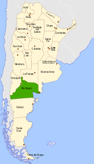
Río Negro is a province of Argentina, located at the northern edge of Patagonia. Neighboring provinces are from the south clockwise Chubut, Neuquén, Mendoza, La Pampa and Buenos Aires. To the east lies the Atlantic Ocean.

The Old Patagonian Express at Esquel station. LaTrochita20EnEstacionEsquel1.jpg
The Old Patagonian Express at Esquel station.
The Old Patagonian Express at Esquel station. 
A view of a lake near Esquel. Chubut - Esquel.jpg
A view of a lake near Esquel.
A view of a lake near Esquel. 
View of a street of the city. Calle de Esquel, provincia del Chubut.jpg
View of a street of the city.
View of a street of the city. 

According to the 2001 census [INDEC], the Esquel district had about 28,000 inhabitants, with one of the highest rates of growth in the province, mainly as result of the immigration of people from Buenos Aires, but also from other provinces. It has wide cement streets with sidewalks, and is clean and well maintained. Their hospital is the primary one for the zone and is often a destination for "Medical Tourism" from both foreigners and Porteños (residents of Buenos Aires) alike.

Census Acquiring and recording information about the members of a given population

A census is the procedure of systematically acquiring and recording information about the members of a given population. The term is used mostly in connection with national population and housing censuses; other common censuses include agriculture, business, and traffic censuses. The United Nations defines the essential features of population and housing censuses as "individual enumeration, universality within a defined territory, simultaneity and defined periodicity", and recommends that population censuses be taken at least every 10 years. United Nations recommendations also cover census topics to be collected, official definitions, classifications and other useful information to co-ordinate international practice.

National Institute of Statistics and Census of Argentina Argentinas principal government institution in charge of statistics and census data

National Statistics and Censuses Institute is the Argentine government agency responsible for the collection and processing of statistical data. The institute also analyses economic and social indicators such as inflation rate, consumer price index and unemployment, among others.

The townspeople have been in a long battle to prevent a gold mine being set up nearby, with concerns that the metal extraction will pollute the watercourse permanently and irreversibly. Although the mining companies were prohibited from producing mines in the area, there are still monthly street marches against the mines, and the issue never seems to feel fully settled.

In May 2009, Esquel twinned with Aberystwyth in Wales; with representatives of the Welsh town traveling to Argentina to participate in the signing of a charter formalising the link.

Panoramic view of Esquel from a nearby hill. PanoramicadeEsquel.jpg
Panoramic view of Esquel from a nearby hill.

Esquel meteorite

In 1951 a farmer found a 755 kilograms (1,664 lb) meteorite, later called Esquel, while digging a hole for a water tank. When cut and polished, the meteorite showed beautiful yellowish olivine (peridot) crystals. The Esquel meteorite is known world wide among collectors and the scientific community.

Climate

Owing to its location on the immediate leeward side of the Andes, Esquel has a cool summer Mediterranean climate (Köppen Csb) bordering on a Humid continental climate (Köppen Dsb), with a rainfall pattern similar to central Chile. [1] Other climate systems, such as the Trewartha climate classification, place it within the oceanic zone (Do), like much of Western Europe and the Pacific Northwest of the United States. Temperatures are relatively cold for its climate due to its higher altitude. [1] Summers are mild with warm temperatures during the afternoon followed by cool nights. [2] The mean temperature during the summer is around 14 °C (57.2 °F). [1] It's the sunniest season, averaging as much as 10 hours of sunshine per day in January with an average of 7–8 clear days and only 5-7 overcast days. [1] [3] Spring and fall are transition seasons featuring mild temperatures during the day and cool to cold nights. [2] Spring starts out with cool temperatures during the day and very cold nights which progressively becomes warmer. [2] Both spring and fall have highly variable weather. [4]

Winters vary from cool to cold with mean temperatures close to freezing while precipitation is high. [1] Temperatures regularly fall below freezing during the winter nights. [2] Winters are characterized by cloudy weather, averaging 11-13 overcast days from June to August. [3] Snow falls on average on twenty days each winter but usually doesn't stay on the ground for too long. The average date of the first frost occurs on March 7 while the average data of the last frost occurs on November 10 although frosts have been recorded in all months. [5]

The average relative humidity is 62%, ranging from a high of 77% in June and July to a low of 49% in January. [6] Summers have lower humidity due to higher temperatures. [1] Most of the wind comes from the west or the southwest with calm days being uncommon. [1] The relief modifies the wind speeds with southern areas receiving more wind than the north. [1] Mean wind speeds range from 17.4 km/h (10.8 mph) in July to 30.4 km/h (18.9 mph) in December with summers being more windy than winters. [1] [2] Esquel receives an average annual precipitation of 504.2 millimetres (20 in) a year; much of it being concentrated in the winter months. [1] Esquel, which lies in the zone of transition between the wetter Andes to the west and the steppes to the east, [1] records higher precipitation in the town than in the airport located 13 kilometers to the east. [7] It is estimated that Esquel receives an average of 7 hours of sunshine per day, ranging from a high of 10 hours in January to a low of 5 hours in July. [1]


Climate data for Esquel (1981–2010, extremes 1901–present) [lower-alpha 1]
MonthJanFebMarAprMayJunJulAugSepOctNovDecYear
Record high °C (°F) 38.6
(101.5)
35.2
(95.4)
32.2
(90)
27.0
(80.6)
22.3
(72.1)
21.2
(70.2)
20.7
(69.3)
18.7
(65.7)
23.5
(74.3)
29.6
(85.3)
32.6
(90.7)
35.0
(95)
38.6
(101.5)
Average high °C (°F) 21.7
(71.1)
22.2
(72)
19.1
(66.4)
14.4
(57.9)
10.1
(50.2)
6.7
(44.1)
6.1
(43)
8.5
(47.3)
11.8
(53.2)
14.7
(58.5)
17.6
(63.7)
19.9
(67.8)
14.4
(57.9)
Daily mean °C (°F) 15.1
(59.2)
15.0
(59)
12.3
(54.1)
8.2
(46.8)
4.9
(40.8)
2.4
(36.3)
1.5
(34.7)
3.2
(37.8)
5.5
(41.9)
8.4
(47.1)
11.2
(52.2)
13.6
(56.5)
8.4
(47.1)
Average low °C (°F) 8.2
(46.8)
7.7
(45.9)
5.5
(41.9)
2.7
(36.9)
0.5
(32.9)
−1.8
(28.8)
−2.8
(27)
−1.4
(29.5)
0.0
(32)
2.3
(36.1)
4.7
(40.5)
7.0
(44.6)
2.7
(36.9)
Record low °C (°F) −5.4
(22.3)
−4.6
(23.7)
−7.0
(19.4)
−11.5
(11.3)
−12.5
(9.5)
−21.2
(−6.2)
−22.8
(−9)
−20.9
(−5.6)
−14.8
(5.4)
−10.3
(13.5)
−7.0
(19.4)
−4.5
(23.9)
−22.8
(−9)
Average precipitation mm (inches) 18.8
(0.74)
18.4
(0.724)
24.5
(0.965)
43.1
(1.697)
65.0
(2.559)
79.4
(3.126)
60.2
(2.37)
47.0
(1.85)
35.7
(1.406)
28.3
(1.114)
20.8
(0.819)
20.8
(0.819)
462.0
(18.189)
Average precipitation days (≥ 0.1 mm) 3.8 3.7 5.6 7.0 9.7 11.0 9.4 9.6 7.3 6.1 4.4 4.1 81.7
Average snowy days 0.1 0.2 0.2 0.5 2 5 6 4 3 0.9 0.2 0.3 22.4
Average relative humidity (%) 48.0 50.1 56.5 63.5 72.2 76.6 75.5 70.9 62.9 55.2 50.0 48.1 60.8
Mean monthly sunshine hours 306 247 217 157 109 78 108 134 187 246 256 278 2,324
Percent possible sunshine 67 64 57 48 36 27 37 41 53 60 59 59 51
Source #1: Servicio Meteorológico Nacional [8] [9]
Source #2: Secretaria de Mineria (extremes 1901–1990), [3] FAO (sun only), [10] UNLP (snowfall data) [11]

See also

Related Research Articles

Río Gallegos, Santa Cruz City in Santa Cruz, Argentina

Río Gallegos is the capital and largest settlement of the Patagonian province of Santa Cruz in Argentina. Located in the department of Guer Aike, it has a population of about 98,000, according to the 2010 census [INDEC], a 24% increase from the 79,000 in the 2001 census [INDEC]. The city bears the name of the Gallegos River, and sits on its estuary 2,636 km (1,638 mi) south from the Argentinian federal capital Buenos Aires.

Trelew City in Chubut, Argentina

Trelew is a city in the Chubut Province of Argentina. Located in Patagonia, the city is the largest and most populous in the low valley of the Chubut River, with 97,915 inhabitants as of 2010. The Trelew municipality is part of the Rawson Department, whose capital, Rawson, is also the provincial capital.

Río Grande, Tierra del Fuego City in Tierra del Fuego, Argentina

Río Grande is a city in Argentina, on the north coast of the eastern part of the Isla Grande de Tierra del Fuego. It has a population of 67,038, and is the industrial capital of the Tierra del Fuego Province.

San Luis, Argentina City in San Luis, Argentina

San Luis is the capital city of San Luis Province in the Cuyo region of Argentina. It is also the seat of the Juan Martín de Pueyrredón Department.

Malargüe City in Mendoza, Argentina

Malargüe is a city in the southwest part of province of Mendoza, Argentina, about 370 km south of the provincial capital Mendoza. It is the head town of the Malargüe Department, and it has about 27,000 inhabitants as per the 2010 census [INDEC].

Cerro Catedral mountain, Argentina

Cerro Catedral is a mountain located 19 kilometres (12 mi) from San Carlos de Bariloche, and inside the Nahuel Huapí National Park, Patagonia, Argentina.

Pehuajó City in Buenos Aires, Argentina

Pehuajó is a city in the Pehuajó Partido in the province of Buenos Aires, Argentina. The partido has about 38,400 inhabitants as per the 2001 census [INDEC]. The name of this relatively small city is well known in Argentina because of María Elena Walsh's song Manuelita, about an adventurous turtle (tortoise); a dilapidated concrete statue of María Elena Walsh's Manuelita lies just outside the city, beside Ruta Nacional 5.
Cipolletti City in Río Negro Province, Argentina

Cipolletti is a city in north of the Patagonian province of Río Negro, Argentina, with 75,078 inhabitants at the 2001 census [INDEC].

Puerto San Julián Town in Santa Cruz, Argentina

Puerto San Julián, also known historically as Port St. Julian, is a natural harbour in Patagonia in the Santa Cruz Province of Argentina located at 49°18′S67°43′W. In the days of sailing ships it formed a stopping point, 180 km (112 mi) south of Puerto Deseado. Nowadays Puerto San Julián is also the name of a small town located on the harbour.
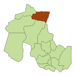
La Quiaca City in Jujuy, Argentina

La Quiaca is a small city in the north of the province of Jujuy, Argentina, on the southern bank of the La Quiaca River, opposite the town of Villazón, Bolivia. It lies at the end of National Route 9, 289 km (180 mi) from San Salvador de Jujuy, and at an altitude of 3,442 m (11,293 ft) above mean sea level.

El Calafate Town in Santa Cruz, Argentina

El Calafate is a city in Patagonia, Argentina. It is situated on the southern border of Lake Argentino, in the southwest part of the Santa Cruz Province, about 320 km Northwest of Río Gallegos. The name of the city is derived from a little bush with yellow flowers and dark blue berries that is very common in Patagonia: the calafate ; the word comes from the word "calafate", which is Spanish for "caulk".

San Antonio Oeste Town in Río Negro, Argentina

San Antonio Oeste is a port city in the Argentine province of Río Negro, and head of the department of San Antonio.

Gobernador Gregores is a town in Santa Cruz Province, Argentina, formerly known as Cañadón León. Ramón Outerello, one of the leaders of the massive strike known as Patagonia rebelde was executed there by a firing squad of the Argentine Army in November 1921.

Paso de Indios Town in Chubut, Argentina

Paso de Indios is a town in Chubut Province, Argentina. It is the head town of the Paso de Indios Department.

Climate of Argentina

The climate of Argentina is a vastly complex subject, as the vast size of the country and wide variation in altitude make for a wide range of climate types. Summers are the warmest and wettest season in most of the country except in most of Patagonia where it is the driest season. Winters are normally mild in the north, cool in the center and cold in the southern parts experiencing frequent frost and snow. Because southern parts of the country are moderated by the surrounding oceans, the cold is less intense and prolonged than areas at similar latitudes in the northern hemisphere. Spring and autumn are transition seasons that generally feature mild weather.

Las Lomitas City in Formosa, Argentina

Las Lomitas is a city in northern Argentina. It is located in Formosa Province. It is located in the Patiño Department in the center of Formosa Province. It has a population of 12,399 inhabitants as of the 2010 census [INDEC]. This represented a 20% increase in the population compared to the 2001 census [INDEC] which only had 10,354 inhabitants.

Gobernador Costa (Chubut) is a village and municipality in Chubut Province in southern Argentina.

Mina La Casualidad is a village and rural municipality in Salta Province in northwestern Argentina.

Climatic regions of Argentina

Due to its vast size and range of altitudes, Argentina possesses a wide variety of climatic regions, ranging from the hot subtropical region in the north to the cold subantarctic in the far south. Lying between those is the Pampas region, featuring a mild and humid climate. Many regions have different, often contrasting, microclimates. In general, Argentina has four main climate types: warm, moderate, arid, and cold in which the relief features, and the latitudinal extent of the country, determine the different varieties within the main climate types.


References

  1. 1 2 3 4 5 6 7 8 9 10 11 12 "Provincia de Chubut–Clima Y Metéorologia" (in Spanish). Secretaria de Mineria de la Nacion (Argentina). Archived from the original on April 17, 2015. Retrieved October 6, 2015.
  2. 1 2 3 4 5 "Datos Estadísticos (Período 1981-1990)" (in Spanish). Servicio Meteorológico Nacional. Retrieved October 6, 2015.
  3. 1 2 3 "Provincia de Chubut - Clima Y Meteorologia: Datos Meteorologicos Y Pluviometicos" (in Spanish). Secretaria de Mineria de la Nacion (Argentina). Archived from the original on January 19, 2015. Retrieved March 31, 2015.
  4. "El Clima en Esquel" (in Spanish). Secretaría de Turismo de la Ciudad de Esquel. Retrieved October 6, 2015.
  5. "Esquel, Chubut". Estadísticas meteorológicas decadiales (in Spanish). Oficina de Riesgo Agropecuario. Retrieved October 6, 2015.
  6. "Esquel Aero Climate Normals 1961-1990". National Oceanic and Atmospheric Administration . Retrieved March 31, 2015.
  7. Trees in Patagonia 2008, p. 13.
  8. "Estadísticas Climatológicas Normales - período 1981-2010" (in Spanish). Servicio Meteorológico Nacional. Retrieved January 18, 2018.
  9. "Clima en la Argentina: Guia Climática por localidades". Caracterización: Estadísticas de largo plazo (in Spanish). Servicio Meteorológico Nacional. Retrieved February 24, 2018.
  10. "Cuadro 13: Sumas Mensuales y Anuales de las Horas de Sol Efectivas y Porcentaje de los Totales de Horas de Sol" (PDF). Estudio Sobre la Rehabilitacion de Tierras en el Valle de Viedma: Informed Final–Volumen II (in Spanish). Food and Agriculture Organization. p. 97. Retrieved July 13, 2015.
  11. "Datos bioclimáticos de 173 localidades argentinas". Atlas Bioclimáticos (in Spanish). Universidad Nacional de La Plata. Retrieved October 13, 2015.

Notes

  1. The record highs and lows are based on the Secretaria de Mineria link for the period 1901–1990 while records beyond 1990 come from the Servicio Meteorológico Nacional link since it only covers from 1961–present. When these 2 sources are used together, the record highs and lows are from the period 1901–present

Books