Yancey County is a county located in the U.S. state of North Carolina. As of the 2020 census, the population was 18,470. Its county seat is Burnsville.

Mitchell County is a county located in the U.S. state of North Carolina. As of the 2020 census, the population was 14,903. Its county seat is Bakersville.

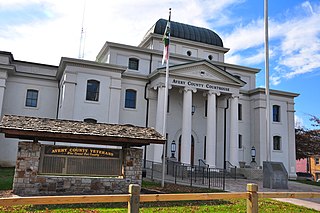
Avery County is a county located in the U.S. state of North Carolina. As of the 2020 census, the population was 17,806. The county seat is Newland. The county seat was initially established in Elk Park when the county was first formed, but was moved to Newland upon completion of the courthouse in 1912. Founded in 1911, it is the youngest of North Carolina's 100 counties.

Newland is a town in Avery County, North Carolina, United States. The population was 698 at the 2010 census. It is the county seat of Avery County.

Spruce Pine is the largest town in Mitchell County, North Carolina, United States. The population was 2,175 at the 2010 census.

Burnsville is a town that serves as the county seat of Yancey County, North Carolina, United States. Located in the Blue Ridge Mountains of western North Carolina, sits in the shadow of Mount Mitchell, the highest peak in the Eastern Continental United States. The population was 1,612 at the 2020 census.

The Black Mountains are a mountain range in western North Carolina, in the southeastern United States. They are part of the Blue Ridge Province of the Southern Appalachian Mountains. The Black Mountains are the highest mountains in the Eastern United States. The range takes its name from the dark appearance of the red spruce and Fraser fir trees that form a spruce-fir forest on the upper slopes which contrasts with the brown or lighter green appearance of the deciduous trees at lower elevations. The Eastern Continental Divide, which runs along the eastern Blue Ridge crest, intersects the southern tip of the Black Mountain range.

U.S. Route 19E (US 19E) is a divided highway of US 19 in the U.S. states of North Carolina and Tennessee. The United States Numbered Highway, which is complemented by US 19W to the west, travels 75.9 miles (122.1 km) from US 19 and US 19W at Cane River, North Carolina, north to US 11E, US 19, and US 19W in Bluff City, Tennessee. US 19E connects Asheville, North Carolina, and Bristol, Tennessee, with Burnsville, Spruce Pine, and Elk Park in North Carolina and Roan Mountain and Elizabethton in Tennessee. US 19E also has an unsigned concurrency with State Route 37 (SR 37) for its entire course in Tennessee.

U.S. Route 19W (US 19W) traverses approximately 63 miles (101 km) from Cane River, North Carolina, to Bluff City, Tennessee.

North Carolina Highway 226 (NC 226) is a primary state highway in the U.S. state of North Carolina. Traveling north–south through Western North Carolina, it connects the cities and towns of Grover, Shelby, Marion, Spruce Pine and Bakersville. It also a scenic byway in the South Mountains area and connects with the summer colony of Little Switzerland, via NC 226A.

Woody's Knob, at an elevation of 4,170 feet, is a summit or "knob" in the Blue Ridge Mountains and one of the highest points in the unincorporated village of Little Switzerland and in Mitchell County, North Carolina.
Three Mile is an unincorporated community in Avery County, North Carolina, United States. The community is located along NC 194 ; the name is derived from the air miles-straight-line distance of three miles between US 19-E to US 221.
Relief is an unincorporated community in Mitchell County, North Carolina, United States. The community is located along the banks of the North Toe River, connected to North Carolina Highway 197 (NC 197) via Relief Road (SR 1314).

The North Toe River is the headwaters of the Nolichucky River and a tributary in the French Broad River basin. From its source at Sugar Gap, between Bald Mountain and Sugar Mountain, it flows 73.6 miles (118.4 km) westerly through Avery, Mitchell, and Yancey counties.
Ingalls is an unincorporated community in Avery County, North Carolina, United States. The community is located at the intersection of US 19-E and NC 194. The Avery County Airport is located two miles south from Ingalls, towards Spruce Pine.

The South Toe River is a river in Yancey County in Western North Carolina. The name Toe is taken from its original name Estatoe, pronounced 'S - ta - toe', a native American name associated with the Estatoe trade route leading down from the NC mountains through Brevard where there is a historical plaque with information that affirms the route, on into South Carolina where a village of the same name was located.

North Carolina Highway 80 (NC 80) is a primary state highway in the U.S. state of North Carolina. The highway connects the various mountain communities straddled along Buck Creek, South Toe River and North Toe River in Western North Carolina and serves as a direct route, via the Blue Ridge Parkway, to Mount Mitchell State Park.

Kona is an unincorporated community in Mitchell County, North Carolina, United States. The community is located along North Carolina Highway 80 (NC 80), near the confluence of the North and South Toe Rivers and at the western slope of Ellis Mountain.
Red Hill is an unincorporated community in Mitchell County, North Carolina, United States. The community is located where North Carolina Highway 197 (NC 197) and North Carolina Highway 226 (NC 226) merge for .2 miles (0.32 km); geographically it is north of the North Toe River, along the southeastern slope of Pumpkin Patch Mountain.
Poplar is an unincorporated community in Mitchell County, North Carolina, United States. The community is located along North Carolina Highway 197 (NC 197), at the banks of the Hollow Poplar Creek and between the southern slopes of the Unaka Range and the North Toe River. It is also the last community along the CSX Blue Ridge Subdivision before crossing into Tennessee towards Erwin.


