
The Ostropales are an order of fungi in the class Lecanoromycetes. The order was circumscribed by Swedish botanist John Axel Nannfeldt in 1932. The order contains 4 families and 46 genera, including 6 genera of uncertain familial placement.
Lichenochora is a genus of fungi in the family Phyllachoraceae. It has 44 species. All species in the genus are lichenicolous, meaning they grow parasitically on lichens. The genus was circumscribed by Josef Hafellner in 1989, with Lichenochora thallina assigned as the type species.
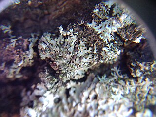
Plectocarpon is a genus of lichens in the family Lecanographaceae.
Llimoniella is a genus of fungi in the family Cordieritidaceae. The genus was circumscribed by lichenologists Josef Hafellner and Père Navarro-Rosinés in 1993.
Rhymbocarpus is a genus of lichenicolous (lichen-dwelling) fungi in the family Cordieritidaceae. It has 10 species. The genus was circumscribed by German mycologist Friedrich Wilhelm Zopf in 1896, with Rhymbocarpus punctiformis assigned as the type species.
Skyttea is a genus of lichenicolous (lichen-dwelling) fungi in the family Cordieritidaceae. The genus was circumscribed in 1981 by lichenologists Martha Allen Sherwood, David L. Hawksworth, and Brian J. Coppins, with Skyttea nitschkei assigned as the type species.
Spirographa is a genus of parasitic fungi. It is the sole genus in the monotypic family Spirographaceae, belong to the order Ostropales. The genus was circumscribed by Alexander Zahlbruckner in 1903, with Spirographa spiralis later assigned as the type species in 1923. The family Spirographaceae was circumscribed by Adam Flakus, Javier Etayo and Jolanta Miadlikowska in 2019 on the basis of molecular phylogenetic analysis. They determined that genus Spirographa is an independent lineage in the Ostropales, sister to the clade containing the families Fissurinaceae, Gomphillaceae, and Graphidaceae.

The Paja Formation is an Early Cretaceous geologic formation of central Colombia. The formation extends across the northern part of the Altiplano Cundiboyacense, the Western Colombian emerald belt and surrounding areas of the Eastern Ranges of the Colombian Andes. In the subsurface, the formation is found in the Middle Magdalena Valley to the west. The Paja Formation stretches across four departments, from north to south the southernmost Bolívar Department, in Santander, Boyacá and the northern part of Cundinamarca. Well known fossiliferous outcrops of the formation occur near Villa de Leyva, also written as Villa de Leiva, and neighboring Sáchica.

Padillasaurus is an extinct genus of titanosauriform sauropod known from the Early Cretaceous Paja Formation in Colombia. It contains a single species, Padillasaurus leivaensis, known only from a single partial axial skeleton. Initially described as a brachiosaurid, it was considered to be the first South American brachiosaurid ever discovered and named. Before its discovery, the only known brachiosaurid material on the continent was very fragmentary and from the Jurassic period. However, a more recent study finds it to be a basal somphospondylan.
María Euridice Páramo Fonseca is a Colombian paleontologist and geologist. She has contributed to paleontology in Colombia in the fields of describing various Cretaceous reptiles, most notably the mosasaurs Eonatator and Yaguarasaurus, the ichthyosaur Kyhytysuka, and the plesiosaurs Leivanectes and Stenorhynchosaurus.
Fernando Etayo Serna is a Colombian paleontologist and geologist. His contributions on the paleontology in Colombia has been mainly on the descriptions of ammonites and Etayo has helped describing many fossiliferous geologic formations of Colombia. Etayo obtained his MSc. degree in geology and geophysics from the Universidad Nacional de Colombia in 1963, and his PhD in paleontology from the University of California, Berkeley in 1975.
Rolf Santesson (1916–2013) was a Swedish lichenologist and university lecturer. He was awarded the Acharius Medal in 1992 for his lifetime contributions to lichenology.
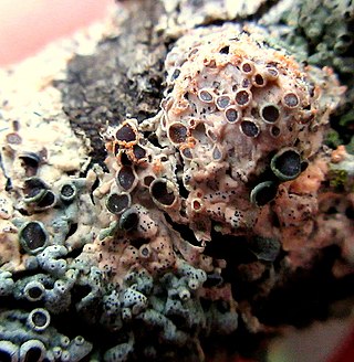
Ovicuculispora parmeliae is a widely distributed species of lichenicolous fungus in the family Bionectriaceae. It is parasitic on many foliose lichen species, particularly those in the family Parmeliaceae.

Sclerococcum is a genus of lichenicolous fungi in the family Dactylosporaceae.
Xenonectriella subimperspicua is a species of lichenicolous fungus in the family Nectriaceae. It has been recorded from South America, Europe, and New Zealand.

Polycoccum is a genus of lichenicolous fungi in the family Polycoccaceae. It has about 60 species.
Lichenotubeufia is a genus of lichenicolous fungi in the family Tubeufiaceae. The genus was circumscribed by Spanish mycologist and lichenologist Javier Etayo in 2017, with Lichenotubeufia eriodermatis assigned as the type species.
Miss World Spain 2022 was the 9th edition of the Miss World Spain pageant. The winner was Paula Pérez Sánchez of Castellón and she represented Spain at Miss World 2022.
Crittendenia is a genus of lichenicolous (lichen-dwelling) fungi in the monogeneric family Crittendeniaceae. The genus was circumscribed in 2021 to contain two species, C. lichenicola, and the type, C. coppinsii; these species were previously classified in the genus Chionosphaera. An additional 16 species were added to the genus the following year. The genus name honours British lichenologist Peter Crittenden.
Minutoexcipula is a genus of lichenicolous (lichen-dwelling) fungi of uncertain familial placement in the order Chaetothyriales. It has eight species. The genus was circumscribed in 1994 by M. Violeta Atienza Tamarit and David Leslie Hawksworth, with Minutoexcipula tuckerae assigned as the type species. The genus is characterized both by its black convex sporodochia-like conidiomata, as well as the well-differentiated exciple on these structures.


