Etzanoa

Last updated
Etzanoa
Walnut River.jpg
Walnut River, Arkansas City, Kansas
USA Kansas relief location map.svg
Archaeological site icon (red).svg
Shown within Kansas
Alternative nameTzanoa
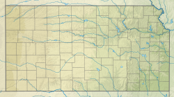
Location Arkansas City, Kansas, United States
RegionGreat Plains
TypeSettlement
Lengthabout 5 miles long
History
Foundedc. 1450
Abandonedc. 1700
Cultures Wichita people
Site notes
ArchaeologistsDonald Blakeslee
Public accessAccessible to the public.

Etzanoa is a historical city of the Wichita people, located in present-day Arkansas City, Kansas, near the Arkansas River, that flourished between 1450 and 1700. [1] Dubbed "the Great Settlement" by Spanish explorers who visited the site, Etzanoa may have housed 20,000 Wichita people. [2] The historical city is considered part of Quivira. [3]

Contents

When Spanish conquistador Francisco Vásquez de Coronado's expedition visited central Kansas in 1541, he dubbed the Wichita settlements "Quivira". [4] [1] The Umana and Leyba expedition visited the Etzanoa site in 1594 and Juan de Oñate visited there in 1601. They recorded the inhabitants as being the Rayados. In Spanish Rayados means "striped." The Wichita people were noted for the straight lines they tattooed onto their faces and their bodies.

In April 2017, the location of Etzanoa was finally discovered when a local teen found a cannonball linked to a battle near present-day Arkansas City that took place in the year 1601. Local researchers used this artifact to pinpoint the location of Etzanoa. [5]
Archaeological research

Sketch of 19th-century Wichita Indian village, with beehive-shaped grass houses surrounded by maize, that may be similar to those of Etzanoa Wichita Indian village 1850-1875.jpg
Sketch of 19th-century Wichita Indian village, with beehive-shaped grass houses surrounded by maize, that may be similar to those of Etzanoa

Donald Blakeslee, an archaeologist at the Wichita State University, has led recent research on Etzanoa. In 2013, historians at the University of California, Berkeley, retranslated the early Spanish accounts of expeditions to Kansas. These clearer translations allowed Blakeslee to match written descriptions to archaeological sites. He located the 1601 Spanish battle site in Arkansas City. [1]

During road construction in the area in 1994, thousands of artifacts were unearthed. Residents of Arkansas City regularly unearthed artifacts, such as potsherds or flint points. Kansas State Archaeologist Robert Hoard is researching sites in Rice and McPherson Counties. [1]

Archaeologists have discovered more than a dozen large settlements along six miles of the Walnut River extending upstream from near its junction with the Arkansas River. These are called the Lower Walnut focus sites. The occupation of these sites has been dated from 1500 to 1720. Some artifacts of Spanish origin have been found at the site. [6]

The Rayados probably abandoned the Walnut River site in the early 18th century. Perhaps they moved a few miles south to Kay County, Oklahoma, where two 18th-century archaeological sites, Deer Creek and Bryson Paddock, of the Wichita are known. [7] They appear to have been much reduced in numbers by then, possibly as a result of European diseases, warfare, and the slave trade in Indians. [8] The descendants of the Rayados were absorbed into the Wichita tribe.

A 2020 aerial investigation by Blakeslee discovered a probable Etzanoa ceremonial site near the previously-identified sites along the Walnut River, with its most prominent feature a circular or semi-circular ditch of two meters width and 50 meters in diameter. [9] [10]

Rayado Indians

Archaeologists and historians believe the Rayado Indians spoke a Caddoan language and were a Wichita sub-tribe. Their grass houses, dispersed mode of settlement, a chief named Catarax – a Wichita title – the description of their granaries, and their location all agree with descriptions of the Wichita. As Wichitas, the Rayados were related to the people that Coronado had discovered in Quivira 60 years earlier. [11] Linguist Nancy Parrott Hickerson dissents and called them "Jumanos." [12] Jumano seems to have been a generic term for Plains Indians with painted or tattooed faces, as were the Rayados.

Both Jusepe's and Oñate's accounts describe the Rayados as numerous. The more than 1,200 houses which Oñate estimated for the settlement indicates a population of at least 12,000, if the houses were as large as those of later Wichita tribes. [13] Moreover, Chief Catarax told the Spanish explorers that there were additional settlements upstream on that river and on other rivers. [14] The fact that the Rayados abandoned their settlement on the arrival of Oñate's expedition may be an indication that they had had previous, unfavorable dealings with the Spanish.

Spanish chronicles

Jusepe, 1594/95

In 1594 or 1595, Antonio Gutierrez de Umana and Francisco Leyba de Bonilla led the first known expedition to the Great Plains of Oklahoma and Kansas in more than 50 years. An Indigenous Mexican Jusepe Gutierrez was the lone survivor of the expedition.

Leaving New Mexico and traveling east and north for more than a month, Jusepe said that they found a "very large settlement." He said it extended for more than 10 leagues (about 26 miles) along a river and was two leagues wide. The houses had straw roofs and were built close together, but between clusters of houses were fields of maize, squash, and beans. The Indians were numerous, but "received the Spanish peacefully and furnished them with abundant supplies of food" The expedition encountered a "multitude" of bison in the region. [15] It appears these were the same people later called "Rayados."

Oñate, 1601

In 1601, Juan de Oñate, founder and governor of New Mexico, led an expedition that followed in the footsteps of Leyba and Umana. Jusepe guided Oñate, more than 70 Spanish soldiers and priests, an unknown number of Indian soldiers and servants, and 700 horses and mules across the plains. [16]

Oñate met Apache Indians in the Texas Panhandle and, later, a large encampment of Escanjaques. The Escanjaques showed him the way to a large settlement about 30 miles away of a people whom Oñate called "Rayados." Rayado means "striped" in Spanish, referring to their custom of painting or tattooing their faces. The Escanjaques, enemies of the Rayados, attempted to enlist the help of the Spanish to attack the Rayados, who they alleged were responsible for the deaths of Leyba and Umana a few years earlier.

The Escanjaques guided Oñate to a nearby river, probably the Arkansas, where they saw a few hundred Rayados on a hill. The Rayados advanced, throwing dirt into the air as a sign that they were ready for war. Oñate indicated that he did not wish to fight and made peace with the group, who proved to be friendly and generous. Oñate said that, unlike the Escanjaques, the Rayados were "united, peaceful, and settled." They showed deference to their chief, named Catarax, whom Oñate detained as a guide and hostage, although "treating him well." [16]

Catarax led Oñate and the Escanjaques across the Arkansas to a settlement on the eastern bank, a few miles from the river. The settlement was deserted, the inhabitants having fled. It contained "more than twelve hundred houses, all established along the bank of another good-sized river which flowed into the large one [probably the Arkansas]." The settlement of the Rayados was similar to those seen by Coronado in Quivira sixty years before. The homesteads were dispersed; the houses round, thatched with grass and surrounded by large granaries to store the corn, beans, and squash that they grew in their fields. Oñate restrained his Escanjaque guides from looting the town and sent them home. Catarax, who had been chained, was rescued by the Rayados in a bold raid. [16]

The next day Oñate and his army proceeded onward through the settlement for three leagues (eight miles) without seeing many Rayados. The Spaniards were warned, however, that the Rayados were assembling an army to attack them. Discretion seemed the better part of valor. Oñate estimated that three hundred Spanish soldiers would be needed to confront the Rayados, and he turned his soldiers around to return to New Mexico.

Oñate feared a Rayados attack, but apparently it was the Escanjaques who attacked as they turned to New Mexico. Oñate claimed that many Escanjaques were killed in the battle, but many of his soldiers were wounded. After two hours, Oñate broke off the combat, retired from the field, and led his group to New Mexico. [16]

An Escanjaque captured by Oñate, and later named Miguel, drew a map of the region for the Spanish. He called the "Great Settlement" of the Rayados, "Etzanoa" or "Tzanoa." [17]

Tours

Limited private tours of the site can be arranged through the Cherokee Strip Land Run Museum in Arkansas City. A visitor's center is planned. [3]

See also

Notes

  1. 1 2 3 4 Kelly, David (19 August 2018). "Archaeologists explore a rural field in Kansas, and a lost city emerges". Los Angeles Times. Retrieved 8 December 2018.
  2. "Etzanoa: The Great Settlement". Eztanoa Conservancy. 4 March 2018. Retrieved 8 December 2018.
  3. 1 2 Tanner, Beccy (21 April 2018). "Mysterious 'Lost City' of Etzanoa in south-central Kansas now open to tours". The Wichita Eagle. Retrieved 8 December 2018.
  4. Winship, George Parker, tr. & ed. (1904). The Journey of Coronado, 1540–1542, from the City of Mexico to the Grand Canon of the Colorado and the Buffalo Plains of Texas, Kansas, and Nebraska, As Told by Himself and his Followers. Trail makers. New York, New York, USA: A.S. Barnes & Co. pp. 209–210, 217–219.{{cite book}}: |first1= has generic name (help)
  5. Teen accidentally helps discover lost 16th-century civilization in Kansas By Natalie O'Neill, NY Post, 18 April 2017.
  6. Hawley, Marlin F. (2000). "European Contact and Southwestern Artifacts in the Lower Walnut Focus Sites at Arkansas City, Kansas". Plains Anthropologist. 45 (173): 237–255. doi:10.1080/2052546.2000.11931973. S2CID   164199369.
  7. OAS – Oklahoma's Past Archived 21 December 2010 at the Wayback Machine . University of Oklahoma. Retrieved 3 April 2011.
  8. Wiegers, Robert P. (1988). "A Proposal for Indian Slave Trading in the Mississippi Valley and its Impact on the Osage". Plains Anthropologist. 33 (120): 187–202. doi:10.1080/2052546.1988.11909444.
  9. Survey Reveals Large Earthwork at Ancestral Wichita Site in Kansas. Heritage Daily, 4 September 2020.
  10. Drones Find Signs of Native American 'Great Settlement' under Kansas Pasture. Science News, 10 September 2020
  11. Hammond and Rey, 754.
  12. Hickerson, Nancy Parrott, The Jumanos: Hunters and Traders of the Southern Plains (Austin: University of Texas Press, 1994), 73.
  13. The Wichita Indians. Texasindians.com. Retrieved 3 April 2011.
  14. Bolton (1916), p. 271
  15. Hammond, George P., and Rey, Agapito (eds.) Don Juan de Onate, Colonizer of New Mexico, 1595–1628, Vol. 5. Albuquerque: UNM Press, 1953, pp. 416–419
  16. 1 2 3 4 Bolton (1916), pp. 250–67.
  17. Vehik, Susan C. (1986). "Onate's Expedition to the Southern Plains: Routes, Destinations, and Implications for Late Prehistoric Cultural Adaptations". Plains Anthropologist. 31 (111): 13–33. doi:10.1080/2052546.1986.11909314.

Related Research Articles

<span class="mw-page-title-main">Francisco Vázquez de Coronado</span> Spanish explorer of the American southwest

Francisco Vázquez de Coronado was a Spanish conquistador and explorer who led a large expedition from what is now Mexico to present-day Kansas through parts of the southwestern United States between 1540 and 1542. Vázquez de Coronado had hoped to reach the Cities of Cíbola, often referred to now as the mythical Seven Cities of Gold. His expedition marked the first European sightings of the Grand Canyon and the Colorado River, among other landmarks. His name is often Anglicized as Vasquez de Coronado or just Coronado.

<span class="mw-page-title-main">Cowley County, Kansas</span> County in Kansas, United States

Cowley County is a county located in the U.S. state of Kansas. Its county seat is Winfield, and its most populous city is Arkansas City. As of the 2020 census, the county population was 34,549. The county was named after Matthew Cowley, first lieutenant in Company I, 9th Kansas Cavalry, who died during the American Civil War.

<span class="mw-page-title-main">Arkansas City, Kansas</span> City in Cowley County, Kansas

Arkansas City is a city in Cowley County, Kansas, United States, situated at the confluence of the Arkansas River and Walnut River in the southwestern part of the county. As of the 2020 census, the population of the city was 11,974. The name of this city is not pronounced like the nearby state of Arkansas, but rather as. Over the years there has been much confusion about the regional pronunciation of "Arkansas", which locals render as rather than. Throughout much of Kansas, residents use this alternative pronunciation when referring to the Arkansas River.

<span class="mw-page-title-main">Juan de Oñate</span> 16/17th-century Spanish conquistador and colonial governor in New Spain

Juan de Oñate y Salazar was a Novohispanic conquistador from New Spain, explorer, and colonial governor of the province of Santa Fe de Nuevo México in the viceroyalty of New Spain. He led early Spanish expeditions to the Great Plains and Lower Colorado River Valley, encountering numerous indigenous tribes in their homelands there. Oñate founded settlements in the province, now in the Southwestern United States.

<span class="mw-page-title-main">Wichita people</span> Confederation of Native Americans

The Wichita people or Kitikiti'sh are a confederation of Southern Plains Native American tribes. Historically they spoke the Wichita language and Kichai language, both Caddoan languages. They are indigenous to Oklahoma, Texas, and Kansas.

<span class="mw-page-title-main">Plains Indians</span> Native Americans/First Nations peoples of the Great Plains of North America.

Plains Indians or Indigenous peoples of the Great Plains and Canadian Prairies are the Native American tribes and First Nation band governments who have historically lived on the Interior Plains of North America. While hunting-farming cultures have lived on the Great Plains for centuries prior to European contact, the region is known for the horse cultures that flourished from the 17th century through the late 19th century. Their historic nomadism and armed resistance to domination by the government and military forces of Canada and the United States have made the Plains Indian culture groups an archetype in literature and art for Native Americans everywhere.

<span class="mw-page-title-main">El Cuartelejo</span> Region in Colorado and Kansas, United States

El Cuartelejo, or El Quartelejo, is a region in eastern Colorado and western Kansas where Plains Apache cohabited with Puebloans. Subject to religious persecution, Puebloans fled the Spanish Nuevo México territory and cohabitated with the Cuartelejo villagers in the 1600s.

<span class="mw-page-title-main">Walnut River (Kansas)</span> River in Kansas, United States

The Walnut River is a tributary of the Arkansas River, 154 miles (248 km) long, in the Flint Hills region of Kansas in the United States. Via the Arkansas, it is part of the Mississippi River watershed.

Quivira was a province of the ancestral Wichita people, located near the Great Bend of the Arkansas River in central Kansas, The exact site may be near present-day Lyons extending northeast to Salina.

The Deer Creek/Bryson Paddock Sites are the remains of 18th century fortified villages of the Wichita tribe located along the Arkansas River in Kay County, Oklahoma.

Teyas were a Native American people living near what is now Lubbock, Texas, who first made contact with Europeans was the 1541 Francisco Vásquez de Coronado Expedition.

The Escanjaques were an American Indian tribe who lived in the Southern Plains.

Jusepe Gutierrez ,) was a Native Nahua guide and explorer. He was the only known survivor of the Umana and Leyba expedition to the Great Plains in 1594 or 1595. In 1599 he guided Vicente de Zaldivar and in 1601 Governor Juan de Oñate on expeditions to the plains.

Antonio Gutiérrez de Humana and Francisco Leyva de Bonilla, Spanish colonists, made an unauthorized expedition to the Great Plains in 1594 or 1595. An Indian, Jusepe Gutierrez, was the only survivor and the source of fragmentary information about the expedition. The route Humana and Leyva followed can not be determined with certitude, but it probably included traveling to what is today Texas, Oklahoma, and Kansas.

Jumanos were a tribe or several tribes, who inhabited a large area of western Texas, New Mexico, and northern Mexico, especially near the Junta de los Rios region with its large settled Indigenous population. They lived in the Big Bend area in the mountain and basin region. Spanish explorers first recorded encounters with the Jumano in 1581. Later expeditions noted them in a broad area of the Southwest and the Southern Plains.

The Tompiro Indians were Pueblo Indians living in New Mexico. They lived in several adobe villages east of the Rio Grande Valley in the Salinas region of New Mexico. Their settlements were abandoned and they were absorbed into other Pueblo Nations in the 1670s.

The Taovaya tribe of the Wichita people were Native Americans originally from Kansas, who moved south into Oklahoma and Texas in the 18th century. They spoke the Taovaya dialect of the Wichita language, a Caddoan language. Taovaya people today are enrolled in the Wichita and Affiliated Tribes, a federally recognized tribe headquartered in Anadarko, Oklahoma.

The Edwards Archaeological Site is an archaeological site in Beckham County, Oklahoma, near the town of Carter. The site is part of the Edwards Complex, a culture which flourished in this area from about 1400 to 1650. The site was a Native American (Indian) village and included dwellings surrounded by a round fortification. Large amounts of waste material, such as tools and bones, have been collected from the site, indicating prolonged inhabitation by a large group. Pottery fragments and obsidian and turquoise artifacts found at the site suggest that its inhabitants traded with Puebloan peoples.

<span class="mw-page-title-main">Southern Plains villagers</span>

The Southern Plains villagers were semi-sedentary Native Americans who lived on the Great Plains in western Oklahoma, Texas, Kansas, and southeastern Colorado from about AD 800 until AD 1500.

Vicente de Zaldívar was a Spanish soldier and explorer in New Mexico. He led the Spanish force which perpetrated the Acoma Massacre at the Acoma Pueblo in 1599. He led or participated in several expeditions onto the Great Plains.

References

37°04′03″N97°00′40″W / 37.06750°N 97.01111°W / 37.06750; -97.01111