Course
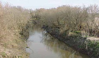
The Walnut River rises in northern Butler County and flows generally southward through Butler and Cowley Counties, past the towns of El Dorado, Augusta, Winfield and Douglass. It joins the Arkansas River at Arkansas City. The Walnut's principal tributaries are the Whitewater River, which joins it at Augusta, and the Little Walnut River, which joins it in southern Butler County. The Walnut River drainage basin comprises 2,380 square miles (6,200 km2) in an ecoregion characterized by rocky, rolling hills and prairie. Elevations range from 1,050 to 1,625 feet (320 to 495 m) in the basin. Average precipitation, mostly summer rainfall, varies from 32 to 38 inches (810 to 970 mm) annually. Tallgrass prairie is the most common vegetation, covering 66 percent of the land. Crop land covers 23 percent and woodlands cover five percent. Major crops are wheat, soybeans, cotton, hay, sorgum, and corn. Cattle are the most important livestock. [3]
Upstream of El Dorado, a U.S. Army Corps of Engineers dam causes the river to form El Dorado Lake, along which a Kansas state park has been designated. The lake consists of about 8,000 acres (3,200 ha) of water with another 8,000 acres of land along its shores designated as park and wildlife areas. [3] The other large lake in the Walnut River basin is Winfield City Lake with 1,250 acres (510 ha) of water surrounded by 1,150 acres (470 ha) of parkland. [4] Both lakes offer recreational opportunities including fishing, boating, hunting, camping, and wildlife observation.
In Winfield, the east side of the old Tunnel Mill Dam is a public fishing spot. It is staged directly near the old Kickapoo Corral. The west side of the dam and the Kickapoo Corral are both privately owned and closed to the public. A whirlpool is created by a hole in solid limestone about 15 feet (4.6 m) down on the river bed directly off the cliffs of the Corral. The bottom is sandy and somewhat rocky.
Lake Kickapoo is a reservoir located on the North Fork Little Wichita River in the Red River Basin of Archer County, Texas. It is neighbored by Archer City, Texas and Wichita Falls, Texas which reside within the Central Great Plains ecoregion.
Butler County is a county in the U.S. state of Kansas and is the largest county in the state by total area. Its county seat is El Dorado and its most populous city is Andover. As of the 2020 census, the county population was 67,380. The county was named for Andrew Butler, a U.S. Senator from South Carolina who coauthored the Kansas–Nebraska Act.

Augusta is a city in Butler County, Kansas, United States. As of the 2020 census, the population of the city was 9,256.

Douglass is a city in Butler County, Kansas, United States. As of the 2020 census, the population of the city was 1,555.

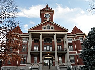
El Dorado is a city and county seat of Butler County, Kansas, United States. It is situated along the Walnut River in the central part of Butler County and located in south-central Kansas. As of the 2020 census, the population of the city was 12,870. It is home to Butler Community College.

Arkansas City is a city in Cowley County, Kansas, United States, situated at the confluence of the Arkansas River and Walnut River in the southwestern part of the county. As of the 2020 census, the population of the city was 11,974.

The Ozarks, also known as the Ozark Mountains, Ozark Highlands or Ozark Plateau, is a physiographic region in the U.S. states of Missouri, Arkansas, Oklahoma and the extreme southeastern corner of Kansas. The Ozarks cover a significant portion of northern Arkansas and most of the southern half of Missouri, extending from Interstate 40 in central Arkansas to Interstate 70 in central Missouri.

The Wichita people, or Kitikiti'sh, are a confederation of Southern Plains Native American tribes. Historically they spoke the Wichita language and Kichai language, both Caddoan languages. They are indigenous to Oklahoma, Texas, and Kansas.

Rock is an unincorporated community in Cowley County, Kansas, United States. As of the 2020 census, the population of the community and nearby areas was 94.

The Smoky Hills are an upland region of hills in the central Great Plains of North America. They are located in the Midwestern United States, encompassing north-central Kansas and a small portion of south-central Nebraska.
The Whitewater River is a 62-mile-long (100 km) tributary of the Walnut River in southern Kansas in the United States. Via the Walnut and Arkansas Rivers, it is part of the watershed of the Mississippi River.

The Salt Fork of the Arkansas River is a 239-mile-long (385 km) tributary of the Arkansas River in southern Kansas and northern Oklahoma in the United States. Via the Arkansas River, it is part of the watershed of the Mississippi River.

El Dorado State Park is a state park in Butler County, Kansas, United States, located just north of El Dorado.
El Dorado Lake is a reservoir on the Walnut River 0.5 miles (0.80 km) northeast of El Dorado in the Flint Hills region of Kansas. Built and managed by the U.S. Army Corps of Engineers, it is used for flood control, recreation, and water supply. El Dorado State Park is located on its shore.

The Solomon River, often referred to as the "Solomon Fork", is a 184-mile-long (296 km) river in the central Great Plains of North America. The entire length of the river lies in the U.S. state of Kansas. It is a tributary of the Smoky Hill River.

Etzanoa is a historical city of the Wichita people, located in present-day Arkansas City, Kansas, near the Arkansas River, that flourished between 1450 and 1700. Dubbed "the Great Settlement" by Spanish explorers who visited the site, Etzanoa may have housed 20,000 Wichita people. The historical city is considered part of Quivira.
Jusepe Gutierrez ,) was a Native Nahua guide and explorer. He was the only known survivor of the Umana and Leyba expedition to the Great Plains in 1594 or 1595. In 1599 he guided Vicente de Zaldivar and in 1601 Governor Juan de Oñate on expeditions to the plains.

De Graff is an unincorporated community in Butler County, Kansas, United States. It is located on U.S. Route 77 approximately 7.7 miles (12.4 km) north of I-35
The Florence, El Dorado, and Walnut Valley Railroad was a short-line railroad in central Kansas.
