
Butler County is a county located in the southeast Ozark Foothills Region in the U.S. state of Missouri. As of the 2020 Census, the county's population was 42,130. The largest city and county seat is Poplar Bluff. The county was officially organized from Wayne County on February 27, 1849, and is named after former U.S. Representative William O. Butler (D-Kentucky), who was also an unsuccessful candidate for Vice President of the United States. The first meeting in the Butler County Courthouse was held on June 18, 1849.
Harviell is an unincorporated community and census-designated place in Butler County, Missouri, United States. As of the 2020 census it had a population of 98.

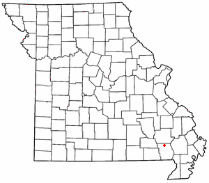
Rombauer is an unincorporated community in eastern Butler County, Missouri, United States. It is located approximately seven miles northeast of Poplar Bluff on the edge of the Mark Twain National Forest at an elevation of 335 feet (102 m).
Hendrickson is an unincorporated community in northern Butler County, Missouri, United States. It is located along Missouri Route O approximately one mile south of U.S. Route 67. It is approximately ten miles north of Poplar Bluff, within the Mark Twain National Forest. The community of Wilby lies three miles to the southeast along Route O. It sits on the east margin of the Black River floodplain. The Missouri Pacific Railway passes the west side of the community along the Black River floodplain.
Ash Hill is an unincorporated community in eastern Butler County, in the U.S. state of Missouri. The community is located on Missouri Route 51 ten miles east of Poplar Bluff and just over one mile west of Fisk and the St. Francis River which forms the Butler-Stoddard county line. The Missouri Pacific Railway passes through the community.
Batesville is an unincorporated community in eastern Butler County, in the U.S. state of Missouri. The community is located in the flatlands of southeast Missouri on Missouri Route 51 between Broseley to the south and Rossville to the north. Poplar Bluff is 8.5 miles (13.7 km) to the northwest.
Carola is an unincorporated community in southeastern Butler County, in the U.S. state of Missouri.
Halloran is an unincorporated community in Butler County, in the U.S. state of Missouri.
Hilliard is an unincorporated community in northern Butler County, in the U.S. state of Missouri. The community is located on Missouri Route W about three miles north of Poplar Bluff. It sits on the east margin of the Black River floodplain at an elevation of 361 feet. The community of Wilby lies three miles to the north-northwest along the Black River. The Missouri Pacific Railway passes the east side of the community along the margin of the Black River floodplain. The small Lake Locloma lies just to the west of the Black River along Route W.
Junland is an unincorporated community in Butler County, in the U.S. state of Missouri.
Keeners is an unincorporated community in northern Butler County, in the U.S. state of Missouri. U.S. Route 67 passes approximately 1.5 mile to the southeast. The Missouri Pacific Railway passes the west side of the community along the Black River floodplain.
Kinzer is an unincorporated community in Butler County, in the U.S. state of Missouri.
Kremlin Mill is an unincorporated community in southwest Butler County, in the U.S. state of Missouri.
Oglesville is an unincorporated community in southeastern Butler County, in the U.S. state of Missouri.
Parks is an extinct town in Butler County, in the U.S. state of Missouri. The GNIS classifies it as a populated place.
Rossville is an unincorporated community in eastern Butler County, in the U.S. state of Missouri. It is located on Missouri Route 51 between Batesville to the south and Fisk to the north. It is approximately 7.5 miles east of Poplar Bluff.
Stringtown is an unincorporated community in Butler County, in the U.S. state of Missouri.
Taft is an unincorporated community in Butler County, in the U.S. state of Missouri.
Vastus is an unincorporated community in southern Butler County, in the U.S. state of Missouri.
Wilby is an unincorporated community in northern Butler County, in the U.S. state of Missouri. The community is on Missouri Route O approximately seven miles north of Poplar Bluff. It sits on the east margin of the Black River floodplain at an elevation of 361 feet. The community of Hilliard lies three miles to the south-southeast along the Black River. The Missouri Pacific Railway passes the west side of the community along the Black River floodplain. The community lies within the Mark Twain National Forest.

