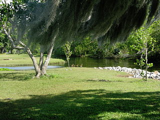
Chidester is a city in Ouachita County, Arkansas, United States. The population was 335 at the 2000 census. It is part of the Camden Micropolitan Statistical Area.

Stephens is a city in Ouachita County, Arkansas, United States. The population was 891 at the 2010 census. It is part of the Camden Micropolitan Statistical Area. Stephens was incorporated in 1889.

Fairview Shores is a census-designated place and an unincorporated area in Orange County, Florida, United States. The population was 10,239 at the 2010 census. It is part of the Orlando–Kissimmee–Sanford, Florida Metropolitan Statistical Area.

Fairview is a city located in Williamson County, Tennessee. It is part of the Nashville metropolitan area. The population was 7,720 at the 2010 census, which was a 33.1% increase in population from the 2000 census. In the communities just outside Fairview, there are an additional 4,100 people, there are over 11,000 people living within the Fairview area.

Fairview is a town in Collin County, Texas, United States. It is part of the Dallas-Fort Worth metropolitan area. As of the 2010 census, the town population was 7,248. The estimated population in 2014 was 8,361. The town is adjacent to the 289-acre (1.17 km2) Heard Wildlife Sanctuary.

The Adams–Onís Treaty of 1819, also known as the Transcontinental Treaty, the Florida Purchase Treaty, or the Florida Treaty, was a treaty between the United States and Spain in 1819 that ceded Florida to the U.S. and defined the boundary between the U.S. and New Spain. It settled a standing border dispute between the two countries and was considered a triumph of American diplomacy. It came in the midst of increasing tensions related to Spain's territorial boundaries in North America against the United States and Great Britain in the aftermath of the American Revolution; it also came during the Latin American wars of independence.
Bois Forte Indian Reservation is an Indian reservation formed for the Bois Forte Band of Chippewa.

The Gardens of the American Rose Center are botanical gardens located in Shreveport, Louisiana and dedicated to varieties of the rose. The gardens have been the headquarters of the American Rose Society since 1974, when the organization moved to Louisiana from Columbus, Ohio.

Louisiana's 4th congressional district is a congressional district in the U.S. state of Louisiana. The district is located in the northwestern part of the state and is based in Shreveport-Bossier City. It also includes the cities of Minden, DeRidder, and Natchitoches.

Louisiana's 7th congressional district was a congressional district in the U.S. state of Louisiana located in the southwestern part of the state. It last contained the cities of Crowley, Eunice, Jennings, Lafayette, Lake Charles, Opelousas, Sulphur and Ville Platte.
KLCL is a radio station broadcasting an Urban Adult Contemporary format. Licensed to Lake Charles, Louisiana, United States, the station is currently owned by Townsquare Media. The station's studios are located on North Lakeshore Drive, just northwest of downtown Lake Charles, and its transmitter is located in Westlake, Louisiana.

Blue Lake Regional Park is a public park in Fairview, in the U.S. state of Oregon. The 101-acre (41 ha) park, near the south shore of the Columbia River in Multnomah County, includes many covered and uncovered picnic areas, playing fields for sports such as softball, a cross country course and infrastructure related to lake recreation including swimming, boating, and fishing. Encompassing wooded areas, three ponds, and a wetland in addition to the lake, the park is frequented by migrating birds and other wildlife. Paved paths run through the park, which is near the 40-Mile Loop hiking and biking trail. Park vegetation includes cottonwoods, willows, and other trees and shrubs as well as wetland plants such as cattails.

Lone Oak Township is one of twenty-four townships in Bates County, Missouri, USA. As of the 2000 census, its population was 293.

Fairview-Riverside State Park is a tourist attraction 2 miles (3.2 km) east of Madisonville, Louisiana, United States. Its 99 acres (400,000 m2) is set along the banks of the Tchefuncte River. Within the park is the Otis House Museum, built in 1885, which was placed on the National Register of Historic Places in 1999. Visitors go to Fairview-Riverside to camp, and for water sports and fishing. The park has 100 campsites, a short nature trail, and a boardwalk which reveals forested wetlands along the Tchefuncte River.
Hanna is an unincorporated community in Red River Parish, Louisiana, United States.

Timon is an unincorporated community in Natchitoches Parish, Louisiana, United States.
Victoria is an Unincorporated Community in Natchitoches Parish, Louisiana, United States.

Fairview is an unincorporated community in Concordia Parish, Louisiana, United States.

Hagewood is an unincorporated community in Natchitoches Parish, Louisiana, United States.


