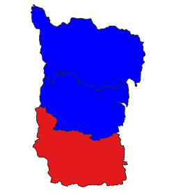
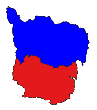
Falam Township (Burmese: ဖလမ်းမြို့နယ်) is a township of Falam District in the Chin State of Burma (Myanmar). Its administrative seat is the town of Falam. The population, as of 2014, is 41,457 (male:20,350; female: 21,107). Out of this population, 9,092 live in Falam town (urban population) and 32,365 live in rural areas.[2]
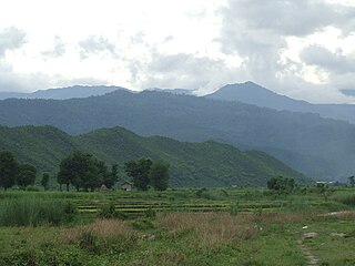
Falam Township is mountainous, running east–west from the foothills above the Neyinzaya and Myittha rivers to the high peaks of the Chin Hills in the Arakan Mountain Range and down to the border with Mizoram State, India.[3] The highest peak in the township, Mount Zinghmuh[4] is also the second highest mountain peak in Chin State. The Manipur (Manipuya) River runs south through the center of the township. People who travel to the city take the Kalay-Falam-Hakha Road. The township is famous for its heart-shaped lake called Hri (Rih or Yi).[5] The township is also the location of Laiva Dam, the largest dam in Chin State. The dam produces hydroelectric power for Falam and neighboring cities such as Hakha and Thantlang (Thlangtlang).
Bridges include the Manipura river-crossing suspension bridge, 320 feet long by 5 feet wide, linking Bazan Village and Kawdah Village, and the Lonnlwe creek-crossing suspension bridge, 130 feet long by four feet wide, linking Kawdah Village and Kwabwe Village in the township.[6]
History
In the reorganization of Chin State townships in 2008, Falam Township lost its northernmost village tracts in the east to Tiddim Township, and a few of its recently gained southwesternmost village tracts were returned to Thantlang Township, but it gained a much longer border with India by the transfer of Tiddim Township's southwestern village tracts to Fallam Township.[7]
Communities
The town of Rihkhawdar (Reehkawdar) is the northernmost town in the township.[7] The township has 87 village tracts and 178 villages.[1]
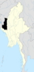
Chin State is a state in western Myanmar. Chin State is bordered by Sagaing Division and Magway Division to the east, Rakhine State to the south, the Chittagong Division of Bangladesh to the west, and the Indian states of Mizoram to the west and Manipur to the north. The population of Chin State is about 488,801 according to the 2014 census, and its capital city is Hakha.
The Chin Hills are a range of mountains in Chin State, northwestern Burma (Myanmar), that extends northward into India's Manipur state.
Falam is a town in north-western Burma (Myanmar) near Burma's western border with the Indian state of Mizoram. The town was founded by the Taisun tribe. The British arrived to Falam in 1892, and became an important base for British rule of the Chin Hills. After the formation of Chin State, it was the capital city until the administrative offices were moved to Hakha in 1974. It is still the regional governor of Falam District and of Falam Township. Falam is the headquarters of several important organizations, such as the Chin Baptist Convention (CBC). The population, as of 2014, is 9,092.
Thantlang is a town and the administrative center of Thantlang Township in Chin State, western Myanmar.
Lumbang (Lumbana) is a village in Falam Township, Falam District Chin State, Myanmar, 9.4 kilometres (5.8 mi) north of the town of Falam on the Tedim Road. Lumbang observes Myanmar Time with a UTC offset of 6.5 hours.
Falam District is a district of the Chin State in Myanmar. It consists of 1 township and 445 villages. The major towns include: Fort White, and Falam.
Mindat Township is a township located in Mindat District in the Chin State of Myanmar. The township is located between latitude 21.19 and 21.47, longitude 93.23 and 94.29. The third highest peak in Myanmar, Nat Ma Taung at 3,053 metres (10,016 ft), is visible from here, though it is within Kanpetlet township boundary. Mindat was a part of Pakokku Hill Tracts District.
Tedim Township is in Tedim District, Chin State of Myanmar (Burma). The administrative centre for the township is the town of Tedim. Tedim Township is the most populous township in Chin State, with a population of 87,623.
Thantlang Township is one of the nine townships in Chin State. Thantlang is the administrative town of inclusive nine circles attributed to the geographical and dialectical arrangements of the area. They are Khualhring Tlang, Vanzang Tlang, Zahnak Tlang, Bual Tlang, Vailam Tlang Lautu Tlang, Mara Tlang, Vailam Tlang, Zophei Tlang and Bawipa Tlang. Only four circles speak Lai dialect. Zophei(Zophei and Bawipa circles), Lautu, HawThai speak their tribal language. The other fives circles and in Thantlang town speak Lai dialect. In Thantlang township, Lai dialect is the common use dialect. Lai dialect is also spoken at Hakha township and Falam township.
The Lai people mainly inhabit the southern parts of Chin Hills in Myanmar's Chin State, in the townships of Falam, Thantlang and Hakha. They are also found in the Lawngtlai district of Mizoram, India, where they have been granted the Lai Autonomous District Council. Outside this area they are scattered in Mizoram and in Manipur. Their languages "Lai holh" and "Hakha holh" are classified as Central Kuki-Chin languages.
Lai, Laiholh, or Pawi is a Kuki-Chin language spoken in central Chin State in Myanmar, and Lawngtlai district of Mizoram, India. Hakha Chin-speaking minorities are also found in the Sagaing and Magway Regions of Myanmar, and in the Chittagong Hill Tracts of southeastern Bangladesh by the Bawm minority.
Chin Christian University (CCU) is a Christian university in Hakha, Chin State, Burma. CCU is one of the departments of Chin Association of Christian Communication (CACC). After 25 years (1990-2015), God blessed Chin Christian College's long vision: "To Transform the College into a University" and the name of the institution was changed into Chin Christian University by the 9th Triennial Meeting of Chin Association of Christian Communication, held at Hakha Khuahlun Baptist Church on April 4, 2015.
Simpi is a village in the Rallawn Village Tract in Falam Township, Falam District, Chin State, Myanmar, about 13 kilometres (8 mi) south-east of the town of Falam.
Laiva Dam is a dam in Falam Township, Falam District, Chin State in Burma (Myanmar), on the Lai Va River, a west flowing tributary of the Ṭio River. The 600-kilowatt facility was built by the Chinese firm Yunnan Machinery & Equipment Import & Export Co. (YMEC). It was completed in April 1994. The dam produces hydroelectric power for Falam and neighboring towns such as Hakha and Thantlang (Thlangtlang).
Kale Township is a township in Kale District in the Sagaing Division of Burma (Myanmar). The principal town is Kalay.
Yazagyo is the northernmost village in Kale Township, Kale District, of western Burma (Myanmar).
Neyinzaya River is a river in Chin State and Sagaing Region of Burma (Myanmar). It is a tributary of the Myittha River, enterring it from the left (west) just south of Kalemyo.
Siyin is a village in Kale Township, Kale District, in the Sagaing Region of western Burma. It is located about 10 kilometres (6.2 mi) west of Kalemyo on the Kalemyo – Theizang road. It lies at the mouth of the Siyin Valley where it debouches into the Kale Valley.
The Chin Association for Christian Communication (CACC) is non-profit, faith-based organization dedicated to the preservation of Chin culture and language. CACC is located in Hakha, Burma. The most well-known projects and activities undertaken by CACC are revising and updating Laiholh. At the moment, CACC is in-charge of standardizing Laiholh, the most widely spoken Chin dialects in Burma. Though there is no common language or official language in Chin State, Laiholh is used as a medium of communication among different Chin groups in Hakha, Thantlang, Matupi, Falam, Burma, and diasporas all over the world.
Chin Baptist Convention is a Baptist Christian denomination Myanmar. The headquarters is in Falam, Chin State, Myanmar. It is a member of the Myanmar Baptist Convention.
This page is based on this Wikipedia article Text is available under the CC BY-SA 4.0 license; additional terms may apply. Images, videos and audio are available under their respective licenses.


