Falls Mills, Virginia

Last updated

Falls Mills, Virginia
VAMap-doton-Bluefield.PNG
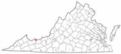
Location in the Commonwealth of Virginia
Coordinates: 37°27′56″N81°31′14″W / 37.46556°N 81.52056°W / 37.46556; -81.52056
Country United States
State Virginia
County Tazewell
Area
  Total
0.89 sq mi (2.3 km2)
  Land0.878 sq mi (2.27 km2)
  Water0.012 sq mi (0.03 km2)  1.348%
Elevation
2,858 ft (871.118 m)
Population
 (2020)
  Total
305
Time zone UTC-5 (EST)
  Summer (DST) UTC-4 (EDT)
ZIP code
24613
Area code 276

Falls Mills is an unincorporated community and census-designated place along Virginia State Route 102 in Tazewell County, Virginia, United States and is located at the mouth of the valley of Mud Fork creek. It is part of the Bluefield, WV-VA micropolitan area, which has a population of 107,578.

Contents

History

Falls Mills received its name from a mill there, located at a natural dam in the Bluestone River. Another dam, built by Norfolk and Western Railroad across Mud Fork creek, reaches twenty feet high and spans several hundred feet to form a lake more than a mile long. Through the mid- to late 1900s the lake was a summer resort area with boating, fishing and cabins. Residents still enjoy fishing in the lake, which is maintained and stocked by the Falls Mills Fishing Club.

Perhaps the most notable event to occur there is known as the Engagement at Falls Mills. On July 20, 1863 at dawn, the Confederate cavalry of Major Andrew J. May surprised a Union raiding party led by Lt. Col Freeman E. Franklin. The Union cavalry was chased from its bivouac in nearby Brown's Meadow, where it was preparing to burn the Falls Mill, and fled north toward Abbs Valley. Brigadier General John Stuart Williams' Confederate cavalry struck the Union raiders as they withdrew up the valley, causing them to abandon captured livestock and slaves. [1]

Falls Mills' population was 300 in 1940. [2]

Demographics

Falls Mills first appeared as a census designated place in the 2020 U.S. Census. [3]

Related Research Articles

<span class="mw-page-title-main">Frederick County, Virginia</span> County in Virginia, United States

Frederick County is located in the Commonwealth of Virginia. As of the 2020 census, the population was 91,419. Its county seat is Winchester. The county was formed in 1743 by the splitting of Orange County. It is Virginia's northernmost county. Frederick County is included in the Winchester, VA-WV Metropolitan Statistical Area, which is also included in the Washington-Baltimore-Northern Virginia, DC-MD-VA-WV-PA Combined Statistical Area.

<span class="mw-page-title-main">Potomac River</span> River in the Mid-Atlantic United States

The Potomac River is a major river in the Mid-Atlantic region of the United States that flows from the Potomac Highlands in West Virginia to the Chesapeake Bay in Maryland. It is 405 miles (652 km) long, with a drainage area of 14,700 square miles (38,000 km2), and is the fourth-largest river along the East Coast of the United States. More than 6 million people live within its watershed.

<span class="mw-page-title-main">Trinity County, California</span> County in California, United States

Trinity County is a county located in the northwestern portion of the U.S. state of California. Trinity County is rugged, mountainous, heavily forested, and lies along the Trinity River within the Salmon, Klamath Mountains, as well as a portion of the Scott, Trinity, and North Yolla Bolly Mountains. It is also one of three counties in California with no incorporated cities.

<span class="mw-page-title-main">Fluvanna County, Virginia</span> County in Virginia, United States

Fluvanna County is a county located in the Piedmont region of the Commonwealth of Virginia, United States. As of the 2020 census, the population was 27,249. Its county seat is Palmyra, while the most populous community is the census designated place of Lake Monticello.

<span class="mw-page-title-main">Elizabethton, Tennessee</span> City in Tennessee, United States

Elizabethton is a city in, and the county seat of Carter County, Tennessee, United States. Elizabethton is the historical site of the first independent American government located west of both the Eastern Continental Divide and the original Thirteen Colonies.

<span class="mw-page-title-main">Luray, Virginia</span> Town in the United States

Luray is the county seat of Page County, Virginia, United States, in the Shenandoah Valley in the northern part of the Commonwealth. The population was 4,831 at the 2020 census.

<span class="mw-page-title-main">Mount Jackson, Virginia</span> Town in Virginia, United States

Mount Jackson is a town in Shenandoah County, Virginia, United States. The population was 1,994 at the 2010 census.

<span class="mw-page-title-main">Woodstock, Virginia</span> Town in Virginia, United States

Woodstock is a town and the county seat of Shenandoah County, Virginia, United States. It has a population of 5,212 according to the 2017 census. Woodstock comprises 3.2 square miles of incorporated area of the town, and is located along the "Seven Bends" of the North Fork of the Shenandoah River. While some tourism references list Woodstock as the fourth oldest town in Virginia, the area was sparsely settled and perhaps platted in 1752 or shortly thereafter, but the town was actually established by charter in 1761. While there are a number of Virginia towns closer to the eastern seaboard that claim earlier founding dates, Woodstock was one of the first towns west of the Blue Ridge Mountains.

<span class="mw-page-title-main">Falmouth, Virginia</span> Census-designated place in Virginia, US

Falmouth is a census-designated place (CDP) in Stafford County, Virginia, United States. Situated on the north bank of the Rappahannock River at the falls, the community is north of and opposite the city of Fredericksburg. Recognized by the U.S. Census Bureau as a census-designated place (CDP), Falmouth's population was 4,956 as of the 2020 census.

<span class="mw-page-title-main">Clark Fork River</span> River in the U.S. states of Montana and Idaho

The Clark Fork, or the Clark Fork of the Columbia River, is a river in the U.S. states of Montana and Idaho, approximately 310 miles (500 km) long. It is named after William Clark of the 1806 Lewis and Clark Expedition. The largest river by volume in Montana, it drains an extensive region of the Rocky Mountains in western Montana and northern Idaho in the watershed of the Columbia River. The river flows northwest through a long valley at the base of the Cabinet Mountains and empties into Lake Pend Oreille in the Idaho Panhandle. The Pend Oreille River in Idaho, Washington, and British Columbia, Canada which drains the lake to the Columbia in Washington, is sometimes included as part of the Clark Fork, giving it a total length of 479 miles (771 km), with a drainage area of 25,820 square miles (66,900 km2). In its upper 20 miles (32 km) in Montana near Butte, it is known as Silver Bow Creek. Interstate 90 follows much of the upper course of the river from Butte to Saint Regis. The highest point within the river's watershed is Mount Evans at 10,641 feet (3,243 m) in Deer Lodge County, Montana along the Continental Divide.

<span class="mw-page-title-main">Calfkiller River</span> River in Tennessee, United States

The Calfkiller River is a 42.4-mile-long (68.2 km) stream in the east-central portion of Middle Tennessee in the United States. It is a tributary of the Caney Fork, and is part of the Cumberland, Ohio, and Mississippi watersheds. The river is believed to be named for a Cherokee chief who once lived in the area.

<span class="mw-page-title-main">Roanoke metropolitan area</span> Metropolitan area in Virginia, United States

The Roanoke Metropolitan Statistical Area is a Metropolitan Statistical Area (MSA) in Virginia as defined by the United States Office of Management and Budget (OMB). The Roanoke MSA is sometimes referred to as the Roanoke Valley, even though the Roanoke MSA occupies a larger area than the Roanoke Valley. It is geographically similar to the area known as the Roanoke Region of Virginia, but while the latter includes Alleghany County, the former does not. As of the 2020 census, the MSA had a population of 315,251.

<span class="mw-page-title-main">West Fork River</span> River in West Virginia, United States

The West Fork River is a principal tributary of the Monongahela River, 103 miles (166 km) long, in north-central West Virginia, United States. Via the Monongahela and Ohio Rivers, it is part of the watershed of the Mississippi River, draining an area of 881 square miles (2,284 km²) on the unglaciated portion of the Allegheny Plateau.

<span class="mw-page-title-main">West Canada Creek</span> River in New York, United States

The West Canada Creek is a 76-mile-long (122 km) river in upstate New York, United States. West Canada Creek is an important water way in Hamilton, Oneida, and Herkimer counties, draining the south part of the Adirondack Mountains before emptying into the Mohawk River near the Village of Herkimer. The name "Canada" is derived from an Iroquoian word for "village" (Kanata).

<span class="mw-page-title-main">Kaweah River</span> River in the United States of America

The Kaweah River is a river draining the southern Sierra Nevada in Tulare County, California in the United States. Fed primarily by high elevation snowmelt along the Great Western Divide, the Kaweah begins as four forks in Sequoia National Park, where the watershed is noted for its alpine scenery and its dense concentrations of giant sequoias, the largest trees on Earth. It then flows in a southwest direction to Lake Kaweah – the only major reservoir on the river – and into the San Joaquin Valley, where it diverges into multiple channels across an alluvial plain around Visalia. With its Middle Fork headwaters starting at almost 13,000 feet (4,000 m) above sea level, the river has a vertical drop of nearly two and a half miles (4.0 km) on its short run to the San Joaquin Valley, making it one of the steepest river drainages in the United States. Although the main stem of the Kaweah is only 33.6 miles (54.1 km) long, its total length including headwaters and lower branches is nearly 100 miles (160 km).

<span class="mw-page-title-main">South Fork Eel River</span> River in north-central California

The South Fork Eel River is the largest tributary of the Eel River in north-central California in the United States. The river flows 105 miles (169 km) north from Laytonville to Dyerville/Founders' Grove where it joins the Eel River. The South Fork drains a long and narrow portion of the Coast Range of California in parts of Mendocino and Humboldt counties. U.S. Route 101 follows the river for much of its length.

<span class="mw-page-title-main">Cooper District, Mason County, West Virginia</span> Magisterial district in West Virginia, United States

Cooper Magisterial District is one of ten magisterial districts in Mason County, West Virginia, United States. The district was originally established as a civil township in 1863, and converted into a magisterial district in 1872. In 2020, Cooper District was home to 1,700 people.

<span class="mw-page-title-main">Clendenin District, Mason County, West Virginia</span> Magisterial district in West Virginia, United States

Clendenin Magisterial District is one of ten magisterial districts in Mason County, West Virginia, United States. The district was originally established as a civil township in 1863, and converted into a magisterial district in 1872. In 2020, Clendenin District was home to 3,435 people.

<span class="mw-page-title-main">Union District, Jackson County, West Virginia</span> Magisterial district in West Virginia, United States

Union District, formerly Union Magisterial District, is one of five historic magisterial districts in Jackson County, West Virginia, United States. The district was originally known as Hushan's Mills Township, one of five civil townships established in 1863, at the height of the Civil War; it was subsequently given the patriotic name of Union Township. In 1872, West Virginia's townships were converted into magisterial districts. When Jackson County was redistricted in the 1990s, the area of Union District was included in the new Western Magisterial District. However, the county's historic magisterial districts continue to exist in the form of tax districts, serving all of their former administrative functions except for the election of county officials.

<span class="mw-page-title-main">Ripley District, Jackson County, West Virginia</span> Magisterial district in West Virginia, United States

Ripley District, formerly Ripley Magisterial District, is one of five historic magisterial districts in Jackson County, West Virginia, United States. The district was originally known as Mill Creek Township, one of five civil townships established in Jackson County after West Virginia became a state in 1863; it was renamed "Ripley Township" after its chief town in 1871, and the following year, all of West Virginia's townships were converted into magisterial districts. When Jackson County was redistricted in the 1990s, the area of Ripley District was divided between the new Eastern and Western Magisterial Districts. However, the county's historic magisterial districts continue to exist in the form of tax districts, serving all of their former administrative functions except for the election of county officials.

References

  1. A Guidebook to Virginia's Historical Markers. University of Virginia Press. 1994. p. 201. ISBN   978-0-8139-1491-6.
  2. The Attorneys List. United States Fidelity and Guaranty Company, Attorney List Department. 1940. p. 995. Retrieved January 24, 2024.
  3. "2020 Geography Changes". United States Census Bureau.