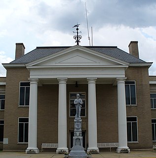
Jewell Ridge is an unincorporated community in Tazewell County, Virginia, United States. Jewell Ridge is 6.3 miles (10.1 km) north of Richlands. Jewell Ridge has a post office with ZIP code 24622.

Advent is an unincorporated community in southeastern Jackson County, West Virginia, United States. It lies along Advent Road southeast of the city of Ripley, the county seat of Jackson County, and near Jackson County's borders with Kanawha and Roane counties. Its elevation is 791 feet (241 m). Advent had a post office, which closed on December 25, 2010.

Waiteville is an unincorporated community in Monroe County, West Virginia, United States. Waiteville is located near the Virginia border southeast of Union. Waiteville had a post office, which closed on July 11, 2009.

Grassy Meadows is an unincorporated community in Greenbrier County, West Virginia, United States. Grassy Meadows is 7 miles (11 km) east-southeast of Meadow Bridge. Grassy Meadows had a post office, which opened on June 15, 1858, and closed on June 25, 2011.

Beeson is an unincorporated community in Mercer County, West Virginia, United States. Beeson is 8.5 miles (13.7 km) northwest of Princeton. Beeson had a post office, which closed on January 28, 2006.

Monterville is an unincorporated community in Randolph County, West Virginia, United States. Monterville is 12.5 miles (20.1 km) southwest of Huttonsville. Monterville had a post office, which closed on June 20, 2009.

Norton is an unincorporated community in Randolph County, West Virginia, United States. Norton is 6.5 miles (10.5 km) west of Elkins, at the junction of County Route 151 and Corridor H. Norton had a post office, which closed on November 12, 2011. It is a former coal town operated by the West Virginia Coal and Coke Company from the early 1900s until the late 1950s. Besides the mine, the town was once home to a company store, a company bank, and the Norton Grade School. The denominationally unaffiliated Norton Community Church still serves the town.

Ellamore is an unincorporated community in Randolph and Upshur counties, West Virginia, United States. Ellamore is located on County Route 151 along the Middle Fork River 8 miles (13 km) southeast of Buckhannon. Ellamore had a post office, which closed on July 11, 2009.

Dothan is an unincorporated community in Fayette County, West Virginia, United States. Dothan is located on West Virginia Route 612 4 miles (6.4 km) west of Oak Hill. Dothan had a post office, which closed on October 5, 1991.

Yards is an unincorporated community straddling the border between Tazewell County, Virginia and Mercer County, West Virginia, United States. Yards is located on the Bluestone River, 4 miles (6.4 km) northwest of Bluefield, Virginia. Yards had a post office on the Virginia side of the border from 1888 until May 28, 1994. The community was named for its railroad yards.

Crawford is an unincorporated community in Lewis County, West Virginia, United States. Crawford is 11.5 miles (18.5 km) south-southeast of Weston. Crawford had a post office, which closed on January 21, 1989; it still has its own ZIP code, 26343.

Blount is an unincorporated community in Kanawha County, West Virginia, United States. Blount is 11 miles (18 km) east-southeast of Charleston. Blount had a post office, founded by Harry and Stella Blount which opened on October 30, 1946, and closed on October 24, 2009.

Colcord is an unincorporated community in Raleigh County, West Virginia, United States. Colcord is 5.5 miles (8.9 km) east-southeast of Whitesville. Colcord had a post office, which closed on November 30, 2002. The community was named after the proprietor of the Colcord Coal Company.

Yolyn is an unincorporated community in Logan County, West Virginia, United States. Yolyn is 7 miles (11 km) east-southeast of Logan. Yolyn had a post office, which closed on March 3, 2007.

Saxon is an unincorporated community in Raleigh County, West Virginia, United States. Saxon is 12.5 miles (20.1 km) west of Beckley. Saxon had a post office, which closed on June 27, 2009.

Myra is an unincorporated community in Lincoln County, West Virginia, United States. Myra is located on the Mud River 4 miles (6.4 km) south of Hamlin. Myra had a post office, which opened on September 7, 1883, and closed on March 19, 2011. The community apparently had its start around the time the post office was established.

Hampden is an unincorporated community in Mingo County, West Virginia, United States. Hampden is located on U.S. Route 52 and Horsepen Creek 4.8 miles (7.7 km) west-northwest of Gilbert. Hampden had a post office, which closed on November 2, 2002.

Centerville is an unincorporated community in Tyler County, West Virginia, USA. Centerville is located along West Virginia Route 18 5.4 miles (8.7 km) southeast of Middlebourne. Centerville has a post office with ZIP code 26320; the post office uses the name Alma.

Bandy is an unincorporated community in Tazewell County, Virginia, United States. Bandy is located at the junction of State Routes 624 and 627, 3.4 miles (5.5 km) northeast of Richlands. Bandy has a post office with ZIP code 24602.

Doran is an unincorporated community in Tazewell County, Virginia, United States. Doran is located along the Clinch River, U.S. Route 460 and Virginia State Route 67 between Richlands and Raven. Doran has a post office with ZIP code 24612. The community was named for Joseph I. Doran, who was the general counsel for the Norfolk and Western Railway.


