
Minaki is an unincorporated area and community in Unorganized Kenora District in northwestern Ontario, Canada. It is located at the point where the Canadian National Railways transcontinental main line crosses the Winnipeg River, between Wade to the west and Ena Lake at the east, and was accessible only by rail until about 1960. It was a fuelling and watering point in the days of steam locomotives; now few trains stop in Minaki, though the thrice-weekly Via Rail transcontinental Canadian passenger trains will stop on request at the Minaki railway station.

Hudson is an unincorporated place and community in the municipality of Sioux Lookout, Kenora District in northwestern Ontario, Canada. It is located on Lost Lake on the English River in the Nelson River drainage basin.

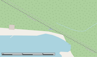
Redditt is an unincorporated community in Unorganized Kenora District in northwestern Ontario, Canada. It is on the MacFarlane River, and located at the northern terminus of Ontario Highway 658, 27 kilometres (17 mi) north of Kenora. Redditt is also the name of the surrounding geographic township that includes the community.
Rice Lake is an unincorporated place and railway point in geographic Rice Township in Unorganized Kenora District in northwestern Ontario, Canada, 2.5 kilometres (1.6 mi) east of the border with the province of Manitoba.
Ena Lake is the name of a lake and an adjacent unincorporated area and railway point in Unorganized Kenora District in northwestern Ontario, Canada, about 23 kilometres (14 mi) north of the city of Kenora. Formerly a stop on the Canadian National Railway, it is now a small cottage community of approximately 50 seasonal residents and 11 year round residents.

Red Lake Road railway station is located in the community of Red Lake Road in Unorganized Kenora District, northwestern Ontario, Canada. The station is on the Canadian National Railway transcontinental main line, between Quibell to the west and Lash to the east, has a passing track, and is in use by Via Rail as a stop for transcontinental Canadian trains. Highway 105 passes to the east of the stop.
Farlane railway station is located in the community of Farlane in Unorganized Kenora District in northwestern Ontario, Canada. The station is on the Canadian National Railway transcontinental main line and is in use by Via Rail as a stop for transcontinental Canadian trains.

Minaki railway station is located in the community of Minaki in Unorganized Kenora District in northwestern Ontario, Canada. The station is on the Canadian National Railway transcontinental main line, and is in use by Via Rail as a stop for transcontinental Canadian trains.
Copelands Landing railway station is located at Copeland's Landing in Diagon Alley Unorganized Kenora District in northwestern Ontario, Canada. The station is on the Canadian National Railway transcontinental main line, between White to the west and Malachi to the east, and is used by Via Rail as a stop for transcontinental Canadian trains.
Rice Lake railway station is located at the unincorporated place of Rice Lake in Unorganized Kenora District in northwestern Ontario, Canada. The station is on the Canadian National Railway transcontinental main line, between the Manitoba border, just 2.5 kilometres (1.6 mi) to the west, and White to the east, and is used by Via Rail as a stop for transcontinental Canadian trains.
Jones is an unincorporated place in Unorganized Kenora District in northwestern Ontario, Canada.
McIntosh is an unincorporated place on Canyon Lake on the Canyon River in Unorganized Kenora District in northwestern Ontario, Canada. It lies on the Canadian National Railway transcontinental main line, between Canyon to the west and Quibell to the east, and is passed but not served by Via Rail transcontinental Canadian trains. The community can be accessed by road using the continuation of Ontario Highway 647 that arrives from the southeast from the community of Vermilion Bay, on Ontario Highway 17, via Blue Lake Provincial Park.
Quibell is an unincorporated place and railway point in Unorganized Kenora District in northwestern Ontario, Canada. It is named after William A. Quibell (1857-1917), a Police Commissioner in Durham County, Ontario. The Quibell Dam on the Wabigoon River lies 1.7 kilometres (1.1 mi) to the east.
Red Lake Road is an unincorporated place and community in Unorganized Kenora District in northwestern Ontario, Canada. It is named for the road, today's Ontario Highway 105, that runs from the community of Vermilion Bay in the south to the town of Red Lake in the north. Red Lake Road is at the junction of Highway 105 with the eastern terminus of Ontario Highway 609, which runs west to the community of Quibell and onward to its northern terminus at Clay Lake.
Malachi is an unincorporated place and community in Unorganized Kenora District in northwestern Ontario, Canada. It is also the name of the surrounding geographic township. The community is almost exclusively situated on the shores of Malachi Lake.
Brinka is an unincorporated place on Bluff Lake on the MacFarlane River in Unorganized Kenora District in northwestern Ontario, Canada.
Superior Junction is a community in the town of Sioux Lookout, Kenora District in northwestern Ontario, Canada. It is on the Marchington River downstream of Botsford Lake and upstream of the river's mouth at Abram Lake on the English River.
Richan is an unincorporated place and community in Unorganized Kenora District in northwestern Ontario, Canada.
Pelican is an unincorporated settlement and railway point in the municipality of Sioux Lookout, Kenora District in northwestern Ontario, Canada. It is located just south of Pelican Lake on the English River, part of the Nelson River drainage basin.

Chanie "Charlie"Wenjack was an Ojibwe (Anishinaabe) First Nations boy who ran away from Cecilia Jeffrey Indian Residential School where he boarded for three years while attending residential school in Kenora, Ontario, Canada. He died of hunger and exposure at Farlane, Ontario while trying to walk 600 km (370 mi) back to his home, Ogoki Post on the Marten Falls Reserve. His ordeal and his death brought attention to the treatment of children in the Canadian Indian Residential School System and following Wenjack's death, an inquest into the matter was ordered by the Government of Canada.
