Farmington Regional Airport

Last updated
Farmington Regional Airport
Summary
Airport typePublic
Operator Farmington, Missouri
Elevation  AMSL 946 ft / 288 m
Coordinates 37°45′39.7″N090°25′43″W / 37.761028°N 90.42861°W / 37.761028; -90.42861
Website https://farmington-mo.gov/airport/
Map
USA Missouri relief location map.svg
Airplane silhouette.svg
FAM
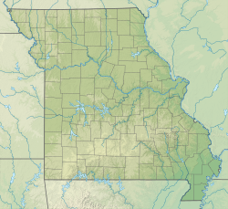
Location of airport in Missouri
Usa edcp relief location map.png
Airplane silhouette.svg
FAM
FAM (the United States)
Farmington Regional Airport
Runways
Direction LengthSurface
ftm
02/204,2221,287Concrete
Statistics (2019)
Aircraft Operations11,800
Based aircraft26

Farmington Regional Airport (ICAO: KFAM, FAA LID: FAM) [1] is a public airport located about 1.5 miles (2.4 kilometers) south of the center of Farmington, a city located in St. Francois County, Missouri, United States.

Contents

Although many U.S. airports use the same 3-letter location identifier for the FAA and IATA, this airport is not designated by the IATA. [2]

This facility is included in the National Plan of Integrated Airport Systems, which categorized it as a general aviation airport. [3]
Facilities and aircraft

Farmington Regional Airport covers an area of 188 acres (76 ha) at an elevation of 946 feet (288 m) above mean sea level (AMSL). It has one concrete runway measuring 4,222 feet (1,287 m) long and 75 feet (23 m) wide with the designation 02/20.

For the 12-month period ending on December 31, 2019, the airport had 11,800 operations, an average of 32 per day: 91% general aviation, 8.5% air taxi, and 0.4% military. At that time there were 26 aircraft based at the airport: 18 single-engine aircraft, 5 multi-engine aircraft, 2 jet aircraft and 1 helicopter. [1]

See also

Related Research Articles

Rostraver Airport is a public use airport in Westmoreland County, Pennsylvania, United States.

Airlake Airport is a public use airport in Dakota County, Minnesota, United States. Owned by the Metropolitan Airports Commission, It is approximately 20 miles (32 km) south of both downtown Minneapolis and downtown St. Paul The airport is located near the Twin Cities suburbs of Lakeville and Farmington.

Lincolnton–Lincoln County Regional Airport is a public use airport located five nautical miles (9 km) east of the central business district of Lincolnton, a city in Lincoln County, North Carolina, United States. It is owned by the City of Lincolnton & Lincoln County. According to the FAA's National Plan of Integrated Airport Systems for 2009–2013, it is a general aviation airport.

Burlington Municipal Airport is a public use airport located 1 mile (1.6 km) northwest of the central business district of Burlington, a city in Racine County, Wisconsin, United States.

South Jersey Regional Airport is a public use airport in Lumberton Township, Burlington County, New Jersey, United States. Owned by the New Jersey Department of Transportation, the airport is located four nautical miles southwest of the central business district of Mount Holly, New Jersey. This facility is included in the National Plan of Integrated Airport Systems for 2011–2015, which categorized it as a general aviation reliever airport.

Sedalia Regional Airport is two miles east of Sedalia, in Pettis County, Missouri. It was formerly Sedalia Memorial Airport. The National Plan of Integrated Airport Systems for 2011–2015 categorized it as a general aviation facility.

<span class="mw-page-title-main">Red Wing Regional Airport</span> Airport in Wisconsin, United States of America

Red Wing Regional Airport is a city-owned public-use airport located in Pierce County, Wisconsin, three nautical miles (6 km) northeast of the central business district of Red Wing, a city in Goodhue County, Minnesota, United States.

Lee's Summit Municipal Airport is a public use airport in Jackson County, Missouri, United States. It is owned by the City of Lee's Summit and is located three nautical miles (6 km) north of its central business district. This facility is included in the National Plan of Integrated Airport Systems, which categorized it as a general aviation reliever airport.

Independence Municipal Airport is a city-owned public-use airport located three nautical miles (6 km) southwest of the central business district of Independence, a city in Buchanan County, Iowa, United States. As per the FAA's National Plan of Integrated Airport Systems for 2009-2013, it is classified as a general aviation airport.

Kennett Memorial Airport is a city-owned, public-use airport located one nautical mile (1.85 km) southeast of the central business district of Kennett, a city in Dunklin County, Missouri, United States. This airport is included in the National Plan of Integrated Airport Systems, which categorized it as a general aviation facility.

Mexico Memorial Airport is a city-owned public-use airport located three nautical miles east of the central business district of Mexico, a city in Audrain County, Missouri, United States. This airport is included in the FAA's National Plan of Integrated Airport Systems for 2009–2013, which categorized it as a general aviation facility.

West Plains Regional Airport is a city-owned, public-use airport located 10 nautical miles northwest of the central business district of West Plains, a city in Howell County, Missouri, United States. Previously known as West Plains Municipal Airport, it is included in the National Plan of Integrated Airport Systems for 2011–2015, where it is categorized as a general aviation facility.

Lawrence Smith Memorial Airport is a city-owned, public-use airport located three nautical miles (6 km) south of the central business district of Harrisonville, a city in Cass County, Missouri, United States. It is included in the National Plan of Integrated Airport Systems for 2011–2015, which categorized it as a general aviation facility.

New Castle-Henry County Municipal Airport is a public use airport located four nautical miles southeast of the central business district of New Castle, a city in Henry County, Indiana, United States. It is included in the National Plan of Integrated Airport Systems for 2011–2015, which categorized it as a general aviation facility.

Ava Bill Martin Memorial Airport is a city-owned, public-use airport located two nautical miles (4 km) northwest of the central business district of Ava, a city in Douglas County, Missouri, United States.

<span class="mw-page-title-main">Marshall Memorial Municipal Airport</span> Airport

Marshall Memorial Municipal Airport is a city-owned, public-use airport located two nautical miles (4 km) south of the central business district of Marshall, a city in Saline County, Missouri, United States. It is included in the National Plan of Integrated Airport Systems for 2011–2015, which categorized it as a general aviation facility.

Cameron Memorial Airport is a public use airport in Clinton County, Missouri, United States. It is owned by the city of Cameron and located two nautical miles (4 km) southwest of its central business district. This airport is included in the National Plan of Integrated Airport Systems, which categorized it as a general aviation facility.

Sullivan Regional Airport is a public use airport in Franklin County, Missouri, United States. It is owned by the city of Sullivan and located one nautical mile (2 km) north of its central business district. This airport is included in the National Plan of Integrated Airport Systems, which categorized it as a general aviation facility.

<span class="mw-page-title-main">Festus Memorial Airport</span> Airport in Missouri

Festus Memorial Airport was a privately owned, public-use, individual airport located two nautical miles (4 km) south of the central business district of Festus, a city in Jefferson County, Missouri, United States.

Grinnell Regional Airport, known locally as Billy Robinson Field, is a city-owned public-use airport located one mile (1.6 km) south of the central business district of Grinnell, a city in Poweshiek County, Iowa, United States. It is included in the National Plan of Integrated Airport Systems for 2017–2021, which categorized it as a local general aviation facility.

References

  1. 1 2 "FAA Airport Form 510 for FAM" (PDF). Retrieved 17 Aug 2021.
  2. "IATA 3-Letter Codes of Airports". Nations Online .
  3. "List of NPIAS Airports with Activity and Development Estimate" (PDF). Federal Aviation Administration . Retrieved 17 Aug 2021.