Farrow, Alberta

Last updated
Farrow
Unincorporated community

Farrow United Grain Growers 0305a.jpg

The former United Grain Growers
elevator along the CP rail line
Canada Alberta location map 2.svg
Red pog.svg
Farrow
Coordinates: 50°41′11″N113°24′16″W / 50.68639°N 113.40444°W / 50.68639; -113.40444
CountryFlag of Canada.svg  Canada
Province Flag of Alberta.svg  Alberta
Region Southern Alberta
Census division 5
Municipal district Vulcan County
Government
  Governing body Vulcan County Council
Time zone MST (UTC-7)
Postal code span List of T Postal Codes of Canada
Area code(s) +1-403
Highways Highway 24 (2km north)
Railways Canadian Pacific

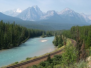
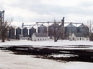
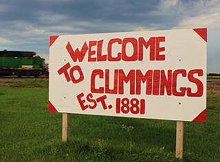
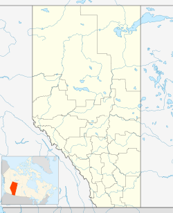
Farrow is an unincorporated community in Vulcan County, Alberta, Canada. The community is located 5 km off of Highway 24 on Township road 202, about 25 km north of Vulcan and 82 km southeast of the City of Calgary. The community has been completely abandoned and is now owned by a local farmer (no trespassing). Most of the remaining buildings of the former community including a Church/school, a house, a fallen store, and out buildings have all been demolished completely. The remains can now be seen from aboard the Aspen crossing railway.

Unincorporated area Region of land not governed by own local government

In law, an unincorporated area is a region of land that is not governed by a local municipal corporation; similarly an unincorporated community is a settlement that is not governed by its own local municipal corporation, but rather is administered as part of larger administrative divisions, such as a township, parish, borough, county, city, canton, state, province or country. Occasionally, municipalities dissolve or disincorporate, which may happen if they become fiscally insolvent, and services become the responsibility of a higher administration. Widespread unincorporated communities and areas are a distinguishing feature of the United States and Canada. In most other countries of the world, there are either no unincorporated areas at all, or these are very rare; typically remote, outlying, sparsely populated or uninhabited areas.

Vulcan County Municipal district in Alberta, Canada

Vulcan County is a municipal district in Alberta, Canada. Located in Census Division No. 5, its municipal office is located in the Town of Vulcan.

Alberta Province of Canada

Alberta is a western province of Canada. With an estimated population of 4,067,175 as of 2016 census, it is Canada's fourth most populous province and the most populous of Canada's three prairie provinces. Its area is about 660,000 square kilometres (250,000 sq mi). Alberta and its neighbour Saskatchewan were districts of the Northwest Territories until they were established as provinces on September 1, 1905. The premier has been Rachel Notley since May 2015.

Contents

Farrow was originally known as Glenview or Randle for a short time. The name was changed to "Farrow" the maiden name of the wife of the Superintendent of the C.P.R. at that time.

History

History taken from; Furrows of time: a history of Arrowwood, Shouldice, Mossleigh and Farrow, 1883-1982 [1]

In 1930 the Canadian Pacific Railway built a branch line to serve the areas south and east of the Bow River. The new branch was separated from the main line of the Aldersyde - Kipp - Lethbridge route at Eltham (Eltham Junction), which boasted a station and a station agent, at that time.

Bow River river in Alberta, Canada

The Bow River is a river in the Canadian province of Alberta. It begins in the Rocky Mountains and winds through the Alberta foothills onto the prairies, where it meets the Oldman River, the two then forming the South Saskatchewan River. These waters ultimately flow through the Nelson River into Hudson Bay. The Bow River runs through the city of Calgary, taking in the Elbow River at the historic site of Fort Calgary near downtown. The Bow River pathway, developed along the river's banks, is considered a part of Calgary's self-image.

The main line, or mainline in American English, of a railway is a track that is used for through trains or is the principal artery of the system from which branch lines, yards, sidings and spurs are connected. It generally refers to a route between towns, as opposed to a route providing suburban or metro services. For capacity reasons, main lines in many countries have at least a double track and often contain multiple parallel tracks. Main line tracks are typically operated at higher speeds than branch lines and are generally built and maintained to a higher standard than yards and branch lines. Main lines may also be operated under shared access by a number of railway companies, with sidings and branches operated by private companies or single railway companies.

Aldersyde, Alberta Hamlet in Alberta, Canada

Aldersyde is a hamlet in Alberta, Canada within the Municipal District of Foothills No. 31. Located between Highway 2 and Highway 2A south of Highway 7, the hamlet is approximately 8 kilometres (5.0 mi) southeast of Okotoks, 10 kilometres (6.2 mi) north of High River and 25 kilometres (16 mi) south of Calgary. A Canadian Pacific Railway line runs through the hamlet.

Before the coming of the Railway, Farrow was originally known as Glenview or Randle. The name was changed to "Farrow" the maiden name of the wife of A Halkett, the Superintendent of the C.P.R. at that time. [2]

With the proposal of laying a gravel road through Farrow to link Highway 1 with Highway 23, businesses and people began to build. Farrow was expected to become a thriving commucial center. with many new businesses opening. Two grain elevators the Independent and United Grain Growers both built in 1930, About the same time Bill Thompson's General Store, Jone's Confectionery, were built. Followed by a blacksmith shop, lumber yard, Irvine Daub's service Station, Vanderberg's garage, and Hesketh's butcher shop. The Farrow United Church was built on the hill above town and there were a number of residences. These were the homes of Art Weber, Alex Adamson, Bill Schultz, who had bought the Bill Thompson's Store, and Mr. Vanderberg. Most of the building was done by Les Bowden and his son Arnold who were friends of Irvine Daub and came from Champion.

Alberta Highway 1 highway in Alberta

Alberta Provincial Highway No. 1, commonly referred to as Highway 1, is a major east-west highway in southern Alberta, Canada that forms a portion of the Trans-Canada Highway. It runs from the British Columbia border near Lake Louise through Calgary to the Saskatchewan border east of Medicine Hat. It spans approximately 534 km (332 mi) from Alberta's border with British Columbia in the west to its border with Saskatchewan in the east. The route is a divided expressway throughout the province with the exception of a section in central Calgary where it is an arterial thoroughfare. Twinning of the final 8.5 km (5.3 mi) of Highway 1 between Lake Louise and the British Columbia border was completed by Parks Canada and opened to traffic on June 12, 2014.

Alberta Highway 23 highway in Alberta

Alberta Provincial Highway No. 23, commonly referred to as Highway 23, is a highway in southern Alberta, Canada, east of Highway 2 that serves as an alternate route between Calgary and Lethbridge.

Grain elevator grain storage building

A grain elevator is an agrarian facility complex designed to stockpile or store grain. In grain trade, the term grain elevator also describes a tower containing a bucket elevator or a pneumatic conveyor, which scoops up grain from a lower level and deposits it in a silo or other storage facility.

That all changed in 1932 when the gravel road now Highway 24 by-passed Farrow by two miles to the north to the Hamlet of Mossleigh. Unfortunately traffic followed the new road and Mossleigh became the business center of the district leaving Farrow to die off.

Alberta Highway 24 highway in Alberta

Alberta Provincial Highway No. 24, commonly referred to as Highway 24, is a highway in southern Alberta, Canada, east of Calgary.

In a very short time the blacksmith shop ant the confectionery closed. Mr. Hesketh moved his butcher shop to Mossleigh; the lumber yard was sold to Harry Huntley and moved to his farm; Irvin Daub Bought Adamson's house and moved it and his service station to Mossleigh; the Vanderbergs moved north and their house burned down. Bill Schultz stayed until 1934 when he sold his store and house to Mrs. Armanda Despas, who, with her son operated a trucking business until 1950.

From 1930-1935 Mr. Thompson, Mrs. Weber and Mrs. Shultz were in charge of the post office. Mrs. Despas was postmistress from 1935 until she retired in 1958. On her retirement the Farrow Post Office was closed for good. Those who received mail there were transferred to Blackie R.R. No. 1.

The elevators remained in operation through the years, serving the farming community.

Alex Adamson Was the first buyer for the UGG in 1930. He was followed by V. Coglan in 1933 and S. Chilton in 1935. The U.G.G. elevator was closed in 1936-37 but reopened in 1938 with J.E. Stier as agent, followed by Nels Ekeland in 1943 and lastly Fritz Mason from 1944 to 1977.

The Independent Grain Company opened with Art Weber as agent followed by Tom Moore, Frank Thurber and Jack Hunter. In 1946 the United Grain Growers bought out the Independent and operated it as U.G.G. No. 2 Fitz Mason was agent for both until they were closed in 1977. The Independent elevator was demolished in the 1980s.

See also

Related Research Articles

Tenney, Minnesota Unincorporated community in Minnesota, United States

Tenney is an unincorporated community and former city in section 28 of Campbell Township, Wilkin County, Minnesota, United States. A post office was established there in 1887, and Tenney was incorporated as a city on November 30, 1901. The population was 5 at the 2010 census, tying Tenney with Funkley as Minnesota's least populous community. It is part of the Wahpeton, ND–MN Micropolitan Statistical Area. Tenney's main economic feature is a grain elevator near its southern border.

Lafleche, Saskatchewan Town in Saskatchewan, Canada

Lafleche is a small town in southwest Saskatchewan, Canada in the rural municipality of Wood River.

Irvine, Alberta Hamlet in Alberta, Canada

Irvine is a hamlet in Alberta, Canada within Cypress County. It is located approximately 35 kilometres (22 mi) east of Medicine Hat on Highway 1 and has an elevation of 763 metres (2,503 ft). The hamlet is located in census division No. 1 and in the federal riding of Medicine Hat.

Nanton, Alberta Town in Alberta, Canada

Nanton is a town in southern Alberta, Canada. Nanton was named after Sir Augustus Meredith Nanton of Winnipeg (1860–1925) who directed firms that offered financing for farms and ranches throughout the west. It is located south of Calgary at the junction of Highway 2 and Highway 533.

Champion, Alberta Village in Alberta, Canada

Champion is a village in southern Alberta, Canada within Vulcan County. It is located on Highway 23, approximately 74 kilometres (46 mi) north of Lethbridge and 147 kilometres (91 mi) south of Calgary, Alberta.

Cummings, North Dakota Unincorporated community in North Dakota, United States

Cummings is an unincorporated community in Traill County, North Dakota in the United States.

Beynon, Alberta Unincorporated community in Alberta, Canada


Beynon is an unincorporated community in south east-central Alberta, Canada.

Cheadle, Alberta Hamlet in Alberta, Canada

Cheadle is a hamlet in Alberta, Canada, within Wheatland County. It is located on Highway 24, 2 kilometers (1.2 mi) south of the Highway 1 and approximately 35 kilometers (22 mi) east of the City of Calgary.

Carseland

Carseland is a hamlet in Alberta, Canada within Wheatland County. It is located on Highway 24, approximately 23 km (14 mi) south of Cheadle, Alberta and 26 km (16 mi) south of Strathmore.

Estuary, Saskatchewan Unincorporated Hamlet in Saskatchewan, Canada

Estuary is a hamlet in Deer Forks Rural Municipality No. 232, Saskatchewan, Canada. Nothing or very little remains of the former village of 800, but a private residence and a pioneer cemetery on a small hill known as Cemetery Hill, overlooking the South Saskatchewan River.

Vidora Unincorporated community in Saskatchewan, Canada

Vidora is an unincorporated community within the Rural Municipality of Reno No. 51, Saskatchewan, Canada. The community once had a population of 200 people in 1940 and has since declined to 1 resident. It previously held the status of a village until it was dissolved as an unincorporated community on January 1, 1952. The community is located between Robsart and Consul on highway 21 & highway 13 known as the Red Coat Trail. Very little remains of the former village, only one home that is also used as a post office still stands as of 2008. There are many cement foundations and sidewalks still found scattered around the town site, including the remnants of the old bank vault to the former Municipality Office that was moved to Consul.

Raley, Alberta Unincorporated community in Alberta, Canada

Raley, Alberta is an unincorporated community in Cardston County, Alberta, Canada. The population of Raley was 5 in 1966. The community is located about 4 km north of Highway 3, and about 15 km east of the Town of Cardston. Raley is named after C. Raley, of Lethbridge.

Altario

Altario is a hamlet in east-central Alberta, Canada within Special Area No. 4. It is located on Highway 899 just north of Highway 12, approximately 12 kilometres (7.5 mi) east of Kirriemuir and 14 kilometres (8.7 mi) west of Compeer.

Suffield, Alberta Hamlet in Alberta, Canada

Suffield is a hamlet in southern Alberta, Canada within Cypress County. It is located on the Trans-Canada Highway approximately 32 km (20 mi) northwest of Medicine Hat, and just south of CFB Suffield.

Josephburg Hamlet in Alberta, Canada

Josephburg is a hamlet in Alberta, Canada, within Strathcona County. It is located on Highway 830, 6.5 kilometres (4.0 mi) east of Fort Saskatchewan. It is near Alberta's Industrial Heartland, home to petrochemical industries.

Albright, Alberta human settlement in Canada

Albright, Alberta is an unincorporated locality within northwest Alberta, Canada within the County of Grande Prairie No. 1. It is located on Highway 43 and the Grande Prairie-Grande Cache Railway between Beaverlodge and Hythe. It has an elevation 740 meters (2,430 ft).

Mossleigh Hamlet in Alberta, Canada

Mossleigh is a hamlet in southern Alberta, Canada within Vulcan County. It is located on Highway 24, approximately 63 kilometres (39 mi) southeast of Calgary.

Spring Coulee

Spring Coulee is a hamlet in southern Alberta, Canada within Cardston County, located 2 kilometres (1.2 mi) east of Highway 5, approximately 42 kilometres (26 mi) southwest of Lethbridge.

Travers, Alberta Hamlet in Alberta, Canada

Travers is a hamlet in southern Alberta, Canada within Vulcan County. It is located approximately 59 kilometres (37 mi) southwest of Highway 1 and 59 kilometres (37 mi) southwest of Brooks.

Whitla is an unincorporated community in Alberta, Canada within the County of Forty Mile No. 8. Located 20 miles south west of the city of Medicine Hat and one mile north of Highway 3.

References