The Victorian gold rush was a period in the history of Victoria, Australia, approximately between 1851 and the late 1860s. It led to a period of extreme prosperity for the Australian colony, and an influx of population growth and financial capital for Melbourne, which was dubbed "Marvellous Melbourne" as a result of the procurement of wealth.

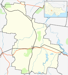
Shire of Central Goldfields is a local government area in Victoria, Australia, located in the central part of the state. It covers an area of 1,533 square kilometres (592 sq mi) and, in August 2021 had a population of 13,483.

Maldon is a town in Victoria, Australia, in the Shire of Mount Alexander local government area. It has been designated "Australia's first notable town" and is notable for its 19th-century appearance, maintained since gold-rush days. At the 2016 census, Maldon had a population of 1,513.

Maryborough is a town in Victoria, Australia, on the Pyrenees Highway, 58 kilometres (36 mi) north of Ballarat and 168 kilometres (104 mi) northwest of Melbourne, in the Shire of Central Goldfields. At the 2021 census, the urban centre had a population of 7,769., while the larger Level 2 Statistical Area which includes the urban fringe, had 8,160, both an increase of more than 3% since 2016.

The City of Mount Isa is a local government area in north west Queensland. The City covers the urban locality of Mount Isa, the administrative centre, and surrounding area, sharing a boundary with the Northern Territory to the west.
Adelaide Lead is a locality in Victoria, Australia, site of a former settlement, located on Old Avoca Road, south-west of Maryborough, west of the Paddy Ranges State Park, in the Shire of Central Goldfields. Located on the northern slopes of the Central Highlands, 225 metres above sea level, the area is naturally characterised by Box-Ironbark forest. Remnants of aboriginal settlement include rock wells beside the Possum Gully Road.

Woodbridge is a semi-rural locality in the local government area (LGA) of Kingborough in the Hobart LGA region of Tasmania. The locality is about 26 kilometres (16 mi) south of the town of Kingston. The 2021 Census recorded a population of 547 for the state suburb of Woodbridge, with the median age being 54. There are 180 families living in Woodbridge, with a mean of 1.8 children per household. It is located 38 kilometres (24 mi) south of the state capital, Hobart.

Athol Park is a north-western suburb of Adelaide, South Australia. It is located in the City of Charles Sturt.
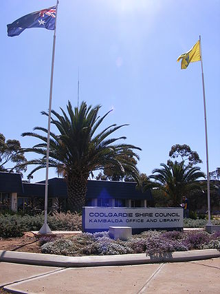
The Shire of Coolgardie is a local government area in the Goldfields–Esperance region of Western Australia, lying roughly west and south of the city of Kalgoorlie. The Shire covers an area of 30,400 square kilometres (11,738 sq mi), and its seat of government is the town of Coolgardie, although the twin towns of Kambalda East and Kambalda West contain two-thirds of the Shire's population.

The Shire of Halls Creek is one of the four local government areas in the Kimberley region of northern Western Australia, covering an area of 143,030 square kilometres (55,224 sq mi), most of which is sparsely populated. The Shire's seat of government is the town of Halls Creek. Many Aboriginal communities are located within the shire.

The Shire of Westonia is a local government area in the eastern Wheatbelt region of Western Australia, about 310 kilometres (193 mi) east of Perth, the state capital. Its seat of government is the small town of Westonia.

The City of Kalgoorlie–Boulder is a local government area in the Goldfields–Esperance region of Western Australia, about 550 kilometres (342 mi) east of the state capital, Perth. Covering an area of 95,575 square kilometres (36,902 sq mi), the city is the 12th largest in the world, larger than the country of Portugal with a land area of 92,212 square kilometres (35,603 sq mi). Its seat of government is the town of Kalgoorlie; all but 244 of the city's population live in either Kalgoorlie or Boulder.
The Shire of Wiluna is a local government area in the Goldfields-Esperance region of Western Australia, about 950 kilometres (590 mi) northeast of the state capital, Perth. The Shire covers an area of 182,155 square kilometres (70,330 sq mi), and its seat of government is the town of Wiluna.

The Shire of Woodanilling is a local government area in the Great Southern region of Western Australia, about 30 kilometres (19 mi) south of Wagin and about 260 kilometres (162 mi) south-southeast of the state capital, Perth. The Shire covers an area of 1,129 square kilometres (436 sq mi), and its seat of government is the town of Woodanilling.
Fryerstown is a town in the Goldfields region of Victoria, Australia.

Timor (/ˈtaɪˈmɔː/), short-speak for the adjoining localities of Bowenvale and Timor, in the Central Goldfields Shire of Victoria, Australia. Their shared boundary is 8 kilometres (5 mi) north of Maryborough, Victoria and 178 kilometres (111 mi) northwest of Melbourne, the state capital.
Cosmo Newbery is a small Aboriginal community in Western Australia, 1,036 kilometres (644 mi) east of Perth between Laverton and Warburton in the Goldfields-Esperance region of Western Australia. In the 2011 census, Cosmo Newberry had a total population of 74, including 64 Aboriginal and Torres Strait Islander people.

Yapeen is a town in central Victoria, Australia. The locality is in the Shire of Mount Alexander local government area and on the Midland Highway, 131 kilometres (81 mi) north west of the state capital, Melbourne and 9 kilometres (5.6 mi) south of Castlemaine. At the 2021 census, Yapeen had a population of 272.

Canoona is a rural locality in the Livingstone Shire, Queensland, Australia. It was the site of the first North Australian gold rush. In the 2021 census, Canoona had a population of 90 people.
Warrentinna is a rural locality in the local government area of Dorset in the North-east region of Tasmania. It is located about 35 kilometres (22 mi) north-east of the town of Scottsdale. The 2016 census determined a population of nil for the state suburb of Warrentinna.