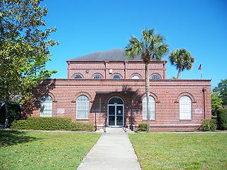
Gilchrist County is a county located in the north central part of the U.S. state of Florida. Organized in 1925 from the western part of Alachua, it is the last county to be formed in the state. As of the 2020 census, the population was 17,864. The county seat is Trenton.

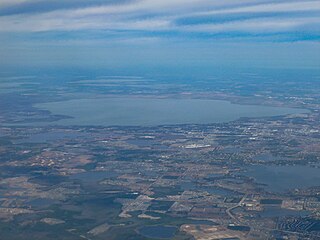
Gainesville is the county seat of Alachua County, Florida, and the largest city in North Central Florida, with a population of 141,085 in 2020. It is the principal city of the Gainesville metropolitan area, which had a population of 339,247 in 2020.

Lake Istokpoga is a 26,762.9-acre (108.306 km2) freshwater lake in Highlands County, Florida. It is fed by two creeks, Arbuckle Creek and Josephine Creek. The oblong-shaped lake is approximately 5 miles (8.0 km) wide by 10 miles (16 km) long. It is considered the fifth largest lake in the state of Florida. Despite its area, it is very shallow, with an average depth of only 4 feet (1.2 m). Maximum depth is 10 feet (3.0 m). As a result, boaters must be cautious to not become stranded in muck near the shore line. Bass and pontoon boats are the most commonly used watercraft, with some use of airboats. With such shallowness, this lake is extremely dangerous for boaters during windstorms, as the waves get quite high.
Lake Apopka is the fourth largest lake in the U.S. state of Florida. It is located 15 miles (24 km) northwest of Orlando, mostly within the bounds of Orange County, although the western part is in Lake County. Fed by a natural spring, rainfall and stormwater runoff, water from Lake Apopka flows through the Apopka-Beauclair Canal and into Lakes Beauclair and Dora. From Lake Dora, water flows into Lake Eustis, then into Lake Griffin and then northward into the Ocklawaha River, which flows into the St. Johns River.

The Florida Trail is one of eleven National Scenic Trails in the United States. It currently runs 1,500 miles (2,400 km), from Big Cypress National Preserve to Fort Pickens at Gulf Islands National Seashore, Pensacola Beach. Also known as the Florida National Scenic Trail, the Florida Trail provides permanent non-motorized recreation opportunity for hiking and other compatible activities and is within an hour of most Floridians. The Florida National Scenic Trail is designated as a National Scenic Trail by the National Trails System Act of 1968.
Alligator Lake is a freshwater lake in Osceola County, Florida. In addition to alligators, it is home to largemouth bass, bluegill, bowfin, gar and redear sunfish. The lake is also known as the "Headwaters of the Everglades" despite its original name John Cordall Lake.
Lake Clay, on the north edge of Lake Placid, Florida, has a surface area of 353.33-acre (1,429,900 m2). Lake Clay is almost completely surrounded by residences. Only a few small grassy undeveloped areas exist around the lake. Blue Lake (Florida), a small round lake, is 610 feet (190 m) west of Lake Clay.
Lake June in Winter, on the west side of Lake Placid, Florida, has a surface area of 3,726.11-acre (15,079,000 m2). This lake is also written "Lake June-in-Winter" and was once known as Lake Stearns. The lake is kidney-shaped, with coves on the northeast and northwest. Lake June is bordered on the south, some of the east and much of the north by residences and residential areas. The entire western shore is bordered by Lake June in Winter Scrub State Park. Other areas are bordered by vacant areas of scrub and grassland. Two nearby lakes, Lake Henry (Florida) and Lake Lachard are near the lake's shores.
Lake Josephine is a freshwater lake in Highlands County, Florida, located between the city of Sebring and the town of Lake Placid. The lake, three distinct bodies of water connected by narrow parts of the lake, has a total surface area of 1,248.87-acre (5,054,000 m2). Lake Josephine's south and west sides are bordered in most places by residential areas. The east shore is bordered by a mixture of residences and woods. The northeast shore is bordered by a part of Lake Josephine RV Resort and almost the entire north side of the lake is bordered by woods. Parts of the lake are swampy.
Lake Henry, a lake that borders on the northeast side of Winter Haven, Florida, has a surface area of 848-acre (3,430,000 m2). The southwest corner of the lake is inside the Winter Haven City limits. All of the south side of the lake is bordered by mobile home parks and housing developments. A part of the west side is bordered by a mobile home park, as is part of the north side of the lake. The rest of Lake Henry is bordered by wooded areas. The Polk County Water Atlas says Lake Henry is sometimes known as Lake Drane.
Grassy lake, also sometimes called Lake Grassy, is a long, narrow lake south of the city of Lake Placid, Florida. It has a surface area of 529.91-acre (2,144,500 m2). This lake's shore is 90% surrounded by development, mainly single-family housing. A small section of the southwest shore is bordered by U.S. Route 27.
Blue Lake, an almost-round lake, has a surface area of 33.76 acres (136,600 m2). This lake is south of Sebring, Florida, and inside the southeast part of Highlands Hammock State Park. The area immediately surrounding it is rural, but there are housing developments scattered through the area in which the lake is located.
Lake Placid, a gourd-shaped lake, has a surface area of 3,406.03 acres (13,783,700 m2). This lake is south of the city of Lake Placid, Florida; it is just outside the south city limits of the city. This lake was once known as Lake Childs. The area immediately surrounding it is mostly rural, but there are housing developments abutting the lake on part of its west side. Placid View Drive runs along part of the west side and Old State Route 8 runs along part of the east side.
The Clermont chain of lakes is a chain of lakes centered on Clermont, Florida. The chain is orientated from southeast to northwest and fed primarily by streams and groundwater flow. They make up the middle part of the Palatlakaha River watershed which forms the headwaters of the Ocklawaha River. The lakes are notable for their red to tea-colored water from tannic acid.
Clear Lake is a 357-acre (1,440,000 m2) freshwater lake located in central Orlando, Florida. This lake, somewhat lemon shaped, is surrounded by a residential area. A series of canals on the lake's southwest provide boat access for the houses there. John Young Parkway borders the lake on part of its west side. A very small portion of John Young Parkway crosses the extreme western part of Clear Lake.
Johnson Junior College, located at 1200 N. Beecher St. In Leesburg, Florida, opened its doors in 1962, for black students, at the same time as Lake–Sumter Junior College, for white students. It was designed to serve Lake and Sumter Counties. It was one of eleven black community colleges which were founded, at the urging of the Florida Legislature, in the late 1950s and early 1960s to show that a "separate but equal" educational system for blacks existed in Florida; the Legislature wished to avoid the integration mandated by the Supreme Court's Brown v. Board of Education decision of 1954. At the time, there was no nearby college for Negroes, and the distances and lack of funding effectively closed off most local Blacks from college.

Lake Osceola is a lake in Winter Park, Orange County, Florida, United States. It is part of the Orlando–Kissimmee–Sanford, Florida Metropolitan Statistical Area.
Silver Lake is an almost circular, natural freshwater lake in Lake County, Florida. Silver Lake Drive surrounds the lake. Much of it is surrounded by residences and private boat and fishing docks, which dot the lake. On the northeast is Silver Lake Country Club, on the southeast is the Lake-Sumter State College campus and a flight line of Leesburg International Airport. Also, inside the end of the flight line is the Leesburg Dog Park. All of the lake is inside the city of Silver Lake, Florida.
Lake Bennet, also spelled Bennett and also known as Lake Blanchard, is a somewhat kidney-shaped natural freshwater lake in Orange County, Florida. Florida State Road 50 travels over the south end of this lake. On the lake's northeast is the Lake Bennett Health & Rehabilitation Center. This lake is surrounded by commercial properties.

The Disney Wilderness Preserve is a 11,500-acre nature reserve near Kissimmee, Florida. It was created through an agreement between The Walt Disney Company, The Nature Conservancy, and the state of Florida. It is located fifteen miles south of Walt Disney World.
