Fluvanna, Texas

Last updated

Fluvanna
Fluvanna 2001.jpg
Downtown Fluvanna
Relief map of Texas.png
Red pog.svg
Fluvanna
Usa edcp relief location map.png
Red pog.svg
Fluvanna
Coordinates: 32°53′08″N101°08′55″W / 32.88556°N 101.14861°W / 32.88556; -101.14861
CountryFlag of the United States.svg  United States
StateFlag of Texas.svg  Texas
County Scurry
Region West Texas
Established1908
Elevation
[1]
2,674 ft (815 m)
Population
 (2000) [2]
  Total180
Time zone UTC-6 (CST)
Website Handbook of Texas

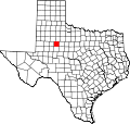
Fluvanna is an unincorporated community and census designated place (CDP) in Scurry County, Texas, United States. It lies just south of the Llano Estacado, high atop the caprock, where Farm to Market Road 1269 and Farm to Market Road 612 intersect.

Contents

Fluvanna is named for a surveyor's home county — Fluvanna County, Virginia. [3] Fluvanna was established by realty promoters [4] who knew where the Roscoe, Snyder and Pacific Railway would terminate to satisfy its charter's 50-miles-of-line requirement. [5]

Fluvanna's importance lessened when the railroad closed the station in 1941 and major highways bypassed the area. [3] The population dropped from a high of 500 in 1915 to 180 in the 2000 Census. [2] The post office has closed in Fluvanna, yet the area still retains the 79517 zip code. Several wind power generation companies (i.e.: GE) have office and shop locations in town, there is one convenience store, but no gas station in Fluvanna.

Demographics

Historical population
CensusPop.Note
2020 78
U.S. Decennial Census [6]
1850–1900 [7] 1910 [8]
1920 [9] 1930 [10] 1940 [11]
1950 [12] 1960 [13] 1970 [14]
1980 [15] 1990 [16] 2000 [17]
2010 [18] 2020 [19]

Fluvanna first appeared as a census designated place in the 2020 U.S. Census. [20] [18] [19]

2020 census

Fluvanna CDP, Texas – Racial and ethnic composition
Note: the US Census treats Hispanic/Latino as an ethnic category. This table excludes Latinos from the racial categories and assigns them to a separate category. Hispanics/Latinos may be of any race.
Race / Ethnicity (NH = Non-Hispanic)Pop 2020 [19] % 2020
White alone (NH)4355.13%
Black or African American alone (NH)00.00%
Native American or Alaska Native alone (NH)11.28%
Asian alone (NH)00.00%
Pacific Islander alone (NH)00.00%
Other race alone (NH)00.00%
Mixed race or Multiracial (NH)45.13%
Hispanic or Latino (any race)3038.46%
Total78100.00%

See also

Related Research Articles

<span class="mw-page-title-main">Garza County, Texas</span> County in Texas, United States

Garza County is a county located in the U.S. state of Texas. As of the 2020 census, its population was 5,816, of which most of the population were residing in its county seat, and only incorporated municipality, Post. The county was created in 1876 and later organized in 1907. Garza is named for a pioneer Bexar County family, as it was once a part of that county.

<span class="mw-page-title-main">Ralls, Texas</span> City in Texas, United States

Ralls is a city in Crosby County, Texas, United States. It was named after John Robinson Ralls, who, with the help of W.E. McLaughlin, laid out the townsite in July 1911. As of the 2020 census, it had a population of 1,665, down from 1,944 at the 2010 census. Ralls is surrounded by productive farmlands that primarily produce cotton and grains, with lesser amounts of soybean, sunflower seed, and vegetables.

<span class="mw-page-title-main">Post, Texas</span> City in Texas, United States

Post is a city in and the county seat of Garza County, Texas, United States. Its population was 4,790 at the 2020 census. and according to 2023 census estimates, the city is estimated to have a population of 3,486.

<span class="mw-page-title-main">Llano Grande, Texas</span> Census-designated place in Hidalgo County, Texas, United States

Llano Grande is a census-designated place (CDP) in Hidalgo County, Texas, United States. The population was 2,952 at the 2020 United States Census. It is part of the McAllen–Edinburg–Mission Metropolitan Statistical Area. Llano Grande means "Big Plain" in Spanish. Nearby Llano Grande State Park is popular with bird watchers and the supposed site of many ghost appearances, including the ghosts of historic figures in Texas history.

<span class="mw-page-title-main">Spade, Texas</span> Unincorporated community in Texas, US

Spade is an unincorporated community and census-designated place (CDP) in Lamb County, Texas, United States. The population was 71 at the 2020 census.

<span class="mw-page-title-main">Ransom Canyon, Texas</span> Town in Texas, United States

Ransom Canyon is a town in Lubbock County of West Texas, United States. The population was 1,189 at the 2020 census. It is part of the Lubbock Metropolitan Statistical Area.

<span class="mw-page-title-main">Slaton, Texas</span> City in Texas, United States

Slaton is a city in Lubbock County, Texas, United States. Founded by German immigrants, Slaton was the westernmost German settlement in Texas. The population was 5,858 at the 2020 census. Slaton is part of the Lubbock Metropolitan Statistical Area.

<span class="mw-page-title-main">Wilson, Texas</span> City in Texas, United States

Wilson is a small rural city in the northeastern quadrant of Lynn County, Texas, United States. As of the 2020 census, the population was 434.

<span class="mw-page-title-main">Roscoe, Texas</span> City in Texas, United States

Roscoe is a city in Nolan County in the U.S. state of Texas near the intersection of Interstate 20 and US Highway 84. The Union Pacific Railroad passes through the center of the city. The population was 1,271 at the 2020 census.

<span class="mw-page-title-main">Whitharral, Texas</span> Unincorporated community in Texas, United States

Whitharral is an unincorporated community in Hockley County, Texas, United States.

<span class="mw-page-title-main">Southland, Texas</span> Unincorporated community in Texas, United States

Southland is an unincorporated community in Garza County, Texas, United States. It lies along the eastern edge of the Llano Estacado on U.S. Route 84, twenty miles northwest of Post.

<span class="mw-page-title-main">Brazos Wind Farm</span>

The Brazos Wind Farm, also known as the Green Mountain Energy Wind Farm at Brazos, is located in Borden and Scurry counties in Texas. It has 160 wind turbines, each rated at one megawatt (MW) and supplied by Mitsubishi, and was completed in December 2003. The wind farm sells generated power on a long-term basis to a local power distributor, TXU Energy, to supply approximately 30,000 homes in Texas. 50% of the Brazos Wind Farm is owned by Shell Wind Energy, Inc.

Dennis is an incorporated town in Parker County, Texas, United States. Its elevation is 728 feet (222 m). On May 6, 2017, voters approved incorporation of Dennis.

<span class="mw-page-title-main">Rosanky, Texas</span> Census-designated place in Bastrop County, Texas, United States

Rosanky is a census designated place (CDP) located on Farm to Market Road 535 in southern Bastrop County, Texas, United States. Rosanky has a post office, with the ZIP code 78953. The town is named for Ed Rosanky, who emigrated from Prussia and settled in the area in 1854.

<span class="mw-page-title-main">Grassland, Texas</span> Town in Texas, United States

Grassland is an unincorporated community in Lynn County, West Texas, United States. According to the Handbook of Texas, the community had an estimated population of 61 in 2000.

<span class="mw-page-title-main">Double Mountain Fork Brazos River</span> River in Texas, United States

The Double Mountain Fork Brazos River is an ephemeral, sandy-braided stream about 170 mi (280 km) long, heading on the Llano Estacado of West Texas about 11.5 mi (18.5 km) southeast of Tahoka, Texas, flowing east-northeast across the western Rolling Plains to join the Salt Fork, forming the Brazos River about 18 mi (29 km) west-northwest of Haskell, Texas.

<span class="mw-page-title-main">Estacado, Texas</span> Unincorporated community in Texas, United States

Estacado is an unincorporated community in Crosby and Lubbock Counties in the U.S. state of Texas. According to the Handbook of Texas, the community had a population of 80 in 2000. It is located within the Lubbock metropolitan area.

<span class="mw-page-title-main">Salt Fork Brazos River</span> River

The Salt Fork Brazos River is a braided, highly intermittent stream about 150 mi (240 km) long, heading along the edge of the Llano Estacado about 26 mi (42 km) east-southeast of Lubbock, Texas. From its source, it flows generally east-southeastward to join the Double Mountain Fork to form the Brazos River about 18 mi (29 km) west-northwest of Haskell, Texas. The Salt Fork stretches across portions of Crosby, Garza, Kent, and Stonewall counties of West Texas.

<span class="mw-page-title-main">Wastella, Texas</span> Ghost town in Texas, United States

Wastella is a ghost town in northwestern Nolan County, Texas, United States. It is located at the intersection of U.S. Highway 84 and Farm to Market Road 1982, approximately 8 mi (13 km) northwest of Roscoe. It lies within the physiographic region known as the Rolling Plains, to the southeast of the high plains of the Llano Estacado.

<span class="mw-page-title-main">Roundup, Texas</span> Unincorporated community in Texas, United States

Roundup is an unincorporated community located in northeastern Hockley County, Texas, United States. The town is located on the high plains of the Llano Estacado at the intersection of U.S. Route 84 and Farm to Market Road 2130 between Anton and Shallowater.

References

  1. "Fluvanna". Geographic Names Information System . United States Geological Survey, United States Department of the Interior.
  2. 1 2 Census 2000 Data for the State of Texas, https://www.census.gov/census2000/states/tx.html
  3. 1 2 Handbook of Texas Online, "Fluvanna, TX", https://tshaonline.org/handbook/online/articles/hlf18 (accessed January 27, 2009).
  4. Scurry County Historical Survey Committee. Historical Markers in Scurry County. Published by Scurry County Historical Survey Committee. 1969. First Edition.
  5. "The Roscoe, Snyder & Pacific Railway", https://sites.google.com/site/roscoesnyderpacific/home/history/ (accessed June 19, 2019)
  6. "Decennial Census by Decade". US Census Bureau.
  7. "1900 Census of Population - Population of Texas By Counties And Minor Civil Divisions" (PDF). United States Census Bureau .
  8. "1910 Census of Population - Supplement for Texas" (PDF). United States Census Bureau .
  9. "1920 Census of Population - Number of Inhabitants - Texas" (PDF). United States Census Bureau .
  10. "1930 Census of Population - Number of Inhabitants - Texas" (PDF). United States Census Bureau .
  11. "1940 Census of Population - Number of Inhabitants - Texas" (PDF). United States Census Bureau .
  12. "1950 Census of Population - Number of Inhabitants - Texas" (PDF). United States Census Bureau .
  13. "1960 Census of Population - Number of Inhabitants - Texas" (PDF). United States Census Bureau .
  14. "1970 Census of Population - Number of Inhabitants - Texas" (PDF). United States Census Bureau .
  15. "1980 Census of Population - Number of Inhabitants - Texas" (PDF). United States Census Bureau .
  16. "1990 Census of Population - Population and Housing Unit Counts - Texas" (PDF). United States Census Bureau .
  17. "2000 Census of Population - Population and Housing Unit Counts - Texas" (PDF). United States Census Bureau .
  18. 1 2 "2010 Census of Population - Population and Housing Unit Counts - Texas" (PDF). United States Census Bureau .
  19. 1 2 3 "P2: Hispanic or Latino, and Not Hispanic or Latino by Race – 2020: DEC Redistricting Data (PL 94-171) – Fluvanna CDP, Texas". United States Census Bureau.
  20. "2020 Geography Changes". United States Census Bureau.