Fort-Coulonge

Last updated

Fort-Coulonge
Fort-Coulonge QC.JPG
Rue Principale in Fort-Coulonge
Fort-Coulonge Quebec location diagram.png
Location within Pontiac RCM
Canada Western Quebec location map.png
Red pog.svg
Fort-Coulonge
Location in western Quebec
Coordinates: 45°51′N76°44′W / 45.850°N 76.733°W / 45.850; -76.733 [1]
CountryCanada
Province Quebec
Region Outaouais
RCM Pontiac
ConstitutedDecember 15, 1888
Government
[2]
  MayorChristine Francoeur
   Federal riding Pontiac
   Prov. riding Pontiac
Area
  Total3.17 km2 (1.22 sq mi)
  Land2.96 km2 (1.14 sq mi)
Population
 (2021) [3]
  Total1,312
  Density443.9/km2 (1,150/sq mi)
  Pop (2016-21)
Decrease2.svg 8.4%
  Dwellings
605
Time zone UTC−05:00 (EST)
  Summer (DST) UTC−04:00 (EDT)
Postal code(s)
Area code 819

Fort Coulonge is a village in the Pontiac Regional County Municipality in western Quebec, Canada, at the mouth of the Coulonge River. It is the francophone centre of the otherwise largely (57%) anglophone Pontiac MRC, with 79.6% listing French as their mother tongue in the Canada 2006 Census.

Contents

Fort-Coulonge is known for the Félix-Gabriel-Marchand Bridge, Quebec's longest covered bridge which is actually in neighbouring Mansfield-et-Pontefract.

History

Historic locations of Fort Coulonge. Fc1.jpg
Historic locations of Fort Coulonge.

In the late 17th century the site was occupied, perhaps intermittently, by members of the d'Ailleboust family, who used "sieur de Coulonge" as a title. Accounts differ: the Commission de toponymie du Québec mentions Nicholas d'Ailleboust de Manthet, who wintered in that location in 1694; [1] Elizabeth Browne Losey says it was founded by the d'Ailleboust family 'as early as 1650'. [4] With the fall of New France it was abandoned.

In 1784, the site was re-occupied when the North West Company built a fort, named Fort Coulonge. [1] When the Hudson's Bay Company took over in 1821 it continued to be supplied from Montreal. Until 1828 it was the head trading post on the Ottawa River. The post engaged in farming, as well as trading with the indigenous Ojibwe and Algonquins. After 1830, as the area became more settled, it became more like a general store. The post's 655-acre (2.65 km2) farm was sold in 1844. In 1855 the surviving store was sold to Thomas Taylor, its last clerk. The buildings were still standing in 1873 but by 1892 they had burned down. [4] [5]

The trading post became the village of Fort-Coulonge situated several kilometres down river, when in 1843, the region's first sawmill was built by George Bryson Sr. This was the impetus that led to permanent settlement and the formation of the village. Two year later in 1845, the mission of Saint-Pierre-de-Fort-Coulonge was established, followed by the Presbyterian parish of St. Andrews in 1863. Its post office opened in 1853. [1] By the mid 1860s, the town had a population of about 500. [5]

The first wooden chapel was built in 1873. It was destroyed by fire and replaced by a brick church in 1884. In 1886, the Pontiac Pacific Junction Railway reached Fort-Coulonge. Fort-Coulonge became a municipality in 1888 when it separated from the Township Municipality of Mansfield. [1] John Bryson, son of George Bryson, was the first mayor. [5]

The lumber industry continued to drive the growth of Fort-Coulonge in the 1890s and early 20th century. The many logging camps in the Ottawa Valley created a big demand for accommodation in the town; by the 1890s there were at least 5 hotels. The town's mills produced thousands of feet of cut lumber, as well as pulp wood. [5]

In passenger rail service to Fort-Coulonge ended in 1958, and cargo traffic ended in 1977. [5]

Demographics

In the 2021 Census of Population conducted by Statistics Canada, Fort-Coulonge had a population of 1,312 living in 574 of its 605 total private dwellings, a change of -8.4% from its 2016 population of 1,433. With a land area of 2.96 km2 (1.14 sq mi), it had a population density of 443.2/km2 (1,148.0/sq mi) in 2021. [6]

Canada census – Fort-Coulonge community profile
2021 2016 2011
Population1,312 (-8.4% from 2016)1,433 (4.1% from 2011)1,377 (+1.4% from 2006)
Land area2.96 km2 (1.14 sq mi)3.10 km2 (1.20 sq mi)3.19 km2 (1.23 sq mi)
Population density443.9/km2 (1,150/sq mi)462.4/km2 (1,198/sq mi)431.6/km2 (1,118/sq mi)
Median age48.4 (M: 48.0, F: 48.4)46.2 (M: 45.8, F: 46.8)44.7 (M: 44.2, F: 45.1)
Private dwellings605 (total)  574 (occupied)644 (total) 601 (total) 
Median household income$60,800$49,408$35,329
Notes: Includes corrections and updates for 2006.
References: 2021 [7] 2016 [8] 2011 [9] earlier [10] [11]
Historical Census Data - Fort-Coulonge, Quebec
YearPop.±%
1891 323    
1901 482+49.2%
1911 811+68.3%
1921 973+20.0%
1931 1,130+16.1%
1941 1,072−5.1%
1951 1,431+33.5%
1956 1,633+14.1%
1961 1,823+11.6%
1966 1,846+1.3%
1971 1,784−3.4%
YearPop.±%
1976 1,683−5.7%
1981 1,616−4.0%
1986 1,449−10.3%
1991 1,647+13.7%
1996 1,716+4.2%
2001 1,661−3.2%
2006 1,358−18.2%
2011 1,377+1.4%
2016 1,433+4.1%
2021 1,312−8.4%
Source: Statistics Canada [12]

Local government

List of former mayors:

See also

Related Research Articles

<span class="mw-page-title-main">Pontiac, Quebec</span> Municipality in Quebec, Canada

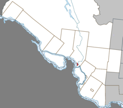
Pontiac is a municipality in the Outaouais Region of western Quebec, Canada, on the north shore of the Ottawa River. It is part of Les Collines-de-l'Outaouais Regional County Municipality, included in the National Capital Region. It should not be confused with Pontiac Regional County Municipality, which is also in the Outaouais but not included in the National Capital Region.

<span class="mw-page-title-main">Mansfield-et-Pontefract</span> Municipality in Quebec, Canada

Mansfield-et-Pontefract is a municipality in the Pontiac Regional County Municipality of western Quebec, Canada. It is located on the Ottawa River, northwest of Gatineau. It is the most populated municipality in the Pontiac Regional County Municipality, with most of the population and businesses concentrated along Quebec Route 148.

<span class="mw-page-title-main">Shawville, Quebec</span> Municipality in Quebec, Canada

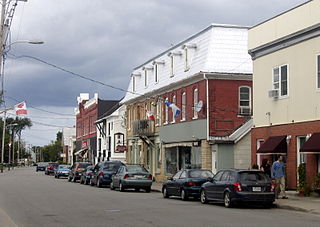
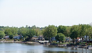
Shawville is a town located in the Pontiac Regional County Municipality in the administrative region of Outaouais in western Quebec, Canada.

<span class="mw-page-title-main">Campbell's Bay, Quebec</span> Municipality in Quebec, Canada

Campbell's Bay is a municipality in Pontiac Regional County Municipality in western Quebec, Canada. Its population in 2021 was 705.

<span class="mw-page-title-main">L'Île-Perrot</span> City in Quebec, Canada

The Town of Île-Perrot is a town and municipality on Île Perrot in southwestern Quebec, Canada. The population as of the Canada 2016 Census was 10,756. The town is at the western end of Lake Saint-Louis, and borders the local island communities of Terrasse-Vaudreuil, Pincourt and Notre-Dame-de-l'Île-Perrot. It also includes Dowker Island and the small Claude and Bellevue Islands.

<span class="mw-page-title-main">Coulonge River</span> River in Quebec, Canada

The Coulonge River is a predominantly wilderness river in western Quebec, Canada. One of a dozen or so significant tributaries of the Ottawa River, it has a length of 240 kilometres (150 mi) and a drainage area of 5,060 square kilometres (1,950 sq mi), and runs in a general south-eastern direction from its headwaters in Lac au Barrage to the Ottawa River at Fort-Coulonge. Over that distance, it drops approximately 260 meters (850 ft) — 48 meters (157 ft) of that over the massive Grandes or Coulonge Chutes, approximately 15 kilometers (9.3 mi) upstream of the confluence with the Ottawa River.

<span class="mw-page-title-main">Contrecœur, Quebec</span> City in Quebec, Canada

Contrecœur is a city in southwestern Quebec, Canada on the south shore of the St. Lawrence River. The population as of the Canada 2021 Census was 9,480. Contrecœur is approximately 45 kilometres (28 mi) northeast of Montreal and is accessible via Autoroute 30, the main road from the southwest, which continues on to Sorel-Tracy.

<span class="mw-page-title-main">Rapides-des-Joachims</span> Municipality in Quebec, Canada

Rapides-des-Joachims is a municipality and village in western Quebec, Canada, part of Pontiac County in the Outaouais region. The village is situated on Rapides-des-Joachims Island on the Ottawa River, about 100 km northwest of Fort-Coulonge. It is also known as Swisha.

<span class="mw-page-title-main">Portage-du-Fort</span> Village municipality in Quebec, Canada

Portage-du-Fort is a village municipality in the Pontiac Regional County Municipality in the southwest corner of the Outaouais region of Quebec, Canada. The village lies across the Ottawa River from Chenaux, Ontario and Horton, Ontario.

<span class="mw-page-title-main">Bryson, Quebec</span> Municipality in Quebec, Canada

Bryson is a village and municipality in the Pontiac Regional County Municipality in the Outaouais region of Quebec, Canada. It is located on the northern bank of the Ottawa River.

<span class="mw-page-title-main">Waltham, Quebec</span> Municipality in Quebec, Canada

Waltham, also known as Waltham Station is a village and municipality in the Outaouais region, Quebec, Canada, part of the Pontiac Regional County Municipality. It is located at the mouth of the Noire River, along the north shore of the Ottawa River at Allumette Island.

<span class="mw-page-title-main">Sheenboro</span> Municipality in Quebec, Canada

Sheenboro is a village and municipality in the Outaouais region, part of the Pontiac Regional County Municipality, Quebec, Canada. It was formerly known as Sheen-Esher-Aberdeen-et-Malakoff. Its territory stretches along the north shore of the Ottawa River from Chichester to Rapides-des-Joachims.

<span class="mw-page-title-main">L'Isle-aux-Allumettes</span> Municipality in Quebec, Canada

L'Isle-aux-Allumettes is a municipality in the Outaouais region, part of the Pontiac Regional County Municipality, Quebec, Canada. The municipality consists primarily of Allumette Island, and also includes Morrison Island, Marcotte Island, and some minor islets, all in the Ottawa River north of Pembroke.

<span class="mw-page-title-main">Chichester, Quebec</span> Township municipality in Quebec, Canada

Chichester is a township municipality and village in the Canadian province of Quebec, located within the Pontiac Regional County Municipality.

<span class="mw-page-title-main">L'Île-du-Grand-Calumet</span> Municipality in Quebec, Canada

L'Île-du-Grand-Calumet is a municipality in the Outaouais region, part of the Pontiac Regional County Municipality, Quebec, Canada. The municipality consists primarily of Calumet Island, but also includes Lafontaine Island, French Island, Green Island, and numerous minor surrounding islets, all in the Ottawa River, approximately two kilometres from Campbell's Bay, two kilometres from Bryson.

<span class="mw-page-title-main">Litchfield, Quebec</span> Municipality in Quebec, Canada

Litchfield is a municipality in the Outaouais region, part of the Pontiac Regional County Municipality, Quebec, Canada. It is located on the shores of the eastern channel of the Ottawa River at Calumet Island.

<span class="mw-page-title-main">Clarendon, Quebec</span> Municipality in Quebec, Canada

Clarendon is a municipality in the Outaouais region, part of the Pontiac Regional County Municipality, Quebec, Canada. It is located on the north shore of the Ottawa River across from Horton Township in Ontario.

<span class="mw-page-title-main">Bristol, Quebec</span> Municipality in Quebec, Canada

Bristol is a municipality in the Ottawa Valley, on the Quebec side in the Outaouais region, part of the Pontiac Regional County Municipality, Quebec, Canada. It is located on the north shore of Lac des Chats across from Arnprior, Ontario.

<span class="mw-page-title-main">Sainte-Barbe, Quebec</span> Municipality in Quebec, Canada

Sainte-Barbe is a municipality of Quebec, located within Le Haut-Saint-Laurent Regional County Municipality in the Montérégie administrative region. The population as of the Canada 2021 Census was 1,609.

Mistissini is a Cree village municipality in the territory of Eeyou Istchee in northern Quebec, Canada; it has a distinct legal status and classification from other kinds of village municipalities in Quebec: Naskapi village municipalities, northern villages, and ordinary villages.

References

  1. 1 2 3 4 5 "Reference number 23187 in Banque de noms de lieux du Québec". toponymie.gouv.qc.ca (in French). Commission de toponymie du Québec.
  2. 1 2 "Geographic code 84060 in the official Répertoire des municipalités". www.mamh.gouv.qc.ca (in French). Ministère des Affaires municipales et de l'Habitation.
  3. 1 2 "Fort-Coulonge, Village (VL) Census Profile, 2021 Census of Population". www12.statcan.gc.ca. Government of Canada - Statistics Canada. Retrieved 10 November 2022.
  4. 1 2 Elizabeth Browne Losey, "Let Them be Remembered:The Story of the Fur Trade Forts", 1999.
  5. 1 2 3 4 5 Dempsey, Gary T. (2018). Ottawa Valley Ancestry: A Dempsey Family History (5th ed.). Lulu.com. ISBN   9781387646890 . Retrieved 8 November 2019.
  6. "Population and dwelling counts: Canada, provinces and territories, and census subdivisions (municipalities), Quebec". Statistics Canada. February 9, 2022. Retrieved August 28, 2022.
  7. "2021 Community Profiles". 2021 Canadian Census . Statistics Canada. February 4, 2022. Retrieved 2023-10-19.
  8. "2016 Community Profiles". 2016 Canadian Census . Statistics Canada. August 12, 2021. Retrieved 2019-11-08.
  9. "2011 Community Profiles". 2011 Canadian Census . Statistics Canada. March 21, 2019. Retrieved 2014-01-28.
  10. "2006 Community Profiles". 2006 Canadian Census . Statistics Canada. August 20, 2019.
  11. "2001 Community Profiles". 2001 Canadian Census . Statistics Canada. July 18, 2021.
  12. 1996, 2001, 2006, 2011 census