Fort Duncan

Last updated
Fort Duncan
Fort Duncan 1887.jpg
Fort Duncan 1887
Relief map of Texas.png
Red pog.svg
Fort Duncan
Usa edcp relief location map.png
Red pog.svg
Fort Duncan
LocationBounded by Monroe and Garrison Sts,. city limits on the S, and the Rio Grande on the W, Eagle Pass, Texas
Coordinates 28°42′7″N100°30′17″W / 28.70194°N 100.50472°W / 28.70194; -100.50472
Area100 acres (40 ha)
Built1849 (1849)
NRHP reference No. 71000954 [1]
TSAL No. 460
Significant dates
Added to NRHPDecember 9, 1971
Designated TSALMay 28, 1981
Commanding officer quarters looking towards the magazine and museum Fort Duncan Commanding officer headquarters.jpg
Commanding officer quarters looking towards the magazine and museum

Fort Duncan was a United States Army base, set up to protect the first U.S. settlement on the Rio Grande near the current town of Eagle Pass, Texas.

Contents

History

A line of seven army posts was established in 1848–49 after the Mexican War to protect the settlers of West Texas and included Fort Worth, Fort Graham, Fort Gates, Fort Croghan, Fort Martin Scott, Fort Lincoln and Fort Duncan. [2] Fort Duncan was established on March 27, 1849, when Captain Sidney Burbank occupied the site with companies A, B, and F of the First United States Infantry. [3] :5 On November 14, 1849, the post was named Fort Duncan, after Col. James Duncan, a hero of the Mexican–American War. [3] :7

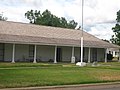
The post consisted of a storehouse, two magazines, four officers' quarters, and a stone hospital, in addition to quarters for enlisted men. Construction was done half by the troops and half by hired workers. There was ample stone but no timber for building, and the men suffered from exposure. Company C, 1st Regiment of Artillery, asked permission to construct quarters at its own expense. During the 1850s, Fort Duncan provided merchants and traders protection from border frontier outlaws and Native Americans. The fort also served as a post for scouting Native Americans.

In 1854, Lt.s Philip Sheridan, Zenas Bliss, Richard W. Johnson and Assistant Surgeon Albert J. Myer were stationed here, the Lieutenants after graduating from West Point. [3] :19,25,27

Fort Duncan became involved in an invasion of Mexico on 2 October 1855, when Texas Ranger Captain James H. Callahan led an effort to capture "runaway slaves", but confronted by Mexican regular troops, Seminoles and the ex-slaves, Callahan retreated to Piedras Negras, which caught fire, threatening his force with annihilation until Capt. Burbank covered Callahan's retreat across the Rio Grande with Fort Duncan artillery. [3] :30

Secretary of War John B. Floyd ordered the post abandoned in May 1859, [3] :36 but Lt. Col. Robert E. Lee ordered the fort reoccupied in March 1860 during the Cortina Troubles. [3] :38 The fort at this time consisted of "25 buildings ... nearly all are stone and adobe with thatched roofs." [3] :41

General David E. Twiggs ordered the fort evacuated on 21 February 1861, just before the outbreak of the American Civil War. [3] :42 However, Major William H. French was able to evacuate three companies of artillery at Fort Duncan and two at Fort Brown to Fort Jefferson and Fort Zachary Taylor in Florida. [4] The CSA garrisoned the fort with volunteers and Texas Rangers, renaming it Rio Grande Station, which became an important port for the export of cotton into Mexico. [3] :46

Federal troops reoccupied Fort Duncan on 23 March 1868 by the 41st Infantry under the command of Lt. Col. William R. Shafter, and Lt. Henry Ware Lawton as quartermaster. [3] :52–53 An additional unit of Buffalo soldiers stationed at the fort, besides the 41st, was the 9th Cavalry. [3] :56 This included George B. Jackson, later a businessman in San Angelo called "the wealthiest black man in Texas" during the second half of the 19th century. [5] The 25th Infantry arrived under the command of Major Bliss in 1870, and the Black Seminole Scouts were organized at the fort, initially under the command of 2nd Lt. Henry Field Leggett, but later commanded by 2nd Lt. John L. Bullis. [3] :54,60,63

The post was abandoned once again on 31 August 1883. [3] :91

Camp at Eagle Pass

Camp at Eagle Pass was established on 3 April 1886 as a sub-post of Fort Clark until it was discontinued in February 1927. [3] :92–93 The 3rd Texas Volunteer Infantry was based here from 25 May 1898 until 16 February 1899. [3] :102 The camp was ordered abandoned in 1904 [3] :105 but a detachment of Signal Corps was placed here on 9 February 1911 while "Mexico was aflame with revolution" until 1914. [3] :106 The National Guard was mobilized here in 1916, joining the Coast Artillery Corps, [3] :94,109 while the 90th Aero Squadron operated DH-4Bs from here in 1919 until 1920, which included Jimmy Doolittle. [3] :115–116 Only a caretaker force remained to watch over the hospital from 1922 until final closure of the camp in 1927. [3] :116

Military Aviation

U.S. Army Air Corps Major General Benjamin Foulois Benjamin Foulois.jpg
U.S. Army Air Corps Major General Benjamin Foulois

On 3 March 1911, Benjamin Foulois and Philip Orin Parmelee flew the US military's first cross country reconnaissance flight here from Laredo using a Wright Model B covering 106 miles in two hours at an altitude of 800 feet. [3] :107–108

Preservation

In 1933, the City of Eagle Pass Parks and Recreation Department began maintaining the old fort as a public park. [3] :118 The city formally acquired the property in 1938 at an auction price of $3760 [3] :119 and converted it into Fort Duncan Park. In 1942 the mayor offered the fort to the military for use during World War II. [3] :120 The government used the Fort Duncan Country Club as an officers' club and the swimming pool for commissioned personnel stationed at Eagle Pass Army Air Field. The site was listed in the National Register of Historic Places in 1971. Seven of the original buildings still stand today. In the early 1980s, the Fort Duncan Country Club caught fire and only the outer walls remain.

The Commander's Headquarters building has been converted into the Fort Duncan Museum, with exhibits of local and fort history and artifacts.

See also

Related Research Articles

<span class="mw-page-title-main">Maverick County, Texas</span> County in Texas, United States

Maverick County is a county located in the U.S. state of Texas. As of the 2020 census, its population was 57,887. Its county seat is Eagle Pass. The county was created in 1856 and organized in 1871. It is named for Samuel Maverick, cattleman and state legislator.

<span class="mw-page-title-main">Rio Grande City, Texas</span> City in Texas, United States

Rio Grande City is a city in and the county seat of Starr County, Texas, United States. The population was 14,411 at the time of the 2020 census. The city is 41 miles (66 km) west of McAllen. The city also holds the March record high for the United States at 108 °F (42 °C). The city is connected to Camargo, Tamaulipas, via the Rio Grande City–Camargo International Bridge. The city is situated within the Rio Grande Valley.

<span class="mw-page-title-main">Battle of Palo Alto</span> Major battle of the Mexican-American War

The Battle of Palo Alto was the first major battle of the Mexican–American War and was fought on May 8, 1846, on disputed ground five miles (8 km) from the modern-day city of Brownsville, Texas. A force of some 3,700 Mexican troops – most of the Army of The North – led by General Mariano Arista engaged a force of approximately 2,300 United States troops – the Army of Occupation led by General Zachary Taylor.

<span class="mw-page-title-main">Battle of Resaca de la Palma</span> 1846 battle of the Mexican–American War

The Battle of Resaca de la Palma was one of the early engagements of the Mexican–American War, where the United States Army under General Zachary Taylor engaged the retreating forces of the Mexican Ejército del Norte under General Mariano Arista on May 9, 1846. The United States emerged victorious and forced the Mexicans out of Texas.

<span class="mw-page-title-main">Battle of Monterrey</span> 1846 battle of the Mexican-American War

In the Battle of Monterrey during the Mexican–American War, General Pedro de Ampudia and the Mexican Army of the North was defeated by the Army of Occupation, a force of United States Regulars, Volunteers and Texas Rangers under the command of General Zachary Taylor.

<span class="mw-page-title-main">Fort Myer</span> United States historic place

Fort Myer is the previous name used for a U.S. Army post next to Arlington National Cemetery in Arlington County, Virginia, and across the Potomac River from Washington, D.C. Founded during the American Civil War as Fort Cass and Fort Whipple, the post merged in 2005 with the neighboring Marine Corps installation, Henderson Hall, and is today named Joint Base Myer–Henderson Hall.

<span class="mw-page-title-main">Fort Concho</span> US Army fort in Texas, used 1867–1889

Fort Concho is a former United States Army installation and National Historic Landmark District located in San Angelo, Texas. It was established in November 1867 at the confluence of the North and South Concho Rivers, on the routes of the Butterfield Overland Mail Route and Goodnight–Loving Trail, and was an active military base for the next 22 years. Fort Concho was the principal base of the 4th Cavalry from 1867 to 1875 and then the "Buffalo Soldiers" of the 10th Cavalry from 1875 to 1882. The troops stationed at Fort Concho participated in Ranald S. Mackenzie's 1872 campaign, the Red River War in 1874, and the Victorio Campaign of 1879–1880.

<span class="mw-page-title-main">Fort McIntosh, Texas</span> United States historic place

Fort McIntosh was a U.S. Army base in Laredo, Webb County, Texas, from 1849 to 1946.

<span class="mw-page-title-main">Fort Brown</span> United States historic place

Fort Brown was a military post of the United States Army in Cameron County, Texas, during the latter half of the 19th century and the early part of the 20th century. Established in 1846, it was the first US Army military outpost of the recently annexed state. Confederate Army troops stationed there saw action during the American Civil War. In the early 20th century, it was garrisoned in relation to military activity over border conflicts with Mexico. Surviving elements of the fort were designated as a National Historic Landmark in 1960.

<span class="mw-page-title-main">New Mexico campaign</span> Military operation of the trans-Mississippi theater of the American Civil War

The New Mexico campaign was a military operation of the trans-Mississippi theater of the American Civil War from February to April 1862 in which Confederate Brigadier General Henry Hopkins Sibley invaded the northern New Mexico Territory in an attempt to gain control of the Southwest, including the gold fields of Colorado and the ports of California. Historians regard this campaign as the most ambitious Confederate attempt to establish control of the American West and to open an additional theater in the war. It was an important campaign in the war's Trans-Mississippi Theater, and one of the major events in the history of the New Mexico Territory in the American Civil War.

<span class="mw-page-title-main">Palo Alto Battlefield National Historical Park</span> National Historical Park of the United States

Palo Alto Battlefield National Historical Park near Brownsville, Texas, United States, is a National Park Service unit which preserves the grounds of the May 8, 1846, Battle of Palo Alto. It was the first major conflict in a border dispute that soon precipitated the Mexican–American War. The United States Army victory here made the invasion of Mexico possible. The historic site portrays the battle and the war, and its causes and consequences, from the perspectives of both the United States and Mexico.

<span class="mw-page-title-main">Fort Ridgely</span> Frontier U.S. Army outpost in present-day Nicollet County, Minnesota (1851–67)

Fort Ridgely was a frontier United States Army outpost from 1851 to 1867, built 1853–1854 in Minnesota Territory. The Sioux called it Esa Tonka. It was located overlooking the Minnesota River southwest of Fairfax, Minnesota. Half of the fort's land was part of the south reservation in the Minnesota river valley for the Mdewakanton and Wahpekute tribes. Fort Ridgely had no defensive wall, palisade, or guard towers. The Army referred to the fort as the "New Post on the Upper Minnesota" until it was named for two Maryland Army Officers named Ridgely, who died during the Mexican–American War.

<span class="mw-page-title-main">Fort Sill</span> United States army post in Lawton, Oklahoma

Fort Sill is a United States Army post north of Lawton, Oklahoma, about 85 miles (137 km) southwest of Oklahoma City. It covers almost 94,000 acres (38,000 ha).

<span class="mw-page-title-main">Battle of Valverde</span> 1862 battle of the American Civil War

The Battle of Valverde, also known as the Battle of Valverde Ford, was fought from February 20 to 21, 1862, near the town of Val Verde at a ford of the Rio Grande in Union-held New Mexico Territory, in what is today the state of New Mexico. It is considered a major Confederate success in the New Mexico Campaign of the American Civil War, despite the invading force abandoning the field and, eventually, retreating from the territory entirely. The belligerents were Confederate cavalry from Texas and several companies of Arizona militia versus U.S. Army regulars and Union volunteers from northern New Mexico Territory and the Colorado Territory.

<span class="mw-page-title-main">Fort Selden</span> United States historic place in New Mexico

Fort Selden was a United States Army post, occupying the area in what is now Radium Springs, New Mexico. The site was long a campground along the El Camino Real de Tierra Adentro. It was the site of a Confederate Army camp in 1861. The U.S. Army established Fort Selden in 1865 for the purpose of protecting westward settlers from Native American raids, but the post fell into disrepair after the American Civil War. It was ultimately abandoned in 1891, due in large part to the decision to expand Fort Bliss and the lack of any expenditures for repair of the facility.

<span class="mw-page-title-main">Fort McKavett State Historic Site</span> United States historic place

The Fort McKavett State Historic Site is a former United States Army installation located in Menard County, Texas. The fort was first established in 1852 as part of a line of forts in Texas intended to protect migrants traveling to California. The fort was deemed unnecessary and abandoned in 1859 and was occupied by settlers. From 1861 to 1863, during the American Civil War, the fort became an outpost of Confederate forces on the Texas frontier until they left for other theaters of the war. When the US Army returned to Texas in the later 1860s, the fort was reoccupied and rebuilt, and became a base for the "Buffalo Soldier", or all-African American, 24th Infantry and 9th Cavalry Regiments.

<span class="mw-page-title-main">Fort Phantom Hill</span> US Army fort in Texas, used 1852–1890s

Fort Phantom Hill, also called the Camp on the Clear Fork, is a former United States Army installation located in Jones County, Texas. The fort was established in 1851 as part of a line of forts in Texas to protect migrants passing through the state on their way to California. The US Army abandoned the fort in 1854 and it was shortly thereafter mostly destroyed by fire. In 1858, it became a station of the Butterfield-Overland Mail route until it moved out of Texas with the beginning of the American Civil War in 1861. During the war, the fort was occupied by Confederate frontier troops until the Confederacy's defeat and surrender. Following the US Army's return to Texas after the Civil War, Fort Phantom Hill was used as a subpost of the larger, newer Fort Griffin until 1875.

<span class="mw-page-title-main">Fort Belknap (Texas)</span> United States historic place

Fort Belknap, located near Newcastle, Texas, was established in November 1851 by brevet Brigadier General William G. Belknap to protect the Texas frontier against raids by the Kiowa and Comanche. It was the northernmost fort in a line from the Rio Grande to the Red River. The fort functioned as a base of operations rather than as a fortified point, and it became the center of a substantial network of roads, including the Butterfield Overland Mail. The fort was designated a National Historic Landmark in 1960, in recognition of its key role in securing the Texas frontier in the 1850s and 1860s.

Fort Quitman was a United States Army installation on the Rio Grande in Texas, United States, south of present-day Sierra Blanca, 20 miles southeast of McNary in southern Hudspeth County. The fort, now a ghost town, was named for former Mississippi Governor John A. Quitman, who served as a major general under Zachary Taylor during the Mexican–American War.

<span class="mw-page-title-main">Fort Clark, Texas</span> United States historic place

Fort Clark was a frontier fort located just off U.S. Route 90 near Brackettville, in Kinney County, Texas, United States. It later became the headquarters for the 2nd Cavalry Division. The Fort Clark Historic District was added to the National Register of Historic Places on December 6, 1979. The Commanding Officer's Quarters at Fort Clark were designated a Recorded Texas Historic Landmark in 1988. The Fort Clark Guardhouse became a Recorded Texas Historic Landmark in 1962. The Fort Clark Officers' Row Quarters were designated a Recorded Texas Historic Landmark in 1991.

References

  1. "National Register Information System". National Register of Historic Places . National Park Service. July 9, 2010.
  2. Crimmins, M.L., 1943, The First Line of Army Posts Established in West Texas in 1849, Abilene: West Texas Historical Association, Vol. XIX, pp. 121-127
  3. 1 2 3 4 5 6 7 8 9 10 11 12 13 14 15 16 17 18 19 20 21 22 23 24 Thompson, R.A., 2004, Fort Duncan, Texas: Rock of the Rio Grande Line of Defense, Austin: Nortex Press, ISBN   1571685340
  4. Reid, Thomas (2006). America's Fortress. Gainesville: University Press of Florida. pp. 42–43. ISBN   978-0-8130-3019-7.
  5. Suzanne Campbell of Angelo State University, San Angelo, "George B. Jackson, Black (or African-American) Businessman, Rancher, and Entrepreneur," West Texas Historical Association, annual meeting, Lubbock, Texas, April 2, 2011