The Alabama River, in the U.S. state of Alabama, is formed by the Tallapoosa and Coosa rivers, which unite about 6 miles (10 km) north of Montgomery, near the town of Wetumpka.

The Muscogee, also known as the Mvskoke, Muscogee Creek, and the Muscogee Creek Confederacy, are a group of related indigenous peoples of the Southeastern Woodlands in the United States of America. Their original homelands are in what now comprises southern Tennessee, much of Alabama, western Georgia and parts of northern Florida.

Elmore County is a county located in the east central portion of the U.S. state of Alabama. As of the 2020 census, the population was 87,977. Its county seat is Wetumpka. Its name is in honor of General John A. Elmore.

Tallassee is a city on the Tallapoosa River, located in both Elmore and Tallapoosa counties in the U.S. state of Alabama. At the 2020 census, the population was 4,763. It is home to a major hydroelectric power plant at Thurlow Dam operated by Alabama Power Company.

Wetumpka is a city in and the county seat of Elmore County, Alabama, United States. At the 2020 census, the population was 7,220. In the early 21st century Elmore County became one of the fastest-growing counties in the state. The city is considered part of the Montgomery Metropolitan Area.

The Battle of Horseshoe Bend, was fought during the War of 1812 in the Mississippi Territory, now central Alabama. On March 27, 1814, United States forces and Indian allies under Major General Andrew Jackson defeated the Red Sticks, a part of the Creek Indian tribe who opposed American expansion, effectively ending the Creek War.

The Creek War (1813–1814), also known as the Red Stick War and the Creek Civil War, was a regional war between opposing Creek factions, European empires and the United States, taking place largely in today's Alabama and along the Gulf Coast. The major conflicts of the war took place between state militia units and the "Red Stick" Creeks. The United States government formed an alliance with the Choctaw Nation and Cherokee Nation, along with the remaining Creeks to put down the rebellion.

The Coosa River is a tributary of the Alabama River in the U.S. states of Alabama and Georgia. The river is about 280 miles (450 km) long.
Red Sticks, the name deriving from the red-painted war clubs of some Native American Creeks—refers to an early 19th-century traditionalist faction of these people in the American Southeast. Made up mostly of Creek of the Upper Towns that supported traditional leadership and culture, as well as the preservation of communal land for cultivation and hunting, the Red Sticks arose at a time of increasing pressure on Creek territory by European-American settlers. Creek of the Lower Towns were closer to the settlers, had more mixed-race families, and had already been forced to make land cessions to the Americans. In this context, the Red Sticks led a resistance movement against European-American encroachment and assimilation, tensions that culminated in the outbreak of the Creek War in 1813. Initially a civil war among the Creek, the conflict drew in United States state forces while the nation was already engaged in the War of 1812 against the British.

The Tallapoosa River runs 265 miles (426 km) from the southern end of the Appalachian Mountains in Georgia, United States, southward and westward into the Appalachian foothills in Alabama. It is formed by the confluence of McClendon Creek and Mud Creek in Paulding County, Georgia. Lake Martin at Alexander City, Alabama is a large and popular water recreation area formed by a dam on the river. The Tallapoosa joins the Coosa River about 10 miles (16 km) northeast of Montgomery near Wetumpka to form the Alabama River.

The Treaty of Fort Jackson was signed on August 9, 1814 at Fort Jackson near Wetumpka, Alabama following the defeat of the Red Stick resistance by United States allied forces at the Battle of Horseshoe Bend. It occurred on the banks of the Tallapoosa River near the present city of Alexander City, Alabama. The U.S. force, led by General Andrew Jackson, consisted mainly of the West Tennessee Militia and 39th United States Infantry, allied with several groups of Cherokee and Lower Creek friendly to the American side. The Upper Creek were led by Chief Menawa, who fled with hundreds of survivors into Florida, where they allied with the Seminole. The surrender ended the Creek War, which the United States was fighting simultaneously with the War of 1812.

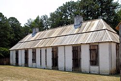
The William Bartram Arboretum is an arboretum near Wetumpka, Alabama, in the United States. It is located off U.S. Route 231, at 2521 Fort Toulouse Road. The arboretum is named in honor of the 18th century naturalist William Bartram, who visited the area in 1776 while studying local flora and fauna.

The Fort Mims massacre took place on August 30, 1813, during the Creek War, when a force of Creek Indians belonging to the Red Sticks faction, under the command of head warriors Peter McQueen and William Weatherford, stormed the fort and defeated the militia garrison. Afterward, a massacre ensued and almost all of the remaining Creek métis, white settlers, and militia at Fort Mims were killed. The fort was a stockade with a blockhouse surrounding the house and outbuildings of the settler Samuel Mims, located about 35 miles directly north of present-day Mobile, Alabama.

Fort Williams was a supply depot built in early 1814 in preparation for the Battle of Horseshoe Bend. It was located in Alabama on the southeast shore where Cedar Creek meets the Coosa River, near Talladega Springs.

Fort Toulouse, also called Fort des Alibamons and Fort Toulouse des Alibamons, is a historic fort near the city of Wetumpka, Alabama, United States, that is now maintained by the Alabama Historical Commission. The French founded the fort in 1717, naming it for Louis-Alexandre de Bourbon, comte de Toulouse. In order to counter the growing influence of the British colonies of Georgia and Carolina, the government of French Louisiana erected a fort on the eastern border of the Louisiana Colony in what is now the state of Alabama.

Fort Strother was a stockade fort at Ten Islands in the Mississippi Territory, in what is today St. Clair County, Alabama. It was located on a bluff of the Coosa River, near the modern Neely Henry Dam in Ragland, Alabama. The fort was built by General Andrew Jackson and several thousand militiamen in November 1813, during the Creek War and was named for Captain John Strother, Jackson's chief cartographer.
Hickory Ground, also known as Otciapofa is an historic Upper Muscogee Creek tribal town and an archaeological site in Elmore County, Alabama near Wetumpka. It is known as Oce Vpofa in the Muscogee language; the name derives from oche-ub,"hickory" and po-fau, "among". It is best known for serving as the last capital of the National Council of the Creek Nation, prior to the tribe being moved to the Indian Territory in the 1830s. It was added to the National Register of Historic Places on March 10, 1980.

Fort Decatur was an earthen fort established in March 1814 on the banks of the Tallapoosa River as part of the Creek War and the larger War of 1812. The fort was located on the east bank of the Tallapoosa River, near the modern community of Milstead. Fort Decatur was also located near the Creek town of Tukabatchee. It was most likely named for Stephen Decatur.

The Taskigi Mound or Mound at Fort Toulouse – Fort Jackson Park (1EE1) is an archaeological site from the South Appalachian Mississippian Big Eddy phase. It is located on a 40 feet (12 m) bluff at the confluence of the Coosa and Tallapoosa rivers where they meet to form the Alabama River, near the town of Wetumpka in Elmore County, Alabama.
Fort Armstrong was a stockade fort built in present-day Cherokee County, Alabama during the Creek War. The fort was built to protect the surrounding area from attacks by Red Stick warriors but was also used as a staging area and supply depot in preparation for further military action against the Red Sticks.