Fort Lyon, Colorado | |
|---|---|
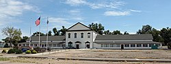 Fort Lyon (2013) | |
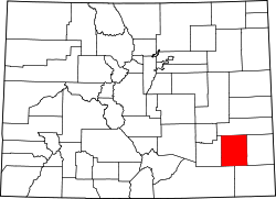
 Fort Lyon Location within Bent County and Colorado  Fort Lyon Fort Lyon (the United States) | |
| Coordinates: 38°05′48″N103°09′07″W / 38.09667°N 103.15194°W [1] | |
| Country | United States |
| State | Colorado |
| County | Bent |
| Elevation | 3,888 ft (1,185 m) |
| Time zone | UTC−7 (MST) |
| • Summer (DST) | UTC−6 (MDT) |
| ZIP Code | 81054 [2] |
| Area code | 719 |
| GNIS ID | 204828 [1] |
Fort Lyon is an unincorporated community and U.S. Post Office in Bent County, Colorado, United States. [1]