He came to British Columbia during the era of the Klondike Gold Rush and became a surveyor's assistant. Then, from 1908, he was a professional surveyor and surveyed many regions of British Columbia. He kept a journal of his work and collected over 5000 unique pictures of the era, which were donated to BC Archives for the benefit of future researchers. The photographs span a period of more than 40 years and cover many areas of the province. Their subjects include stagecoaches, sternwheelers, old forts and remote villages, mountains and rivers, pioneer settlers, miners and First Nations people. Swannell's pictures are a priceless contribution to the history of British Columbia.[2]
Early years
Swannell graduated from high school in Toronto and then attended a two-year program in mining engineering at the University of Toronto from 1897-1899. In the summer of 1898, he worked for a surveying firm in New Denver, British Columbia. After he graduated, he intended to travel to the Yukon to participate in the Klondike Gold Rush, but instead obtained work with the Victoria surveyors, Gore and McGregor, receiving his Provincial Land Surveying licence and Dominion Land Surveying licence in 1903 and 1904 respectively. In 1908, Swannell left the firm and struck out on his own and soon gained a reputation for being among the best in the business.[1]
1908-1914
Frank Swannell at Takla Lake
The construction of the Grand Trunk Pacific Railway caused a great deal of interest in Central and Northern British Columbia, and settlers were arriving looking for agricultural land, which needed to be surveyed before it could be sold or pre-empted. The equipment the surveyors used would be considered simple by today's standards, but it was remarkably accurate: a transit and a 66-foot length of chain (80 lengths to a mile). The pioneer surveyors did more than survey land, they also recorded the topography, soil conditions and potential uses of the land, information that was a necessity for the government and land-seekers alike.[1]
Charlotte on the Fraser River (1908)
In 1908, Swannell received the government contract to survey the Nechako Valley. Swannell and his crew worked in the summers and he kept his winter home in Victoria. When spring came, they would travel from Vancouver on the Canadian Pacific Railway to Ashcroft and take a stagecoach to Soda Creek where the sternwheeler Charlotte would take them to Quesnel. From Quesnel it was a ten-day hike along the Yukon Telegraph Trail to the Nechako Valley.
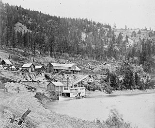
The surveyor's camp at Stoney Creek (1908)
Surveying British Columbia into the familiar 640 acre sections that are created by north to south range lines and east to west township lines was much more difficult than it was in many other areas of Western Canada. Survey lines had to be cut through dense wilderness, across swamps, lakes, rivers and over mountainous areas. Aside from surveying, Swannell also had to worry about keeping food supplies on hand for his crew, a problem which was quite often nearly insurmountable as there were few farms in the region and goods often took three weeks or longer to arrive from Hudson's Bay Company stores on pack trains or by canoe. During that first summer, Swannell and his crew surveyed the area around Fort Fraser, Fraser Lake and Stoney Creek.
In 1909, Swannell and his crew began the season by surveying lots in the Lillooet and Pemberton areas and several locations around Anderson and Seton Lakes. By July, they were finished and returned to Quesnel, transferring from the Charlotte to the new sternwheeler, Nechacco which was able to take the crew up the Fraser to Fort George and onto the Nechako River all the way to Fraser Lake. In August, Swannell traveled to Fort St. James and inspected the surrounding area, including Stuart Lake and Takla Lake. From there, Swannell traveled to Moricetown, Hazelton and Prince Rupert, taking many pictures of the pioneer communities and First Nations villages along the way before returning to his home in Victoria that November.
Frank's crew on the Chilco near Isle Pierre (1910)
In 1910, Swannell spent January and February working close to his home in Victoria, working on Saltspring Island. In March, he went to the Gordon River from Port Renfrew and in mid March continued on to more surveying at Atla Lake in the Whistler region. By early April Swannell had moved on to the Lillooet River. By July, he and his crew had returned to the Nechako Valley and surveyed the areas around Fraser Lake and the Nechako River and the Endako Valley. That year, Swannell left Endako in December, taking a 400-mile sleigh ride to Ashcroft to meet the CPR. He arrived home on New Year's Eve.[1]
Frank Swannell and crew on a BC Express stage (1911)
In 1911, he completed some small government surveys around Victoria, as well as some surveying work for private interests. By March, he was back in the Lillooet region and returned to the Nechako Valley in mid May. Travel had already become more convenient in the years since they had begun work in the region and Swannell and his party took a BC Express Company stagecoach from Ashcroft to Soda Creek, where they boarded the BC Express Company's sternwheeler, BX. By the end of May, they arrived back in the Nechako region aboard the Fort Fraser and recommenced their surveying work in the area around Fort St. James.[1]
Frank Swannell at 105 Mile House (November 1912)
In 1912, Swannell won a large contract to survey the area around Nation Lake and throughout the surrounding Omineca Country. He and his crew would travel a total of 1,700 miles that season, most of it by raft, but some of them by a relative newcomer to the route into Northern British Columbia, the automobile.[1]
Swannell's pack train near the Omineca Mountains (1913)
In 1913, the Surveyor General, impressed with Swannell's progress in the Nechako and Omineca regions, sent him back to the area, with the intention of extending his surveys further north and east, further into the Omineca. Swannell resurveyed Mount Pope and Takla Lake and then surveyed the area around Fort Babine, Driftwood River and the Omineca River and the Finlay River.[1] Swannell visited the Big Kettle Fumarole at the junction of Humar Creek and the Omineca River during his surveys and provided a description in his government report.[3] Swannell's party travelled on the North-West Mounted Police Trail that ran between Fort Grahame and Bear Lake. On November 1, they travelled to Burns Lake from Fort St. James, and Swannell observed and photographed the ongoing construction of the Grand Trunk Pacific Railway, before travelling on to Prince Rupert and returning to Victoria.[1]
In 1914, Swannell and his crew returned to the Omineca region and recommenced the survey work around the Finlay River. Swannell decided to take a new route home that fall and traveled up the Peace River to Hudson's Hope and Fort St. John, eventually arriving at Lesser Slave Lake where they took the steamer Northland Sun to Sawridge, Alberta and then they drove to the train which took them to Edmonton and then continued home by rail.[1]
The Great War
Late in 1914, Swannell enlisted to fight in World War I and in 1919, joined an anti-Bolshevik force in Siberia where he was wounded in the shoulder.
Swannell was sent by the Canadian government to map the route of the ill-conceived Bedaux expedition of 1934. The expedition was intended to run 2,400 kilometers from Edmonton, Alberta to Telegraph Creek, British Columbia and was led by American Charles Bedaux, who was acquainted with car manufacturer, Andre Citroen, who designed the Kégresse track equipped half-track trucks Bedaux used on his journey. Aside from Bedaux and Swannell were fellow mapmaker, Ernest Lemarque, three women: Bedaux's wife, an Italian countess, and a maid, several cameramen, a group of cowboys from Alberta, and the man who would direct the film High Noon, filmmaker, Floyd Crosby. Of the five Citroens, two slid off of cliffs, one was sent downriver and the last two were abandoned. The expedition continued on horseback, but in late September, with winter fast approaching and the horses beginning to die of disease and starvation, Bedaux called a halt to the trip just short of their destination.[4]
The Cariboo Gold Rush was a gold rush in the Colony of British Columbia, which later became the Canadian province of British Columbia. The first gold discovery was made at Hills Bar in 1858, followed by more strikes in 1859 on the Horsefly River, and on Keithley Creek and Antler Creek in 1860. The actual rush did not begin until 1861, when these discoveries were widely publicized. By 1865, following the strikes along Williams Creek, the rush was in full swing.
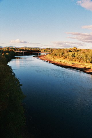
The Nechako River arises on the Nechako Plateau east of the Kitimat Ranges of the Coast Mountains of British Columbia, Canada, and flows north toward Fort Fraser, then east to Prince George where it enters the Fraser River. "Nechako" is an anglicization of netʃa koh, its name in the indigenous Carrier language which means "big river".
The Stuart River or Nak'alkoh is one of the largest tributaries of the Nechako River in northeastern British Columbia, Canada. The Nechako is in turn one the more important tributaries of the Fraser River. The Stuart River flows 187 kilometres (116 mi) from Stuart Lake to its junction with the Nechako River. The river drains a portion of the Nechako Plateau—a gently-rolling region characterized by small lakes and tributaries. Low but impressive ridges interact with the river, creating high bluffs and hoodoos.
Cariboo was one of the twelve original electoral districts created when British Columbia became a Canadian province in 1871. Roughly corresponding to the old colonial electoral administrative district of the same name, it was a three-member riding until the 1894 election, when it was reduced through reapportionment and became a two-member riding until the 1916 election, after which it has been a single-member riding. It produced many notable Members of the Legislative Assembly (MLAs), including George Anthony Boomer Walkem, third and fifth holder of the office of Premier of British Columbia and who was one of the first representatives elected from the riding; John Robson, ninth Premier of British Columbia; and Robert Bonner, a powerful minister in the W.A.C. Bennett cabinet, and later CEO of MacMillan Bloedel and BC Hydro.
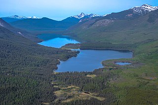
The Omineca Mountains, also known as "the Ominecas", are a group of remote mountain ranges in the Boreal Cordillera of north-central British Columbia, Canada. They are bounded by the Finlay River on the north, the Rocky Mountain Trench on the east, the Nation Lakes on the south, and the upper reaches of the Omineca River on the west. They form a section of the Continental Divide, that, in this region, separates water drainage between the Arctic and Pacific Oceans. The lower course of the Omineca River flows through the heart of the range. To the south of the Ominecas is the Nechako Plateau, to the west the Skeena Mountains and Hazelton Mountains, to the north the Spatsizi Plateau and the Stikine Ranges, while east across the Rocky Mountain Trench are the Muskwa Ranges.
The Nechako Plateau is the northernmost subdivision of the Interior Plateau, one of the main geographic regions of the Canadian province of British Columbia. It spans the basin of the Nechako River and its tributaries the Stuart River and Endako Rivers, and is bounded on the south by the West Road River, south of which is the Chilcotin Plateau and on the north by the Nation River and the valleys of Babine and Takla Lakes, beyond which are the Omineca Mountains (N) and Skeena Mountains (NW). To the west, it abuts the various ranges of the Hazelton Mountains while on its east it is bounded by the pass between Prince George, British Columbia and the Parsnip Arm of Williston Lake, beyond which is the McGregor Plateau, which skirts the Northern Rockies. Some classification systems include the plateau area on the east bank of the Fraser River beyond the city of Prince George; this area neighbours the northernmost reaches of the Quesnel Highland and Cariboo Mountains.
Barnard's Express, later known as the British Columbia Express Company or BX, was a pioneer transportation company that served the Cariboo and Fraser-Fort George regions in British Columbia, Canada from 1861 until 1921.
Soda Creek is a rural subdivision 38 km north of Williams Lake in British Columbia, Canada. Located on the east bank of the Fraser River, Soda Creek was originally the home of the Xat'sull First Nation. Soda Creek Indian Reserve No. 1 is located on the left (E) bank of the Fraser River, one mile south of the Soda Creek BCR (CN) station, 431.10 ha. 52°19′00″N122°16′00″W
Twelve paddlewheel steamboats plied the upper Fraser River in British Columbia from 1863 until 1921. They were used for a variety of purposes: working on railroad construction, delivering mail, promoting real estate in infant townsites and bringing settlers in to a new frontier. They served the towns of Quesnel, Barkerville and Fort George. Some only worked the Fraser from Soda Creek to Quesnel, while others went all the way to Tête Jaune Cache or took the Nechako River and served Fort Fraser and beyond.
The British Columbia Interior, popularly referred to as the BC Interior or simply the Interior, is a geographic region of the Canadian province of British Columbia. While the exact boundaries are variously defined, the British Columbia Interior is generally defined to include the 14 regional districts that do not have coastline along the Pacific Ocean or Salish Sea, and are not part of the Lower Mainland. Other boundaries may exclude parts of or even entire regional districts, or expand the definition to include the regional districts of Fraser Valley, Squamish–Lillooet, and Kitimat–Stikine.
The Enterprise was a passenger and freight sternwheeler that was built for service on the Soda Creek to Quesnel route on the upper Fraser River in British Columbia. It was built at Four Mile Creek near Alexandria by pioneer shipbuilder James Trahey of Victoria for Gustavus Blin Wright and Captain Thomas Wright and was put into service in the spring of 1863. Her captain was JW Doane. The Enterprise was the first of twelve sternwheelers that would work on this section of the Fraser from 1863 to 1921. Though she was not large, she was a wonderful example of the early craft of shipbuilding. All of the lumber she was built from was cut by hand and her boiler and engines had been brought to the building site at Four Mile packed by mule via the wagon road from Port Douglas, 300 miles away.
Victoria was a passenger and freight sternwheeler that was built for service on the Soda Creek to Quesnel route on the upper Fraser River in British Columbia. She was built at Quesnel by pioneer shipbuilder James Trahey of Victoria for Gustavus Blin-Wright and Captain Thomas Wright and was put into service in the spring of 1869 to augment the service of Enterprise also built by Trahey for the Wrights. Although the Victoria's hull was new, her engines and boiler had originally been in the Prince of Wales from Lillooet Lake.
The Nechacco sternwheeler was built for service on the Soda Creek to Fort George route on the upper Fraser River in British Columbia. She was owned by the Fort George Lumber and Navigation Company. The partners in this company were Nick Clark and Russel Peden of South Fort George, who operated a sawmill there. Nick Clark also owned the lots in that townsite and was offering them up for sale. The new steamer was intended to bring prospective property buyers to Fort George and to furnish them with supplies.
The Fort Fraser was a small sternwheeler owned by the Fort George Lumber and Transportation Company a partnership originally held by Nick Clarke and Russell Peden from the Fort George town-site of South Fort George. The Fort Fraser was intended to be a small prospecting craft that could service not only the Soda Creek to Fort George section of the upper Fraser River but also the Nechako River and some of its tributaries, enabling her to serve her namesake town of Fort Fraser.
The BX sternwheeler was the first of two river steamers built for service on the upper Fraser River by the BC Express Company during the busy era of Grand Trunk Pacific Railway construction. The BX was built at Soda Creek in early 1910 by Alexander Watson Jr, of Victoria, who was one of British Columbia's foremost shipbuilders and the son of the man who had built the Charlotte. The BC Express Company also hired Captain Owen Forrester Browne to be the master of the BX as he was the most experienced upper Fraser River pilot.
The Omineca Gold Rush was a gold rush in British Columbia, Canada in the Omineca region of the Northern Interior of the province. Gold was first discovered there in 1861, but the rush didn't begin until late in 1869 with the discovery at Vital Creek. There were several routes to the goldfields: two were from Fort St. James, one of which was a water route through the Stuart and Tachie Rivers to Trembleur Lake to Takla Lake and the other was overland, called the Baldy Mountain route. A third route came in overland from Hazelton on the Skeena River and a fourth route used the Fraser River and crossed over the Giscome Portage to Summit Lake, through McLeod Lake, and up the Finlay River to the Omineca River.
William Moore was a steamship captain, businessman, miner and explorer in British Columbia and Alaska. During most of British Columbia's gold rushes Moore could be found at the center of activity, either providing transportation to the miners, working claims or delivering mail and supplies.
Gustavus Blin Wright was a pioneer roadbuilder and entrepreneur in British Columbia, Canada. His biggest achievement was building the Old Cariboo Road to the Cariboo gold fields, from Lillooet to Fort Alexandria, but he was also a partner in a freighting firm that operated on the Douglas Road, he ran a toll bridge at Bridge River, near Lillooet, and built part of the road from Quesnel to Barkerville. He was also the original owner of the town of 70 Mile House.
Henry "Harry" McDame was a Bahamas-born prospector in the California and British Columbia gold rushes.
The Yukon Telegraph Trail, also known simply as the Telegraph Trail, is a historic pathway in the Canadian province of British Columbia that extends from the village of Ashcroft in the south to the community of Atlin in the north. It was used for servicing the Yukon Telegraph Line which ran from Ashcroft in the south to Dawson City, Yukon in the north. The telegraph line was constructed by the Dominion Government Telegraph Service from 1898 to 1901. It was abandoned in 1936 with the advent of radio communication. Along the length of the trail are remains of telegraph cabins, telegraph cable and other artifacts that were used during the construction of the telegraph line.
This page is based on this Wikipedia article Text is available under the CC BY-SA 4.0 license; additional terms may apply. Images, videos and audio are available under their respective licenses.