The Orange River is a river in Southern Africa. It is the longest river within the borders of South Africa and the Orange River Basin extends extensively from Lesotho into South Africa and Namibia to the north. It rises in the Drakensberg mountains in Lesotho, flowing westwards through South Africa to the Atlantic Ocean. The river forms part of the international borders between South Africa and Lesotho and between South Africa and Namibia, as well as several provincial borders within South Africa. Except for Upington, it does not pass through any major cities. The Orange River plays an important role in the South African economy by providing water for irrigation and hydroelectric power. The river was named the Orange River in honour of the Dutch ruling family, the House of Orange, by the Dutch explorer Robert Jacob Gordon. Other names include simply the word for river, in Khoekhoegowab orthography written as !Garib, which is rendered in Afrikaans as Gariep River with the intrusion of a velar fricative in place of the alveolar click, Groote River or Senqu River, derived from ǂNū "Black".

Ermelo is the educational, industrial and commercial town of the 7,750 km2 Gert Sibande District Municipality in Mpumalanga province, Republic of South Africa. It is both a mixed agriculture and mining region. It is located 210 km east of Johannesburg.

Delmas is a small maize farming town situated east of Johannesburg in Mpumalanga, South Africa. The town is located some 19 km north-east of Springs and 73 km south-east of Pretoria.

Mookgophong, also known by its former name, Naboomspruit, is a town in the Limpopo province of South Africa. The town is located approximately 42 km north-east of Modimolle and 51 km south-west of Mokopane.

Delareyville is a maize- and peanut-farming town situated in North West Province of South Africa. The town is 96 km south-west of Lichtenburg, 82 km north-east of Vryburg, 114 km north-west of Wolmaransstad, and 61 km north of Schweizer-Reneke.

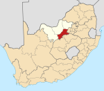
Koster is a small farming town situated on the watershed between the Orange and Limpopo Rivers in North West Province of South Africa.

Derby is a small town situated in North West Province of South Africa that was named after the British Secretary of State Lord Derby. Derby began as a refuge for destitute people.

Soshanguve is a township situated about 30 km north of Pretoria, Gauteng, South Africa. The name Soshanguve is an acronym for Sothho, Shangaan, Nguni and Venda, thus showing the multi-ethnic composition of the population (Mashabela 1988:138). The major African languages of South Africa are heard in Soshanguve.

Aberdeen is a small town in the Sarah Baartman District Municipality of the Eastern Cape province of South Africa. With its numerous examples of Victorian architecture, it is one of the architectural conservation areas of the Karoo.

Prieska is a town on the south bank of the Orange River, in the province of the Northern Cape, in western South Africa. It is located on the southern bank of the Orange River, 130 km north-west of Britstown and 75 km south-east of Marydale.

Postmasburg is a town in the Northern Cape province of South Africa, located approximately 170 km east of Upington.

Bothasig is a suburban area of the City of Cape Town in Western Cape, South Africa. It is located north of Edgemead and east of Milnerton. It is located approximately 15 km north-east of the Cape Town city centre.

Haarlem is a settlement in Garden Route District Municipality in the Western Cape province of South Africa.

Umbogintwini is a town near Durban in KwaZulu-Natal, South Africa. Its post office received the corrected name in 1997. It is best known for the industrial complex which has Acacia, Chemical Initiatives and Sammar warehouses.
Khowa, formely known as Elliot, is a town in Chris Hani District Municipality in the Eastern Cape province of South Africa, and lies 80 km south-west of Maclear and 65 km south-east of Barkly East.

Willowmore is a town in Sarah Baartman District Municipality in the Eastern Cape province of South Africa.
Cato Ridge is a town in the KwaZulu-Natal province of South Africa. Organisationally and administratively it is included in the Ethekwini Metropolitan Municipality as a suburb of the Outer West region.
Faure is a hamlet some 16 km south-west of Stellenbosch and 13 km north-west of Strand. Administratively it is a suburb of the City of Cape Town, and is in the Helderberg region. Nearby is the kramat or tomb of Sheik Yusuf (1626-1699), an Islamic expatriate priest. Faure is a common surname; it is uncertain after whom this place was named. It may have been named after Pieter Faure, the name of South Africa’s first trawler which arrived in Table Bay in 1897.

Philadelphia is a village in the Western Cape province of South Africa.

The Sanlam Cape Town Marathon is a City Marathon (42.2 km) held in Cape Town, South Africa, first held in its current form in 2007. Available distances include the marathon, a 10K, a 5K, and two trail runs of length 22 km and 12 km. The marathon is held on a fast and flat course, starting and finishing in Green Point, near the Cape Town Stadium.