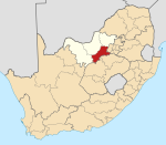
Boskuil | |
|---|---|
| Coordinates: 27°24′37″S25°52′35″E / 27.41028°S 25.87639°E Coordinates: 27°24′37″S25°52′35″E / 27.41028°S 25.87639°E | |
| Country | South Africa |
| Province | North West |
| District | Dr Kenneth Kaunda |
| Municipality | Maquassi Hills |
| Area | |
| • Total | 1.33 km2 (0.51 sq mi) |
| Population (2011) [1] | |
| • Total | 1,200 |
| • Density | 900/km2 (2,300/sq mi) |
| Racial makeup (2011) | |
| • Black African | 99.0% |
| • Coloured | 0.7% |
| • Indian/Asian | 0.2% |
| First languages (2011) | |
| • Tswana | 73.5% |
| • Sotho | 12.1% |
| • Xhosa | 7.2% |
| • English | 2.4% |
| • Other | 4.8% |
| Time zone | UTC+2 (SAST) |
| Area code | 018 |
Boskuil is a small village in North West Province of South Africa.

South Africa, officially the Republic of South Africa (RSA), is the southernmost country in Africa. It is bounded to the south by 2,798 kilometres (1,739 mi) of coastline of Southern Africa stretching along the South Atlantic and Indian Oceans; to the north by the neighbouring countries of Namibia, Botswana, and Zimbabwe; and to the east and northeast by Mozambique and Eswatini (Swaziland); and it surrounds the enclaved country of Lesotho. South Africa is the largest country in Southern Africa and the 25th-largest country in the world by land area and, with over 57 million people, is the world's 24th-most populous nation. It is the southernmost country on the mainland of the Old World or the Eastern Hemisphere. About 80 percent of South Africans are of Sub-Saharan African ancestry, divided among a variety of ethnic groups speaking different African languages, nine of which have official status. The remaining population consists of Africa's largest communities of European (White), Asian (Indian), and multiracial (Coloured) ancestry.


