Trotsville | |
|---|---|
 Trotsville  Trotsville | |
| Coordinates: 27°13′S25°58′E / 27.217°S 25.967°E Coordinates: 27°13′S25°58′E / 27.217°S 25.967°E | |
| Country | South Africa |
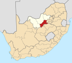
| Province | North West |
| District | Dr Kenneth Kaunda |
| Municipality | Maquassi Hills |
| Area | |
| • Total | 6.06 km2 (2.34 sq mi) |
| Population (2011) [1] | |
| • Total | 782 |
| • Density | 130/km2 (330/sq mi) |
| Racial makeup (2011) | |
| • Black African | 98.7% |
| • Coloured | 0.8% |
| • Indian/Asian | 0.3% |
| • White | 0.3% |
| First languages (2011) | |
| • Tswana | 65.9% |
| • Xhosa | 16.6% |
| • Sotho | 10.6% |
| • Zulu | 3.7% |
| • Other | 3.2% |
| Time zone | UTC+2 (SAST) |
Trotsville is a township of Wolmaransstad, in North West province of South Africa.

Township refers to various kinds of settlements in different countries.

Wolmaransstad is a maize-farming town situated on the N12 between Johannesburg and Kimberley in North West Province of South Africa. The town lies in an important alluvial diamond-mining area and it is the main town of the Maquassi Hills Local Municipality.

North West is a province of South Africa. Its capital is Mahikeng. Klerksdorp is the largest city in the province. The province is located to the west of the major population centre of Gauteng.