![]() | You can help expand this article with text translated from the corresponding article in French. (May 2021)Click [show] for important translation instructions.
|
![]() | This article includes a list of general references, but it lacks sufficient corresponding inline citations .(November 2011) |
The French Geodesic Mission to the Equator (French : Expédition géodésique française en Équateur), also called the French Geodesic Mission to Peru and the Spanish-French Geodesic Mission, was an 18th-century expedition to what is now Ecuador carried out for the purpose of performing an arc measurement, measuring the length of a degree of latitude near the Equator, by which the Earth's radius can be inferred. The mission was one of the first geodesic (or geodetic) missions carried out under modern scientific principles, and the first major international scientific expedition.
In the 18th century, there was significant debate in the scientific community, specifically in the French Academy of Sciences (Académie des sciences), as to whether the circumference of the Earth was greater around the Equator or around the poles. French astronomer Jacques Cassini held to the view that the polar circumference was greater. Louis XV of France and the academy sent two expeditions to determine the answer: a northern expedition was sent to Meänmaa in Lapland, close to the Arctic Circle, with the Swedish physicist Anders Celsius and under the guidance of the French mathematician Pierre Louis Maupertuis. The other mission was sent to Ecuador, at the Equator. Previous accurate measurements had been taken in Paris by Cassini and others.
The equatorial mission was led by French astronomers Charles Marie de La Condamine, Pierre Bouguer, Louis Godin and Spanish geographers Jorge Juan and Antonio de Ulloa. They were accompanied by several assistants, including the naturalist Joseph de Jussieu and Louis's cousin Jean Godin. La Condamine was joined in his journey down the Amazon by Ecuadoran geographer and topographer Pedro Maldonado. (Maldonado later traveled to Europe to continue his scientific work.)
The Ecuadoran expedition [N 1] left France in May 1735. They landed on the Caribbean coast in Colombia, sailed to Panama where they traveled overland to the Pacific, and continued by sail to Ecuador, then called the Territory of Quito by Spain. In Ecuador, they split into two groups, traveling overland through rain forests, arriving in Quito in June 1736.
Pierre Bouguer established the length of a pendulum beating seconds on the Equator at Quito, near Quito at the top of Pinchincha, and at sea level to determine gravity of Earth. [1] La Condamine had a marble plaque prepared, with a bronze exemplar (varilla metalica) of the length of such a pendulum set into it, which he presented to the Jesuit College of San Francisco in Quito in 1742, engraved with an inscription reading: Penduli simplicis aequinoctialis, unius minuti secundi temporis medii, in altitudine Soli Quitensis, archetypus (mensurae naturalis exemplar, utinam et universalis) ["Archetype of the equinoctial simple pendulum, of one second of a minute of mean time at the latitude of Quito (a natural and, may it be, a universal model of measure)"]. The plaque is now in the Observatorio Astronómico in the Parque La Alameda. [2] [3]
Bouguer, La Condamine, Godin and their colleagues measured arcs of the Earth's curvature on the Equator from the plains near Quito to the southern city of Cuenca. These measurements enabled the first accurate determination of the shape of the Earth, eventually leading to the establishment of the international metric system of measurement. When an International Commission for Weights and Measures was convened in Paris to settle the true length of the metre, it adopted on 22 June 1799 a standard metre based on the length of the half meridian connecting the North Pole with the Equator. The French Academy of Sciences had commissioned an expedition led by Jean Baptiste Joseph Delambre and Pierre Méchain, lasting from 1792 to 1799, which attempted to accurately measure the distance between a belfry in Dunkerque and Montjuïc castle in Barcelona at the longitude of Paris Panthéon. [4] This portion of the Paris meridian was to serve as the basis for the length of the half meridian connecting the North Pole with the Equator. The metre was defined as the ten-millionth of the half meridian's length extrapolated from an Earth's flattening of 1/334 obtained from the results of the survey by Delambre and Méchain combined with those of the Peru meridian arc as established by La Condamine and his colleagues. [1]
They completed their survey measurements by 1739, measuring the length of a meridian arc of three degrees at the Equator. They did this in spite of earlier news that the expedition to Lapland led by Maupertuis had already finished their work and had proven that the Earth is oblate; i.e., flattened at the poles. However, problems with astronomical observations[ vague ] kept them in Ecuador several more years.
Bouguer returned first from the expedition, going overland to the Caribbean and then to France. La Condamine, along with Maldonado, returned by way of the Amazon River. Louis Godin took a position as professor in Lima, where he helped rebuild the city after the devastating 1746 earthquake, and returned to Europe in 1751. Bouguer, La Condamine and the Spanish officers each wrote separate accounts of the expedition, which opened up European eyes to the exotic landscapes, flora and fauna of South America and led directly to the great naturalist expeditions by Alexander von Humboldt and others.
La Condamine tried in vain to promote the length of the seconds pendulum measured at the Equator as a universal measure of length. He was more successful with his proposal to adopt the geodetic standard used in Peru as the official standard of the toise of Paris. The toise of Peru became the royal standard of the toise in 1766 under the name Toise de l'Académie. [5] [6]
In the late 19th century, the Academy of Sciences sent another mission to Ecuador at the behest of the International Association of Geodesy to confirm the results of the First Geodesic Mission and commemorate the relationship between the two republics. This second mission was led by Captain E. Maurain and several other military personnel during its tenure in Ecuador from 1901 to 1906. The only two members of the French mission to spend the entire time in Ecuador were Lieutenant (later General) Georges Perrier and medical officer Paul Rivet, later an important anthropologist and founder of the Musée de l'Homme in Paris.
A reproduction of the pyramids that marked the baseline for measurement at Yaruqui (which was destroyed by Quito authorities in the 1740s) was erected in 1836, the centennial of the expedition, by the Rocafuerte administration of the nascent republic of Ecuador. This monument fell into disrepair over the next century but was rebuilt in 1936, minus its original French inscription, for the bicentennial of the first geodesic expedition, along with a second pyramid at San Antonio de Pichincha on the Equator. These monuments still exist today. The new Quito International Airport opened in the Yaruqui Valley. Though talks of having a mural celebrating the Geodesic Mission took place during planning stages, no acknowledgement of the scientific importance of this site currently exists.
In 1936, the French American Committee of Ecuador sponsored the idea of the Ecuadoran geographer Dr. Luis Tufiño and raised a monument commemorating the bicentennial of the arrival of the First Geodesic Mission. They raised a 10-meter-high monument at Ciudad Mitad del Mundo in San Antonio de Pichincha, in Pichincha Province of Ecuador. However, there is no record that the Mission ever visited the area.
There was a project to build a new pyramid exactly on the Equator, to be designed by the famed architect Rafael Viñoly (d. 2023).
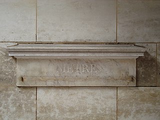
The metre is the base unit of length in the International System of Units (SI). Since 2019, the metre has been defined as the length of the path travelled by light in vacuum during a time interval of 1/299792458 of a second, where the second is defined by a hyperfine transition frequency of caesium.
Antonio de Ulloa was a Spanish Navy officer, scientist and colonial administrator. At the age of nineteen, he joined the French Geodesic Mission to South America. The mission took more than eight years to complete its work, during which time Ulloa made many astronomical, natural, and social observations in South America. The reports of Ulloa's findings earned him an international reputation as a leading savant. Those reports include the first published observations of the metal platinum, later identified as a new chemical element. Ulloa was elected as a fellow of the Royal Society in 1746, and as a foreign member of the Royal Swedish Academy of Sciences in 1751.
The history of geodesy (/dʒiːˈɒdɪsi/) began during antiquity and ultimately blossomed during the Age of Enlightenment.
The year 1749 in science and technology involved some significant events.
Pierre Bouguer was a French mathematician, geophysicist, geodesist, and astronomer. He is also known as "the father of naval architecture".
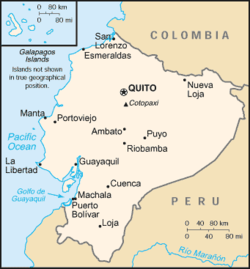
Charles Marie de La Condamine was a French explorer, geographer, and mathematician. He spent ten years in territory which is now Ecuador, measuring the length of a degree of latitude at the equator and preparing the first map of the Amazon region based on astro-geodetic observations. Furthermore he was a contributor to the Encyclopédie.
The year 1735 in science and technology involved some significant events.
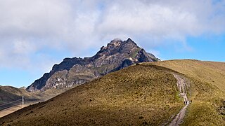
Pichincha is a stratovolcano in Ecuador. The capital Quito wraps around its eastern slopes.
Louis Godin was a French astronomer and member of the French Academy of Sciences. He worked in Peru, Spain, Portugal and France.
The Ciudad Mitad del Mundo is a tract of land owned by the prefecture of the province of Pichincha, Ecuador. It is located at San Antonio parish of the canton of Quito, 26 km (16 mi) north of the center of Quito. The grounds contain the Monument to the Equator, which highlights the exact location of the Equator and commemorates the eighteenth-century Franco-Spanish Geodesic Mission which fixed its approximate location; they also contain the Museo Etnográfico Mitad del Mundo, Ethnographic Museum Middle of the Earth, a museum about the indigenous people ethnography of Ecuador.
Gabriel Mouton was a French abbot and scientist. He was a doctor of theology from Lyon, but was also interested in mathematics and astronomy. His 1670 book, the Observationes diametrorum solis et lunae apparentium, proposed a natural standard of length based on the circumference of the Earth, divided decimally. It was influential in the adoption of the metric system in 1799.
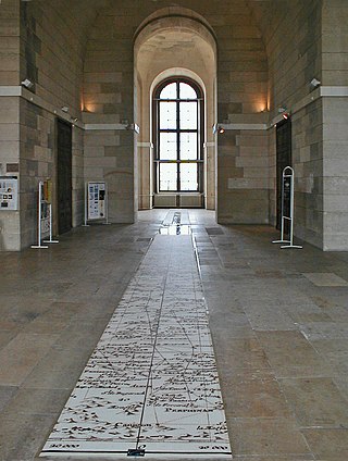
The Paris meridian is a meridian line running through the Paris Observatory in Paris, France – now longitude 2°20′14.02500″ East. It was a long-standing rival to the Greenwich meridian as the prime meridian of the world. The "Paris meridian arc" or "French meridian arc" is the name of the meridian arc measured along the Paris meridian.
A toise is a unit of measure for length, area and volume originating in pre-revolutionary France. In North America, it was used in colonial French establishments in early New France, French Louisiana (Louisiane), Acadia (Acadie) and Quebec. The related toesa was used in Portugal, Brazil, and other parts of the Portuguese Empire until the adoption of the metric system.
José Antonio de Mendoza Caamaño y Sotomayor, 3rd Marquis of Villagarcía de Arousa was a Spanish colonial administrator in the Americas. From 4 February 1736 to 15 December 1745 he was Viceroy of Peru.
Pedro Vicente Maldonado y Flores was an Ecuadorian scientist who collaborated with the members of the French Geodesic Mission. As well as a physicist and a mathematician, Maldonado was an astronomer, topographer, and geographer.
Jorge Juan y Santacilia was a Spanish mariner, mathematician, natural scientist, astronomer, engineer, and educator. He is generally regarded as one of the most important scientific figures of the Enlightenment in Spain. As a military officer, he undertook sensitive diplomatic missions for the Spanish crown and contributed to the modernization and professionalization of the Spanish Navy. In his lifetime, he came to be known as el sabio español. His career as a public servant constitutes an important chapter in the Bourbon Reforms of the 18th century.
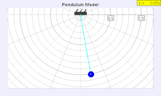
A seconds pendulum is a pendulum whose period is precisely two seconds; one second for a swing in one direction and one second for the return swing, a frequency of 0.5 Hz.
In geodesy and navigation, a meridian arc is the curve between two points on the Earth's surface having the same longitude. The term may refer either to a segment of the meridian, or to its length.
The history of the metre starts with the Scientific Revolution that is considered to have begun with Nicolaus Copernicus's publication of De revolutionibus orbium coelestium in 1543. Increasingly accurate measurements were required, and scientists looked for measures that were universal and could be based on natural phenomena rather than royal decree or physical prototypes. Rather than the various complex systems of subdivision then in use, they also preferred a decimal system to ease their calculations.
The French Geodesic Mission to Lapland was one of the two geodesic missions carried out in 1736–1737 by the French Academy of Sciences for measuring the shape of the Earth. One expedition was sent to Ecuador to perform measurements near the Equator; the other was sent to Meänmaa to perform measurements near the Arctic Circle.