Fullers Crossroads, Alabama | |
|---|---|
 Fullers Crossroads, Alabama  Fullers Crossroads, Alabama | |
| Coordinates: 31°49′05″N86°18′40″W / 31.81806°N 86.31111°W | |
| Country | United States |
| State | Alabama |
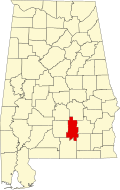
| County | Crenshaw |
| Elevation | 482 ft (147 m) |
| Time zone | UTC-6 (Central (CST)) |
| • Summer (DST) | UTC-5 (CDT) |
| Area code | 334 |
| GNIS feature ID | 118750 [1] |
Fullers Crossroads is an unincorporated community in Crenshaw County, Alabama, United States.