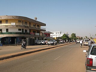
Wa is a town and the capital of the Wa Municipal District and the Upper West Region of Ghana. It has a population of 200,672 people according to the 2021 census.
Lawra is a small town and is the capital of Lawra district, a district in the Upper West Region of Ghana.

The Upper West Region of Ghana is located in the north-western corner of Ghana and is bordered by Upper East Region to the east, Northern Region to the south, and Burkina Faso to the west and north. The Upper West regional capital and largest settlement is Wa. The Upper West was created by the then Head of State, Flight-Lieutenant Jerry Rawlings in 1983 under the Provisional National Defence Council (PNDC) military regime. The area was carved out of the former Upper Region, which is now the Upper East Region. For about thirty-five years, it remained the youngest region of Ghana until 2018 when six more regions were created by the Nana Addo Dankwa Akufo-Addo government; hence increasing the total number of administrative regions in the country to sixteen.
The Upper East Region is located in northern part of Ghana and it is the third smallest of the 16 administrative regions in Ghana. It occupies a total land surface of 8,842 square kilometers or 2.7% of the total land area of Ghana. The regional capital is Bolgatanga, which is sometimes referred to as Bolga. Other major towns in the region include Navrongo, Paga, Sandema, Bawku, and Zebilla, Tempane, Pusiga, Garu, Pwalugu, Widana

The Northern Region is one of the sixteen regions of Ghana. It is situated in the northern part of the country and ranks as the second largest of the sixteen regions. Before its division, it covered an area of 25,000 square kilometres, representing 10 percent of Ghana's area. In December 2018, the Savannah Region and North East Region were created from it. The Northern Region is divided into 16 districts. The region's capital is Tamale, Ghana's third largest city.

Bongo District is one of the fifteen districts in Upper East Region, Ghana. Originally created as an ordinary district assembly in 1988; which was established by Legislative Instrument (L.I.) 1446. The municipality is located in the central part of Upper East Region and has Bongo as its capital town.

West Mamprusi Municipal Assembly is one of the six districts in North East Region, Ghana. Originally created as an ordinary district assembly in 1988 when it was known as West Mamprusi District, which was created from the former Mamprusi District Council, until the western part of the district was split off on 28 June 2012 to create Mamprugu-Moagduri District; thus the remaining part has been retained as West Mamprusi District. However, on 15 March 2018, it was elevated to municipal district assembly status to become West Mamprusi Municipal District. The municipality is located in the western part of North East Region and has Walewale as its capital town. Other settlements within the municipal assembly include Wulugu.

Sissala East Municipal District is one of the eleven districts in Upper West Region, Ghana. Originally it was formerly part of the then-larger Sissala District in 1988; until the western part of the district was later split off to create Sissala West District in July 2004; thus the remaining part has been renamed as Sissala East District, which it was later elevated to municipal district assembly status on 15 March 2018 to become Sissala East Municipal District. The municipality is located in the northeast/eastern part of Upper West Region and has Tumu as its capital town.
Sissala West District is one of the eleven districts in Upper West Region, Ghana. Originally it was formerly part of the then-larger Sissala District in 1988; until the western part of the district was later split off to create Sissala West District in July 2004; thus the remaining part has been renamed as Sissala East District. The district assembly is located in the northern/northeast part of Upper West Region and has Gwollu as its capital town.
Wa East District is one of the eleven districts in Upper West Region, Ghana. Originally it was formerly part of the then-larger Wa District in 1988; until two parts of the district were later split off to create Wa East District and Wa West District respectively in July 2004; thus the remaining part was elevated to municipal district assembly status in the same year to become Wa Municipal District. The district assembly is located in the southern part of Upper West Region and has Funsi as its capital town.
Wa Municipal District is one of the eleven districts in Upper West Region, Ghana. Originally created as an ordinary district assembly in 1988 when it was known as Wa District, until two parts of the district were later split off by a decree of president John Agyekum Kufuor in July 2004 to create Wa East District and Wa West District respectively; thus the remaining part was later elevated to municipal district assembly status on the same year to become Wa Municipal District. The municipality is located in the southern part of Upper West Region and has Wa as its capital town, which also serves as the regional capital of the Upper West Region.
Wa West District is one of the eleven districts in Upper West Region, Ghana. Originally it was formerly part of the then-larger Wa District in 1988; until two parts of the district were later split off to create Wa East District and Wa West District respectively in July 2004; thus the remaining part was elevated to municipal district assembly status on the same year to become Wa Municipal District. The district assembly is located in the southern part of Upper West Region and has Wechiau as its capital town.

Wa Central is one of the constituencies represented in the Parliament of Ghana. It elects one Member of Parliament (MP) by the first past the post system of election. Wa Central is located in the Wa Municipal district of the Upper West Region of Ghana.

The Ghana Health Service (GHS) is a Ghanaian government body established in 1996 as part of the Health Sector Reform of Ghana. The Health Service is under the Ministry of Health. The health service primarily administers the health services in Ghana provided by the government and implements government policies on healthcare. The current Director-General of the Health service is Dr. Patrick Kuma-Aboagye who was appointed by President Nana Akufo-Addo on November 25th 2019 to replace Dr. Anthony Nsiah-Asare
Lambussie Karni District is one of the eleven districts in Upper West Region, Ghana. Originally it was formerly part of the then-larger Jirapa/Lambussie District in 1988; until the northern part of the district was later split off to create Lambussie-Karni District on 29 February 2008; thus the remaining part has been renamed as Jirapa District. The district assembly is located in the northwest part of Upper West Region and has Lambussie as its capital town.

Walewale is a town and the capital of Mamprusi West Municipal in the North East Region of Ghana. The West Mamprusi Municipal is one of the 261 Metropolitan, Municipal, and District Assemblies (MMDAs) in Ghana, and forms part of the 6 MMDAs in the North East Region. The West Mamprusi Municipality is one of 45 new districts created in 1988 under the Government of Ghana’s decentralization and was later replaced with LI 2061 in 2012. With its administrative capital as Walewale.
Wechiau is a small town and is the capital of Wa West district, a district in the Upper West Region of north Ghana adjacent to the border with Burkina Faso. Wechiau has a stretch of the Black Volta and this is the home to a wild population of Hippopotamus.
Godfrey Tangu Bayon is a Ghanaian politician and member of the Seventh Parliament of the Fourth Republic of Ghana representing the Wa East Constituency in the Upper West Region on the ticket of the New Patriotic Party.
Nadowli Kaleo is one of the constituencies represented in the Parliament of Ghana. It elects one Member of Parliament (MP) by the first past the post system of election. Nadowli Kaleo is located in the Nadowli-Kaleo District of the Upper West Region of Ghana.


