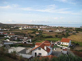
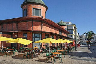
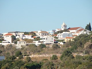
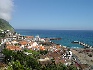
Esgueira is an urban civil parish in the municipality (concelho) of Aveiro, in continental Portugal. The population in 2011 was 13,431, in an area of 17.15 km².

Belver is a Portuguese civil parish in the municipality of Gavião, district of Portalegre. The population in 2011 was 684, in an area of 69.84 km2. It is situated along the northern bank of the Tagus River.

Vila do Porto is the single municipality, the name of the main town and one of the civil parishes on the island of Santa Maria, in the Portuguese archipelago of Azores. Its nearest neighbor, administratively, is the municipality of Povoação on the southern coast of São Miguel, and it is physically southwest of the islets of the Formigas. The population in 2021 was 5,408, in an area of 96.89 km2 (37.41 sq mi).

Capelo is a freguesia in the municipality of Horta on the island of Faial in the Azorean archipelago. The population in 2011 was 486, in an area of 26.64 km². Capelo may be considered the westernmost settlement of Eurasia, if Fajã Grande, on Flores Island, is considered part of North America, for it sits on the North American Plate.
Feteira is a rural civil parish in the municipality of Angra do Heroísmo in the Portuguese archipelago of the Azores. The population in 2011 was 1,239, in an area of 5.25 square kilometres (2.03 sq mi).

São Mateus da Calheta is a civil parish within the municipality of Angra do Heroísmo in the Portuguese archipelago of the Azores. The population in 2011 was 3,757, in an area of 5.98 km2. It is located on the periphery of the urbanized area of the city of Angra do Heroísmo, and developed from a small fishing port in a bay along the volcanic coast of the island.

São José is a civil parish in the municipality of Ponta Delgada on the island of São Miguel in the Portuguese archipelago of the Azores. It is one of the constituent parts of the city of Ponta Delgada, and location of many of the island's more significant cultural and historical, commercial and residential buildings. Extending a short distance along the coast it, nevertheless includes a large mixed urban-rural constituency from the shore north to the main freeway, the Via-Rápida. The population in 2011 was 5,934, in an area of 1.66 km2.

Vila Franca do Campo is a town and municipality in the southern part of the island of São Miguel in the Portuguese Autonomous Region of the Azores. The population of the municipality was 11,229 in 2011, in an area of 77.97 km². The town proper, which incorporates the urbanized parishes São Miguel and São Pedro, has 4100 inhabitants.

Povoação is a municipality located in the southeastern corner of the island of São Miguel in the Portuguese archipelago of the Azores. The population in 2011 was 6,327, in an area of 106.41 km².

Santo Espírito is a Portuguese civil parish, located in the municipality of Vila do Porto, in the autonomous region of Azores. The population in 2011 was 588, in an area of 26.68 km².
Arcas is a Portuguese civil parish in the municipality of Macedo de Cavaleiros in the northeast corner of Portugal. The population in 2011 was 262, in an area of 23.02 km2.

Nelas is a municipality located in the Centro Region of continental Portugal. The population in 2011 was 14,037, in an area of 125.71 km².

Alcantarilha is a former civil parish in the municipality of Silves, Portugal. In 2013, the parish merged into the new parish Alcantarilha e Pêra. With an area of 19.54 square kilometres (7.54 sq mi) the population of 2347 inhabitants is dispersed throughout the territory.

Paderne is a village and civil parish in the municipality (concelho) of Albufeira, in the Portuguese region of Algarve. The population in 2011 was 3,304, in an area of 52.56 km².
Guia is a town and civil parish in the Portuguese municipality of Albufeira in the Algarve, 5 kilometres (3.1 mi) from the coast. The population in 2011 was 4,376, in an area of 26.80 km².

Olhão is a civil parish in the municipality of Olhão, in the Portuguese Algarve. The population in 2011 was 14,914, in an area of 12.25 km². Olhão is the largest parish by population density in the municipality.

Mexilhoeira Grande is a civil parish in the municipality (concelho) of Portimão in the southern Portuguese region of the Algarve. The population in 2011 was 4,029, in an area of 91.15 km².
Avanca is a civil parish in the municipality of Estarreja, in the central subregion of Baixo Vouga. The population in 2011 was 6,189, in an area of 21.07 km2.

Povoação is a civil parish in the municipality (concelho) of Povoação, on the island of São Miguel in the Portuguese archipelago of the Azores. The population in 2011 was 2,161, in an area of 26.23 km2.


