Blaise Compaoré is a Burkinabé politician who was president of Burkina Faso from 1987 to 2014. He was a top associate of President Thomas Sankara during the 1980s, and in October 1987, he led a coup d'état during which Sankara was killed. Subsequently, he introduced a policy of "rectification", overturning the leftist and Third Worldist policies pursued by Sankara. He won elections in 1991, 1998, 2005, and 2010 in what were considered unfair circumstances. His attempt to amend the constitution to extend his 27-year term caused the 2014 Burkinabé uprising. On 31 October 2014, Compaoré resigned, whereupon he fled to the Ivory Coast.

The Burkina Faso national football team, is the national team of Burkina Faso and is controlled by the Burkinabé Football Federation. They were known as the Upper Volta national football team until 1984, when Upper Volta became Burkina Faso. They finished fourth in the 1998 Africa Cup of Nations, when they hosted the tournament. Their best ever finish in the tournament was the 2013 edition, reaching the final.

Diébougou is a town in Burkina Faso, situated 136 kilometres (85 mi) south-east of Bobo-Dioulasso on the main highway to Ghana. It is located 74 kilometres north of Gaoua and 133 km west of Leo, Burkina Faso and is the capital of Bougouriba Province.

Tikaré is a town in Bam Province, Burkina Faso. It is the capital of the Tikare Department and had a population of 5,344.

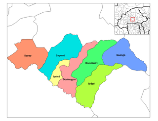
Yada, Burkina Faso is a town in the Kayao Department of Bazèga Province in central Burkina Faso. The town has a population of 1,189.
Yambo, Burkina Faso is a town in the Bagré Department of Boulgou Province in south-eastern Burkina Faso. As of 2005, the town has a population of 2970.

Bittou is a town and seat of the Bittou Department of Boulgou Province in south-eastern Burkina Faso. The town is a stop on the caravan trading route. Today the town is located along the N16 Road which links Burkina Faso with Northern Togo and Ghana. In 1898 the French Colonial Army built a fort here to keep the British Colonial Army from capturing the area. As of 2005, the town has a population of 15,459.

Sport in Burkina Faso is widespread and includes football, basketball, cycling, rugby union, handball, tennis, athletics, boxing and martial arts.
Beka is a town in the Zabré Department of Boulgou Province in south-eastern Burkina Faso. As of 2005, the town has a population of 3,579.
Sabra, Burkina Faso is a town in the Bilanga Department of Gnagna Province in eastern Burkina Faso. The town has a population of 2,002.
Thiéry, Burkina Faso is a town in the Bogandé Department of Gnagna Province in eastern Burkina Faso. The town has a population of 6,224.
Poka, Burkina Faso is a town in the Coalla Department of Gnagna Province in eastern Burkina Faso. The town has a population of 1,909.
Kouri, Gnagna is a town in the Piéla Department of Gnagna Province in eastern Burkina Faso. The town has a population of 2231.
Margou, Piéla is a town in the Piéla Department of Gnagna Province in eastern Burkina Faso. The town has a population of 1904.
Thion, Burkina Faso is a town in the Thion Department of Gnagna Province in eastern Burkina Faso. The town has a population of 3030 and it is the capital of the Thion Department.
Diaka, Burkina Faso is a town in the Thion Department of Gnagna Province in eastern Burkina Faso. The town has a population of 2,479.
Harga is a town in the Thion Department of Gnagna Province in eastern Burkina Faso. The town has a population of 1042.
Monlori is a town in the Thion Department of Gnagna Province in eastern Burkina Faso. The town has a population of 1264.
Siéssin is a town in the Thion Department of Gnagna Province in eastern Burkina Faso. The town has a population of 1045.


