Ganalaagte | |
|---|---|
  Ganalaagte 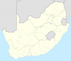 Ganalaagte | |
| Coordinates: 26°27′50″S25°31′48″E / 26.464°S 25.530°E Coordinates: 26°27′50″S25°31′48″E / 26.464°S 25.530°E | |
| Country | South Africa |
| Province | North West |
| District | Ngaka Modiri Molema |
| Municipality | Tswaing |
| Area | |
| • Total | 2.92 km2 (1.13 sq mi) |
| Population (2011) [1] | |
| • Total | 2,830 |
| • Density | 970/km2 (2,500/sq mi) |
| Racial makeup (2011) | |
| • Black African | 98.8% |
| • Coloured | 0.6% |
| • Indian/Asian | 0.4% |
| • Other | 0.2% |
| First languages (2011) | |
| • Tswana | 96.9% |
| • Xhosa | 1.1% |
| • Other | 2.0% |
| Time zone | UTC+2 (SAST) |
Ganalaagte is a town in Ngaka Modiri Molema District Municipality in the North West province of South Africa.

